Wildflowers and Waterfalls of the Columbia River Gorge


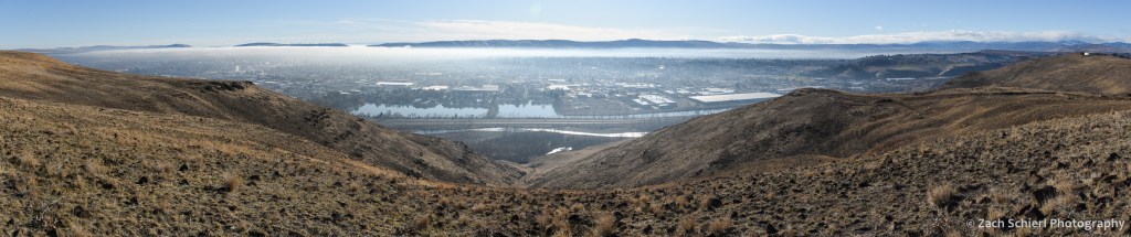
Looking east along the Columbia River Gorge toward The Dalles on an alternately sunny & rainy March afternoon.
In the home stretch of its more than 1,000 mile-long journey from the Canadian Rockies to the Pacific Ocean, the Columbia River has carved a spectacular canyon that now forms the border between Oregon and Washington: the Columbia River Gorge. Nearly 100 miles in length, the Columbia River Gorge is one of the most unique landscapes in the Pacific Northwest, and home to some spectacular geology. Most of the gorge is carved into the Columbia River Basalts, layers upon layers of volcanic rock formed by vast lava flows that inundated most of central and eastern Washington about 16 million years ago. More recently, a series of large glacial outburst floods at the end of the last ice age broadened and re-shaped the gorge as they raged their way down the Columbia River to the Pacific Ocean, creating many of the landforms that we see today.
By the time the Columbia River enters the gorge, its elevation has already dropped to just 160 feet above sea level. The low elevation of the gorge makes it one of the warmest areas in the Pacific Northwest, and a prime destination for some early season camping. We recently spent three days in the Columbia River Gorge soaking up what passes for balmy weather this time of year around here.

An early spring view of the eastern Columbia River Gorge from Rowena Crest Overlook on the Oregon side of the gorge.

Motorcycle headlights illuminate the sweeping curves of the Historic Columbia River Highway just below Rowena Crest. The constellation of Canis Major sits just above the horizon. While the historic highway has been largely replaced by the much less charismatic I-84, large portions remain as backroads or hiking trails.
Two of the main attractions in the Columbia River Gorge are wildflowers and waterfalls. Even now, in mid-to-late March, the wildflower show was already in full swing, particularly in the drier, warmer, eastern reaches of the gorge:

Shooting stars (Dodecatheon sp.) are among the early blooming wildflowers in the eastern Columbia River Gorge. A yellow fritillary (Fritillaria pudica) lurks in the background.

Grass widows (Olsynium douglasii) are some of the earliest wildflowers to bloom in large numbers in the eastern Columbia River Gorge.

More grass widows…

Most grass widows are a vibrant pinkish purple color, but white petals are also found here and there.

Pungent desert parsley (Lomatium grayi) at Horsethief Butte.
One of the most remarkable sights in the Columbia River Gorge is experiencing the rapid change in environment as you drive through the gorge from east to west. The Dalles, located near the eastern end of the gorge, lies in the rain shadow of the Cascade Range and receives very little precipitation: just 14 inches annually. Here, the rocky slopes of the gorge are nearly devoid of any vegetation other than wildflowers and grasses. Just half an hour and a handful of freeway exists to the west, the average annual precipitation has increased to about 30 inches at Hood River, and ponderosa pine and Douglas fir cover the slopes. 20 more miles/minutes to the west, at Cascade Locks, annual precipitation rises to over 75 inches and the gorge is filled with the dense, shady, and mossy forests typically associated with the Pacific Northwest. In other words, you can travel from a true desert to a near-rainforest in less than an hour, while driving on a nearly flat interstate that hugs the shore of massive reservoirs created by dams along the lower Columbia River.

Large clusters of balsamroot (Balsamorhiza sp.) were beginning to flower in some of the drier, eastern parts of the Gorge, like these at Horsethief Butte.

An unknown species of fungus shares a decaying log with some moss. Scenes like this are common in the wetter, western half of the Columbia River Gorge.
The combination of dramatic terrain and copious precipitation at the western end of the Columbia River Gorge (particularly on the more mountainous Oregon side) combines to form some of the most spectacular waterfalls in the United States. As the aforementioned ice age floods flowed through the gorge on their way to the Pacific, they removed the lower ends of valleys belonging to the Columbia’s many tributary streams. Consequently, many of these tributaries enter the gorge several hundred feet above river level, terminating in spectacular plunges that carry their water into the Columbia River:

Latourell Falls plunges over a cliff of columnar basalt at the western end of the Columbia River Gorge, not far from Portland. This photo is a bit blurry; the trails to several of these waterfalls were busy, even on a somewhat chilly Tuesday in March, making it hard to set up a tripod for a steady shot.

Elowah Falls, Columbia River Gorge, Oregon. This shady alcove was heavily burned in the Eagle Creek Fire of 2017, but is already showing signs of re-growth.

Starvation Creek Falls, Columbia River Gorge, Oregon

Starvation Creek Falls, Columbia River Gorge, Oregon
Let’s be clear: with temperatures in the 40s and 50s and the nearly constant winds that blow through the gorge, it was no spring break in Florida, but after a long winter and with the Cascades still buried in snow for several more months, the greenery and signs of spring were a welcome sight. (Even though we did have our tent totally chewed up by an unknown animal…a first for us in many, many nights of camping throughout the west!)
From Washington to Zion

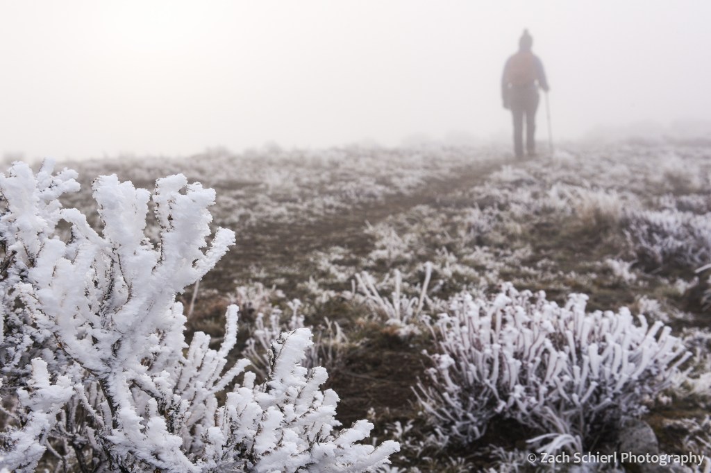
Between work, weather, and the ongoing pandemic, my camera has seen relatively little use the last few months. Here in central Washington, it is inversion season. Atmospheric inversions occur when relatively warm air passing over the Cascade Range traps colder air below in the valleys of the Columbia River Basin. These pools of cold air can persist for weeks, bringing cold temperatures, freezing fog, and poor air quality. Fun, fun, fun! Here’s what things have looked like in recent days:
Stuck inside, I’ve been working on a project to organize and categorize over a decade’s worth of photos. It’s been fun to come across long forgotten gems and months and months of photos that I never even got around to editing in the first place. I plan to post some of the highlights as I come across them.
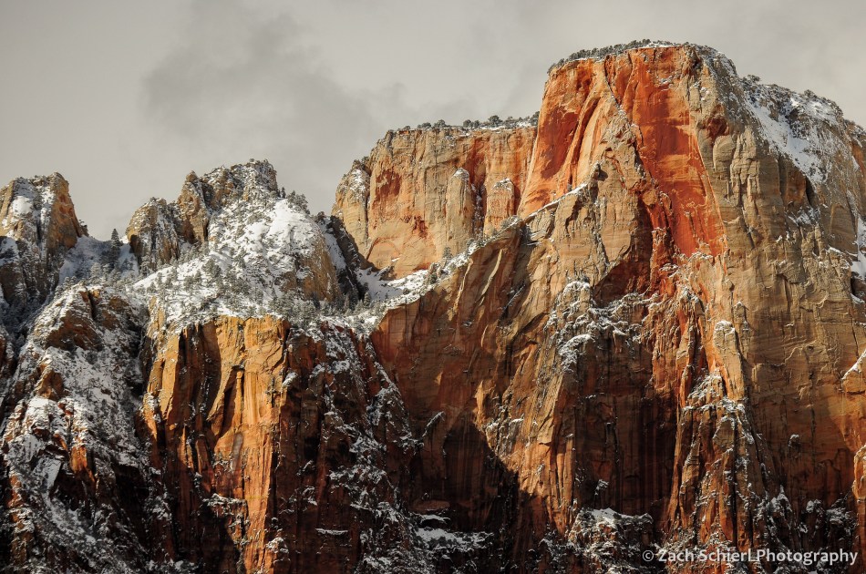
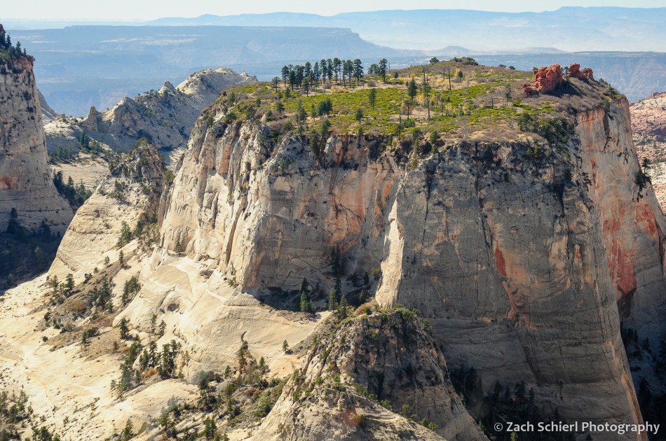
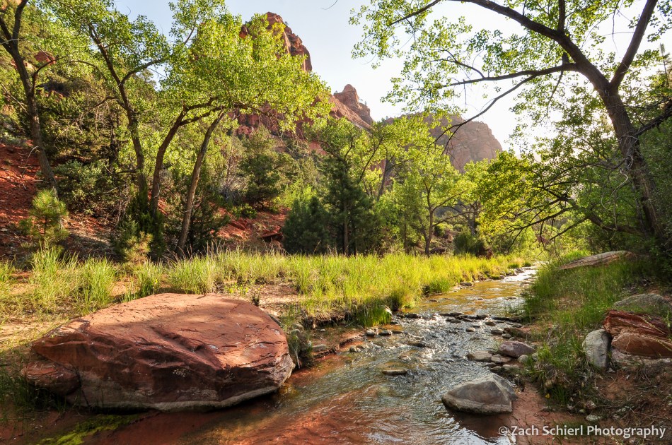
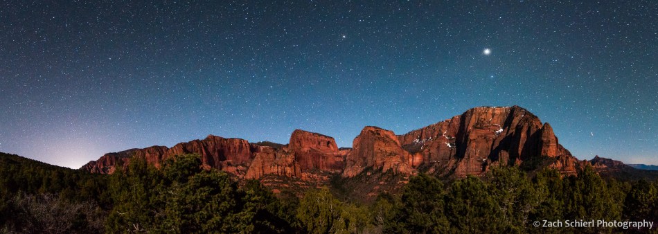
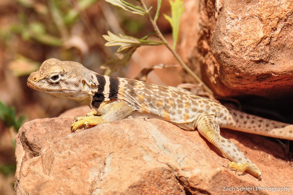
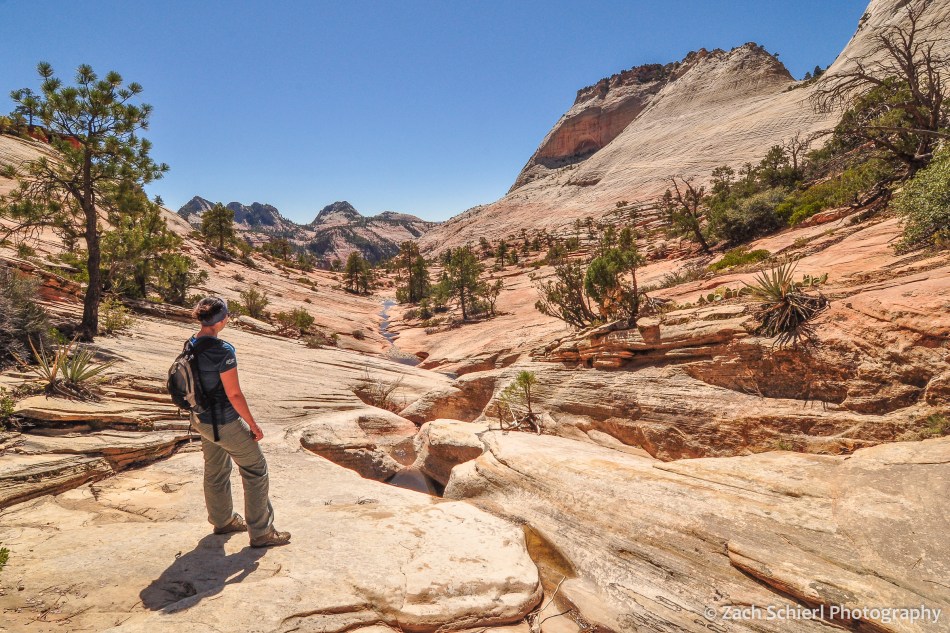
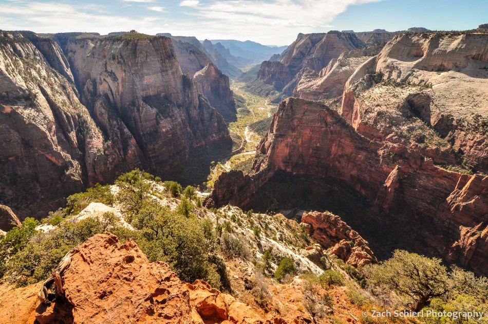
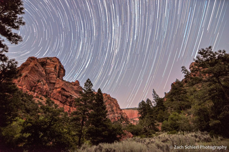
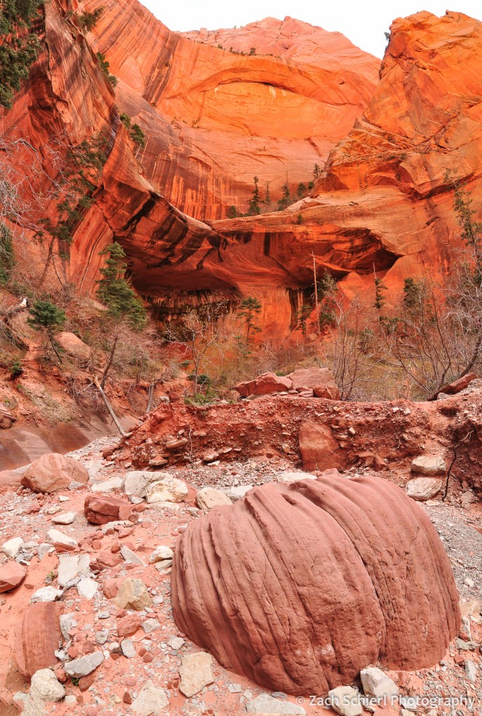
While I post only a tiny fraction of the photos that I take here, looking back through the archives, I’ve noticed one especially glaring omission over the past few years: Zion National Park. Zion is one of my favorite landscapes on Earth, and for a little over three years we lived just 20 minutes from the north end of the park. I was surprised to discover that I haven’t shared any images from Zion since I started this website and blog almost a decade ago. In order to rectify that, here’s a look back at some of my favorite photos from Zion National Park:


Exploring the Eastern Slope

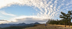
Late afternoon light in the William O. Douglas Wilderness, Wenatchee National Forest, Washington
After a summer of exploring the higher elevations of the Cascades in Washington and Oregon, our recent forays into the mountains have kept us closer to home. A highlight of fall in central Washington is the fall color display put on by the western and subalpine larch, a deciduous conifer that dots the drier slopes and sub-alpine areas of the eastern Cascades. We’ve taken two trips in the past few weeks to look for these gorgeous trees, but sadly arrived a bit early in both cases. Despite the poor timing, these trips took us to some great viewpoints and overlooks and allowed us to experience some amazing autumn sunrises and sunsets:
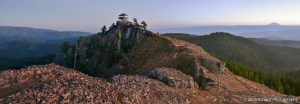
Sunset from Red Top, Wenatchee National Forest, Washington. Mt. Rainier is visible on the horizon at right.
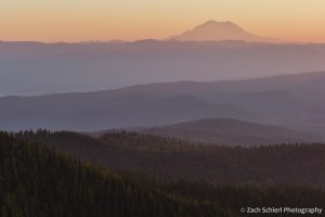
Lingering wildfire smoke makes for a colorful sunset looking across the eastern foothills of the Cascades to Mt. Rainier.
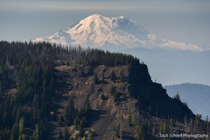
Mt. Rainier rises above cliffs of basalt near Blewett Pass, Wenatchee National Forest, Washington.

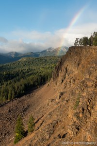
A rainbow intersects the basalt canyons and plateaus of the eastern Cascade foothills, Wenatchee National Forest, Washington
Looking west toward the Cascade crest in the William O. Douglas Wilderness, Wenatchee National Forest, Washington

A peaceful campsite in the William O. Douglas Wilderness. Clouds sneaking over the Cascade crest to the west partially obscure the Milky Way, but not bright Jupiter.
