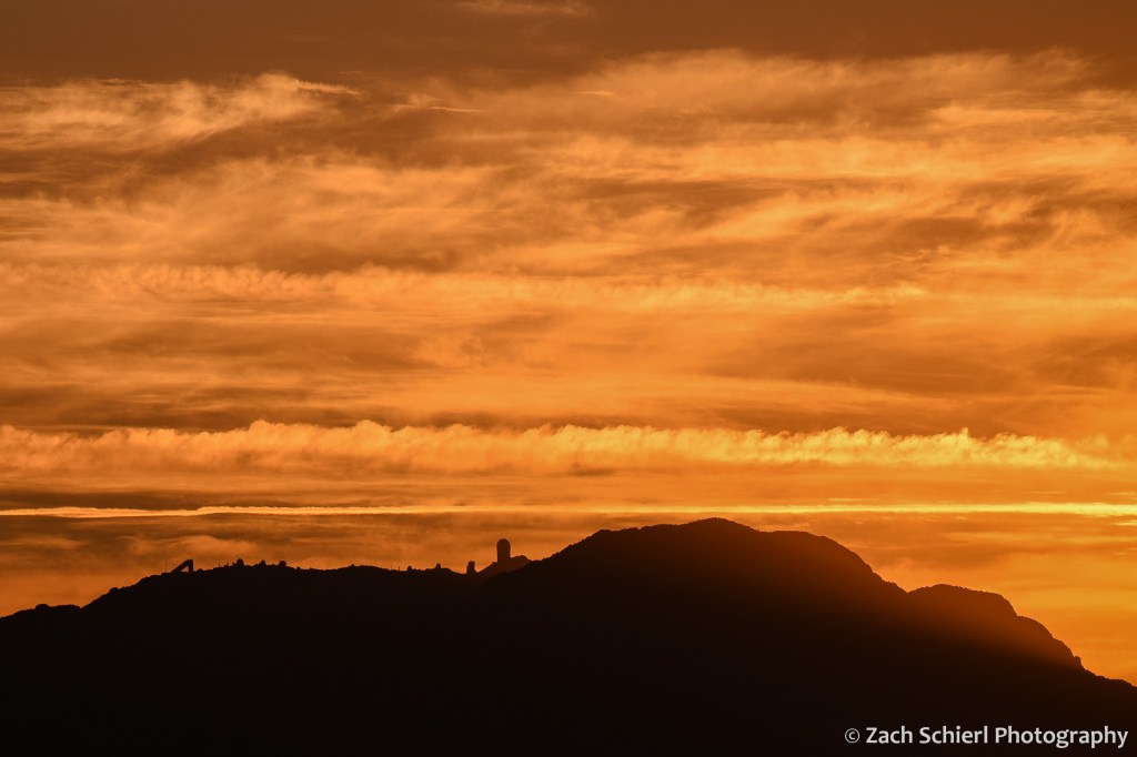
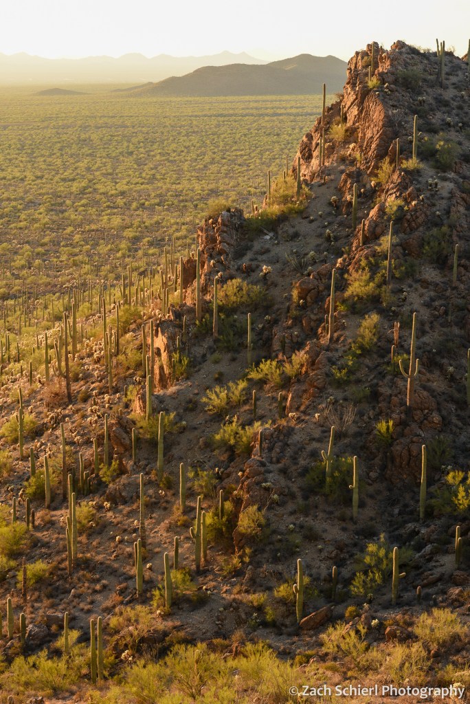
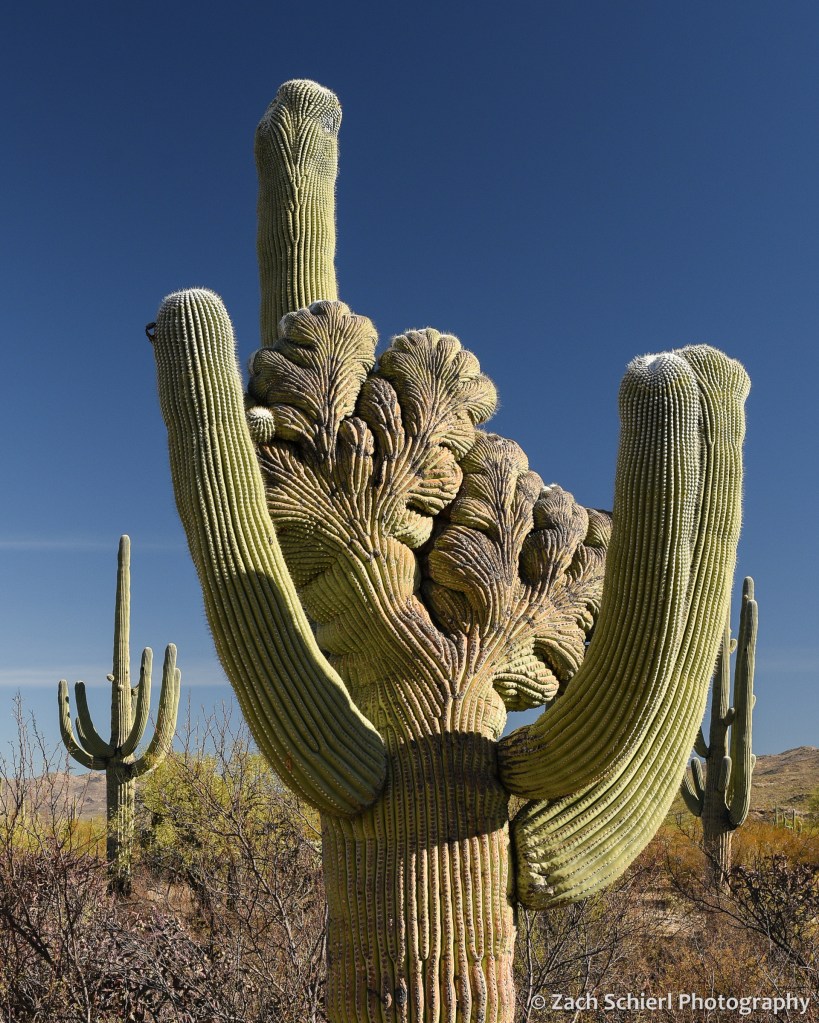
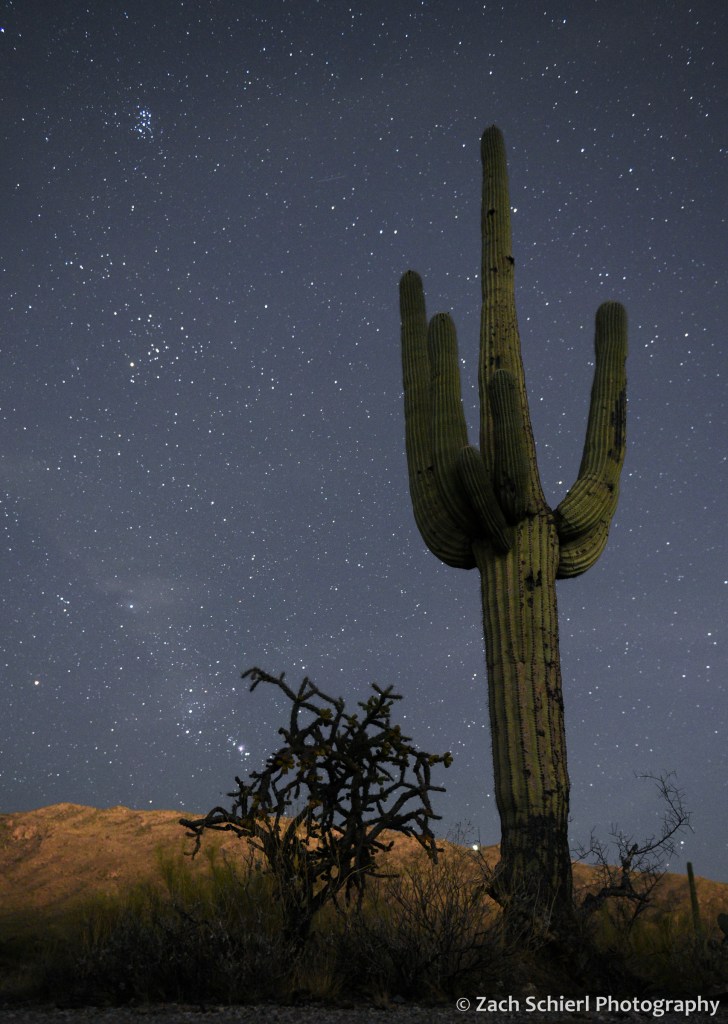
A Break from Winter in the Sonoran Desert


Happy New Year! For the first time since 2019, we were able to visit family in Arizona for the holidays this year. (We had tickets last year, but Southwest Airlines had other plans…) The cheapest flights were into Tucson, so I got to spend a few days hiking and shooting photos in the sunny and 75° Sonoran Desert for a few days at the beginning of the trip. It was a lovely break from the cold, gray central Washington winter, and it is hard to come away from an Arizona sunset without at least a few good photos! Here are a few of my favorites:


Exploring the Mt. Adams Wilderness


Mt. Adams is the largest (by volume) and second highest volcano in the Cascade Range of Washington. Often overshadowed by its neighbors, Mt. Rainier, Mt. St. Helens, and Mt. Hood, we’ve taken a liking to Adams in part because its trails tend to be relatively deserted and in part because we have a fantastic view of the mountain’s east face from our neighborhood in the Yakima Valley. Recently we had the chance to complete a short backpacking trip on the north flank of the mountain which allowed us vantage points that far surpass anything we’ve seen on previous day hikes.
Our hike began and ended at a trailhead (Killen Creek) that is, as the crow flies, just 57 miles from our front door, but takes more than three hours to reach by car, giving some sense as to the relative remoteness of this area. Most of our ~20 mile loop was within the Mt. Adams Wilderness, a 48,000 acre wilderness area designated in 1964 with the original passage of the Wilderness Act.

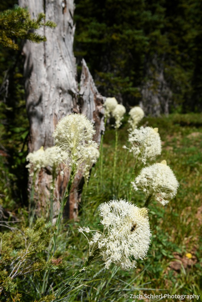
On our first night, we camped at just under 7,000 feet on the north flank of the mountain in one of the most spectacular alpine meadows I’ve seen. No matter which way I turned, the views were extraordinary. To our south, the crumbling volcanic edifice of Mt. Adams loomed large, with the Adams Glacier descending in a stunning icefall from the summit plateau. To the north, broad expanses of dense evergreen forest stretched off into the distance, leading the eye to the massive Mt. Rainier and the rugged skyline of the Goat Rocks on the horizon. To the west, the truncated cone of Mt. St. Helens was backlit by the setting sun. Several lingering snowfields surrounded our campsite, providing a nice source of clear, cold water. A variety of diminutive alpine wildflowers were in full bloom, and the low rumble of rock and ice fall high on the mountain occasionally punctuated the silence, with clouds of dust the only clue as to their location. While this location is reachable by a long day hike, spending the night and being able to explore and photograph in the late afternoon and evening light is one of my favorite things about backpacking!


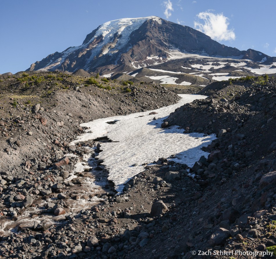
On Day 2, we descended to the Pacific Crest Trail before working our way around to the northeast side of Mt. Adams, passing through a series of wildflower-filled meadows and crossing several inviting streams cascading down from melting snowfields and glaciers higher on the mountain. These meadows also hosted a robust population of mosquitos and other biting insects….not unexpected for the Cascades in July, but an annoyance nonetheless, especially for an Arizona-born desert rat like me!
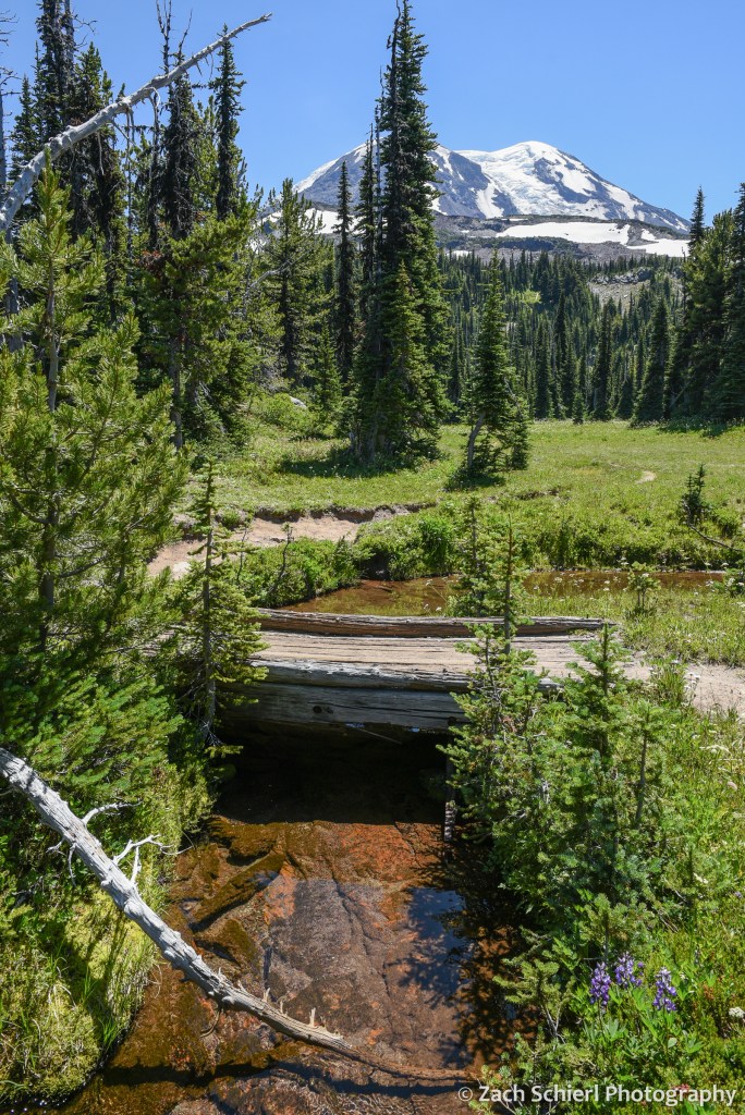

We had shared the trail with quite a few other hikers and backpackers on Day 1, but saw only a few other people from this point forward. Camp on night two was in a small clump of trees on the edge of a relatively recent lava flow. In contrast to the verdant alpine meadows of night one, this landscape was much more rugged, barren, and stark. After setting up our tent, we proceeded up the trail (with much lighter packs!) to find a spot for dinner. We quickly arrived at a stream crossing that we didn’t feel comfortable fording, so we left the trail behind and proceeded to pick our way up the rubbly bank until we arrived at a small knob with a spectacular view of the glaciers on Mt. Adams’ northeast face (Lava, Lyman, and Wilson). Here we enjoyed a delicious meal of instant mashed potatoes mixed with green chiles and an entire bag of bacon bits while listening to the roar of the creek.
Our best wildlife sighting of the trip actually occurred on the drive to the trailhead, when we happened upon a young barred owl sitting in the road. As we approached it flew into a nearby tree where it watched us warily for a few minutes before fleeing deeper into the forest:

Aside from this, we saw surprisingly little wildlife on this trip (unless you count mosquitos): only a few birds, chipmunks, squirrels, and a single marmot and mountain goat in the far distance from our first camp.
From our second camp, we were in a great position to catch sunrise on the final morning of our trip. There aren’t many things I’ll get up at 5:15 am for, but a Mt. Adams sunrise is definitely one of them!

After packing up, we hiked the eight downhill miles back to our car and drove back into the 100 degree blast furnace that is the Yakima Valley in late-July. We are thankful to have beautiful places like Mt. Adams so close to escape the heat this time of year!
Looking back at Spring

Spring is my favorite season here in central Washington. Our winters, while short and relatively mild in terms of snowfall and temperatures, can be quite dreary. Temperature inversions, freezing fog, and bad air quality are a staple of our weather forecasts from November to February. Summers can be brutally hot: the third digit on my home weather station spends quite a bit of time illuminated from June through August. While conditions in the Cascades are more tolerable, here in the arid sagebrush-steppe of the Yakima Valley, shade trees are found only along rivers and in watered urban backyards.
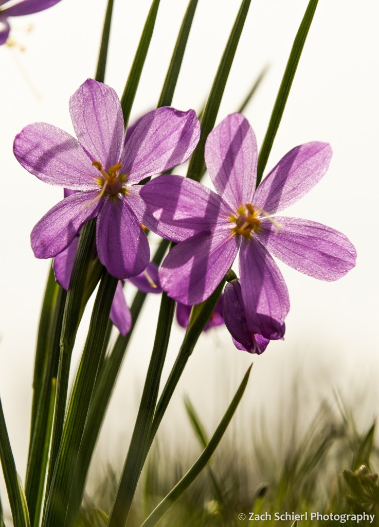
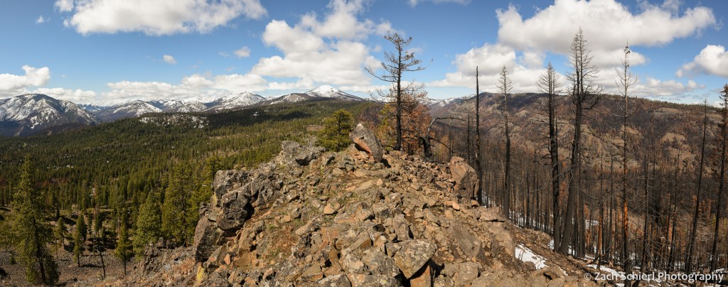
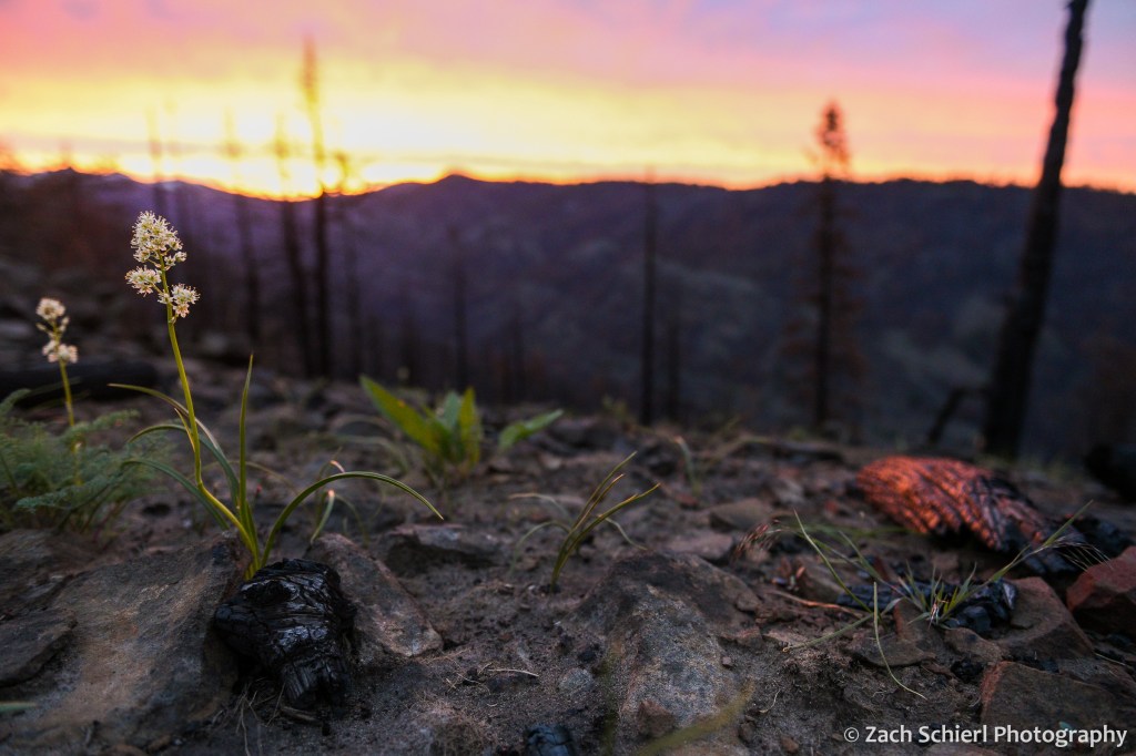
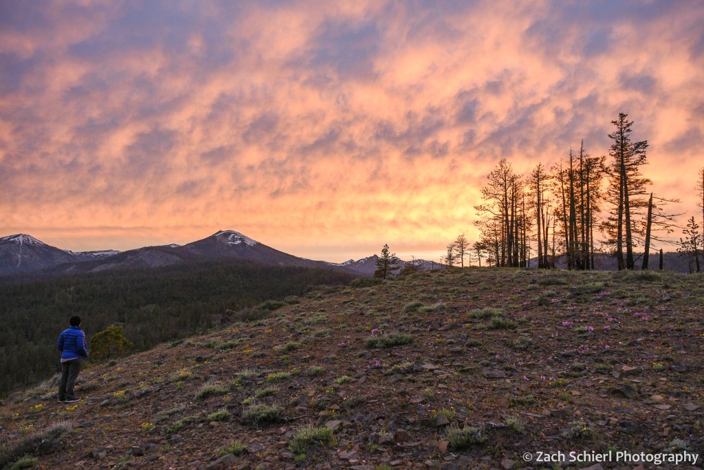
Spring holds the perfect balance: the days get progressively longer, conditions are perfect for outdoor exploring, and, as an added bonus, foothills of the Cascades come alive with wildflowers (one of my favorite photographic subjects the past few years.) Fall has its merits as well, but the with the onset of winter occupying the back of ones mind, the urge to get outside before the snow starts falling can feel almost stressful compared to the relaxed bliss of spring.
Here are some of my favorite photos from this past spring, from March’s vernal equinox up through June’s summer solstice: