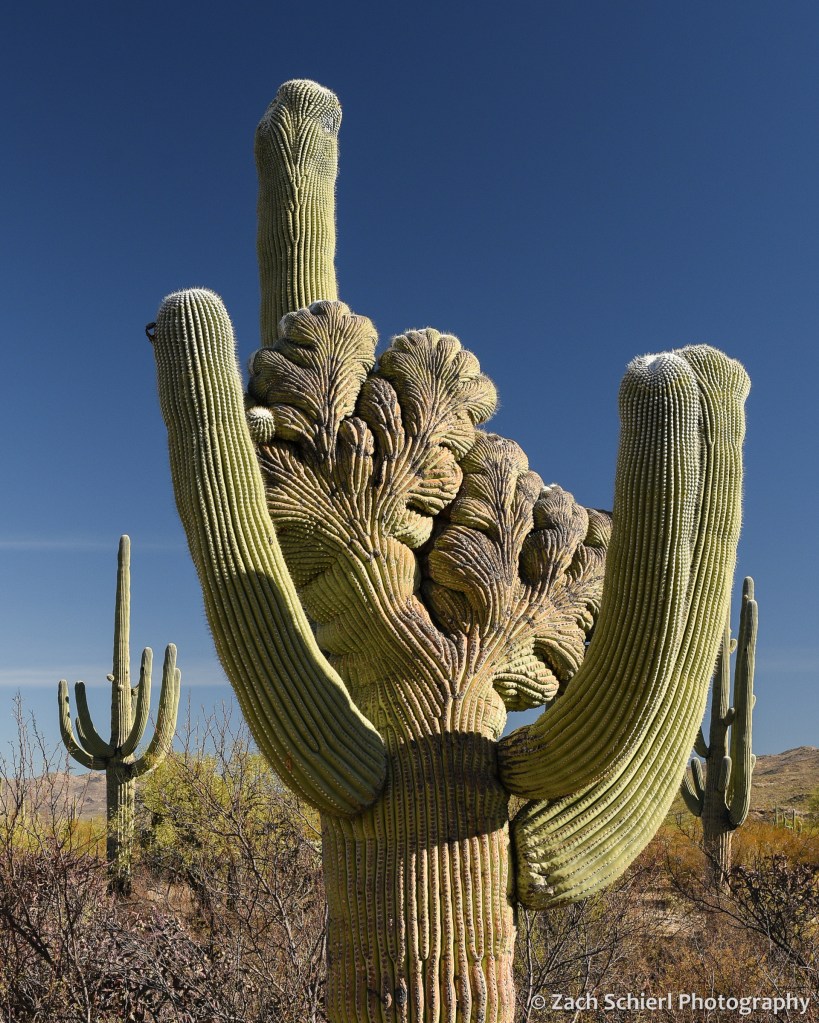
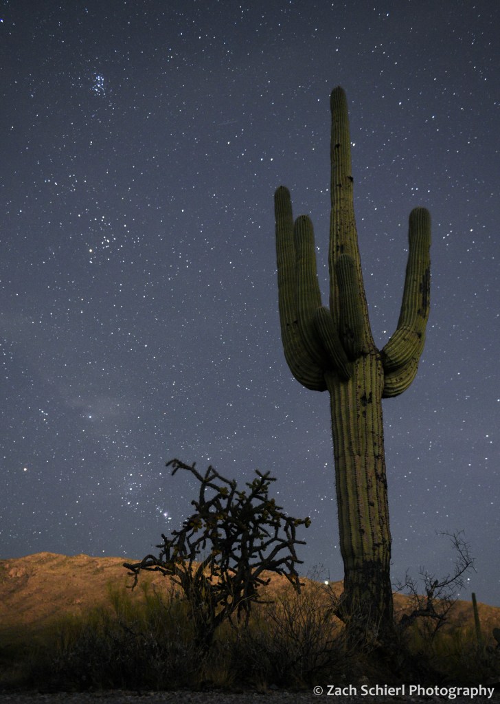
A Break from Winter in the Sonoran Desert


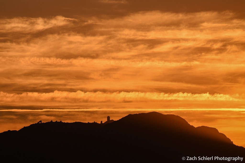
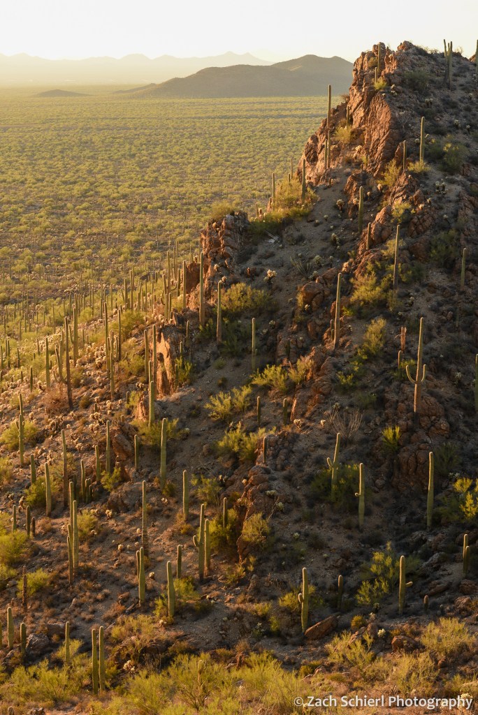
Happy New Year! For the first time since 2019, we were able to visit family in Arizona for the holidays this year. (We had tickets last year, but Southwest Airlines had other plans…) The cheapest flights were into Tucson, so I got to spend a few days hiking and shooting photos in the sunny and 75° Sonoran Desert for a few days at the beginning of the trip. It was a lovely break from the cold, gray central Washington winter, and it is hard to come away from an Arizona sunset without at least a few good photos! Here are a few of my favorites:


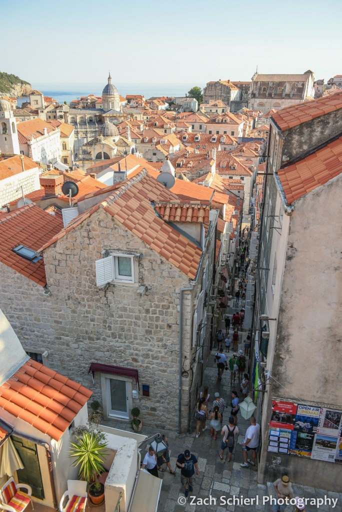
Europe Part 5: Dubrovnik and the Dalmatian Coast


Links to previous posts: Part 1, Part 2, Part 3, Part 4
From Mostar we hopped a bus to Dubrovnik, in theory just a few hours south along Croatia’s Dalmatian Coast. I’m not going to describe that journey in detail here, but it was definitely the most unpleasant travel experience of the trip, and possibly our lives. (Our bout of food poisoning in Italy a few years back, which involved copious vomiting first on a train and then in an elderly Italian woman’s bathroom, didn’t last as long and it wasn’t 100 degrees…)
After crossing the border from Bosnia into Croatia (a crossing that was, thankfully, almost deserted thanks to the opening of the Pelješac Bridge just a few days earlier), the travel gods finally took mercy on us and we arrived in Dubrovnik. We took a taxi to our apartment, and I quickly realized Dubrovnik was another place I was thankful to not be driving. The roads weren’t quite as anarchic as in Sarajevo, but there were a lot of very steep and narrow one way streets, tons of people, and almost non-existent parking. The view from our apartment was gorgeous and expansive due to its location a few hundred feet uphill from the coast. We could see a wide swath of the Adriatic Sea, several islands, and the historic walled old town of Dubrovnik spread out below us. The disadvantage of this location was that getting anywhere involved descending (and later ascending) a series of long, steep staircases in near 100 degree heat + humidity.

Dubrovnik was pretty much the epitome of what comes to mind when you think of a historic European city: narrow stone streets, lots of churches, lots of tourists, all surrounded by imposing city walls and fortifications. Dubrovnik is extra picturesque in that the whole affair is perched on a rocky peninsula that juts out into the Adriatic Sea. Old town Dubrovnik actually used to be two towns divided by a canal. Eventually the canal was filled in to connect the two towns, forming what is now the wide main boulevard known as the Stradun. (We were told that the loose material used to fill in the canal is likely to collapse in the next major earthquake.) The old town is pedestrian only, and boy were there a lot of pedestrians! Overall though, Dubrovnik was not as busy as we feared. A few years ago, there were often eight or nine cruise ships docked here each day, leading to massive and unsustainable crowds. Through some combination of COVID and limitations imposed by the city, cruise ship traffic has been greatly reduced and there was only one ship docked each of our three days in town. Dubrovnik was the only stop on our entire trip where there seemed to be a lot of other American tourists, roughly 50% of whom seemed to be on a Game of Thrones tour or in a Game of Thrones gift shop at any given moment. (Apparently large portions of GoT were filmed here, though we haven’t seen it so that significance was lost on us…)
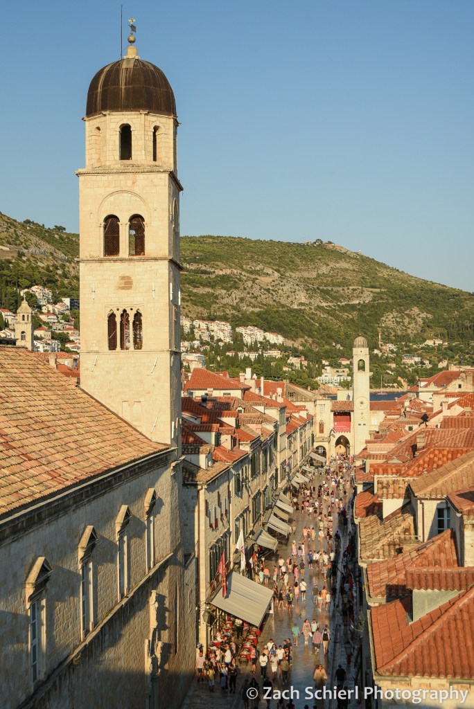
Dubrovnik, long a major trading center along the Adriatic coast, is well-fortified with a ring of tall, thick stone walls completely encircling the old town. A highlight of our visit was a late evening stroll around the top of the walls, with amazing views down into the city on one side, and out into the sea on the other. From above, you can see different colored tile roofs representing buildings of different ages. Most of the city was rebuilt after a big earthquake in 1600, and parts were bombed during Croatia’s war for independence in the 1990s.

As amazing as the city was, it was so hot and humid that we wanted to be in the water the whole time. There were a few small pebbly beaches a short walk from the old town, but these were packed to the point that it was hard to find anywhere to spread out a towel. We found a more relaxing scene by taking a 10-minute ferry ride to an island just offshore: Otok Lokrum. This island is a nature preserve with no permanent population, so there was plenty of room to spread out. There were lots of hiking trails, botanical gardens, some old ruins, a fort, rocky beaches…and cicadas. Lots and lots of very loud cicadas. The cicadas are the ubiquitous soundtrack of the Adriatic coast. Eventually you sort of tune them out, but when you pause to think about them, it is unbelievable how loud they are! We enjoyed swimming and relaxing on a pair of rocky beaches, though we did have to fend off several of the island’s resident peacocks, and avoid the abundant sharp black sea urchins when getting in and out of the water. The following day we kayaked around Otok Lokrum, going into a pair of beautiful sea caves, and getting a seaside view of the imposing Dubrovnik city walls.

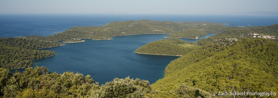
After several days in Dubrovnik (and over a week of being in larger cities), we were ready for a change of pace. Just off the coast of Croatia lies an archipelago of long, narrow islands that are collectively the main tourist destination in Croatia. We settled on a trip to Mljet, one of the larger but least populated islands, of which the western third is protected as one of Croatia’s eight national parks. We arrived on Mljet after an uneventful 1.5 hour ride on a high-speed catamaran from Dubrovnik (less exciting than it sounds…actually quite cheap, with airplane-like seating inside. But comfortable and air conditioned!)
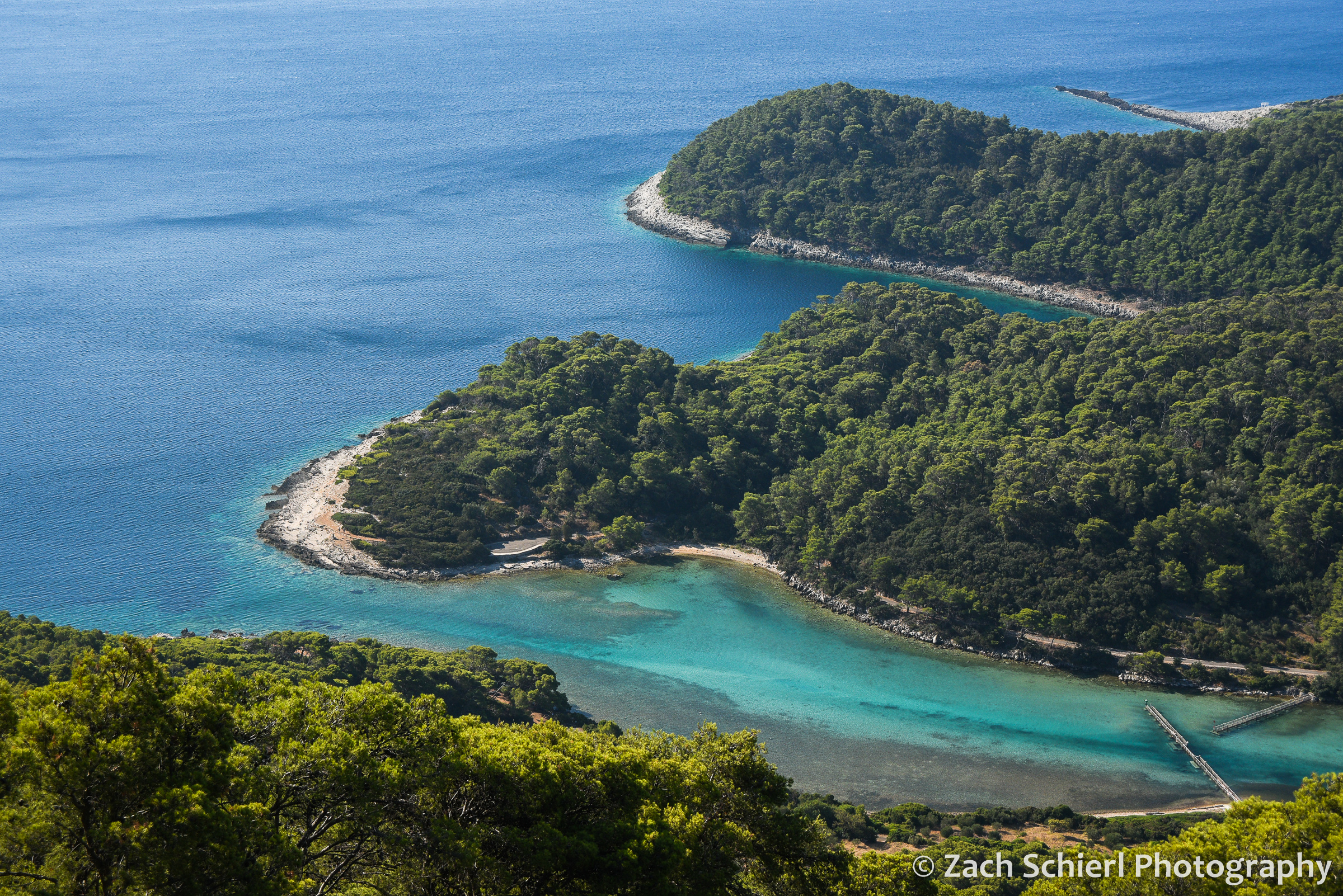
The ferry deposited us in the tiny town of Pomena: a few dozen houses, one hotel, a small market, and a handful of restaurants. The main attraction of Mljet National Park is a pair of lakes: one big, one small. These lakes are connected to the sea (and each other) via a pair of narrow channels, so while they look like lakes and are quite calm, they are actually salty. The small lake (Malo Jezero), was only a 10 minute walk from our rented apartment. We purchased some sandwich ingredients from the small market and headed to the lake for a picnic dinner and a sunset swim in the wonderfully warm water.

The following day we rented bikes to explore the island. A mostly level and paved bike/pedestrian path encircles the large lake, Veliko Jezero, which makes getting around very enjoyable and peaceful…save for the aforementioned cicadas. Along the way, we stopped to read many of the well-done interpretive signs explaining the natural and cultural history of the park. We ended up biking to the village of Soline, which is on the channel that connects Veliko Jezero to the sea. We enjoyed swimming and snorkeling in the channel, where the water was very shallow and had a mix of vivid blue and green hues. It wasn’t exactly the Virgin Islands from a snorkeling standpoint, but we did see lots of colorful fish, huge sea cucumbers, and various sponges. Thanks to some internet intelligence, we also found the largest coral reef in the Mediterranean. Given that there isn’t much coral at all in the Mediterranean, this also isn’t quite as exciting as it sounds. The coral was a muted brown color, and deep enough that it was hard to get a clear look. More exciting was the fact that I spotted several jellyfish a few seconds after getting into the water, and quickly realized they were ALL over the place. This freaked us out for a moment until we looked them up (because there is cell service everywhere in Europe, even in relatively remote national parks!) and realized that this species was harmless to humans.
On day 2, we got up early to hike up to Montokuc, the highest point in the national park, before it got too hot. Our bikes got us halfway there before we had to actually start walking, so the hike itself was pretty short. The summit is only about 250 meters (a little over 800 feet for the metrically challenged) above sea level, but there is a fire lookout tower at the top with spectacular views. We could see the whole western end of Mljet, the large and small lakes, the channel connecting them to the sea, and several other islands along the Dalmatian Coast. We only saw a few other hikers the whole time…probably the fewest people we had been around since the trip began!
The warm water and air temperature made Mljet feel borderline tropical, though it was clear from the vegetation that it is actually a pretty dry place. Wildfire is a major concern on the island in summer, and there was quite a bit of smoke in the air during our visit, wafting in from fires on other islands and the mainland. Overall, Mljet was a much needed change of pace and probably the most relaxing stop on our month-long trip. While we were far from alone, it was certainly less crowded and more peaceful than most nearby destinations. We would have loved to stay for another day…or week!
From Mljet we hopped back on the ferry to Dubrovnik, and then headed south to Montenegro and Albania!

From Washington to Zion

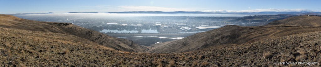
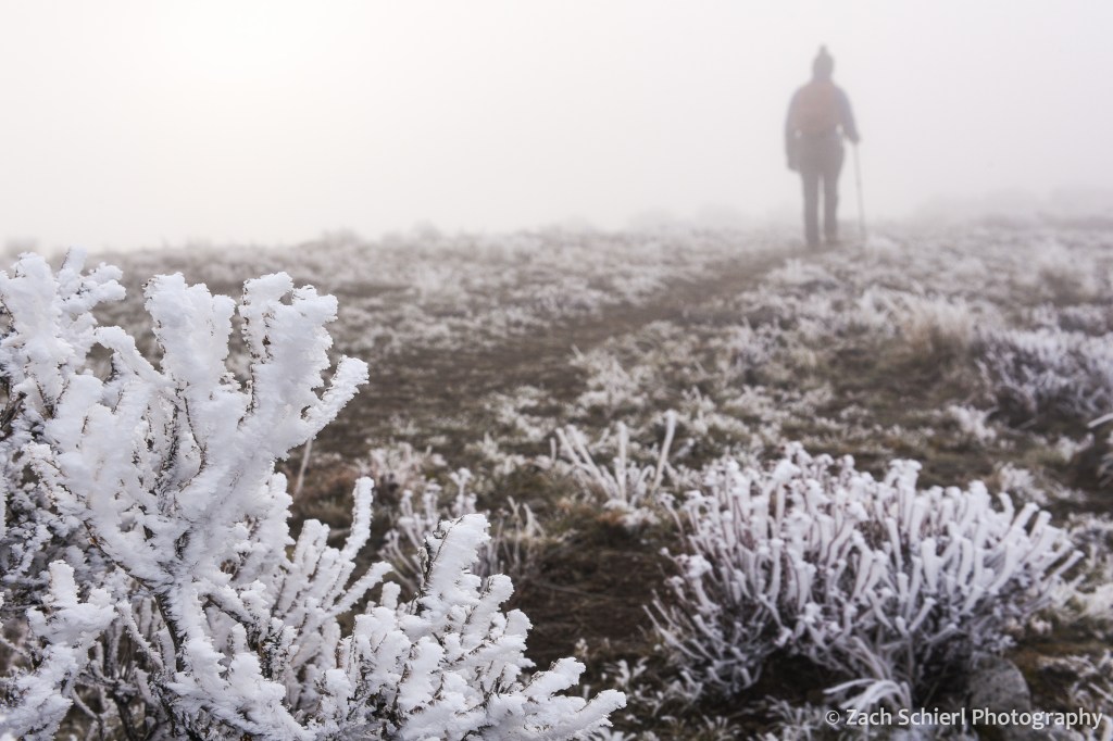
Between work, weather, and the ongoing pandemic, my camera has seen relatively little use the last few months. Here in central Washington, it is inversion season. Atmospheric inversions occur when relatively warm air passing over the Cascade Range traps colder air below in the valleys of the Columbia River Basin. These pools of cold air can persist for weeks, bringing cold temperatures, freezing fog, and poor air quality. Fun, fun, fun! Here’s what things have looked like in recent days:
Stuck inside, I’ve been working on a project to organize and categorize over a decade’s worth of photos. It’s been fun to come across long forgotten gems and months and months of photos that I never even got around to editing in the first place. I plan to post some of the highlights as I come across them.
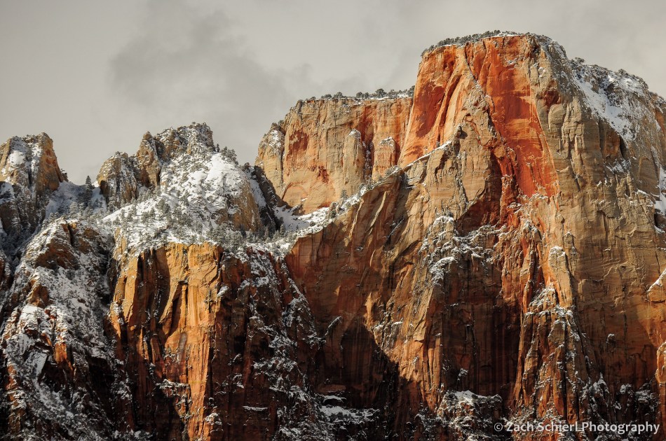
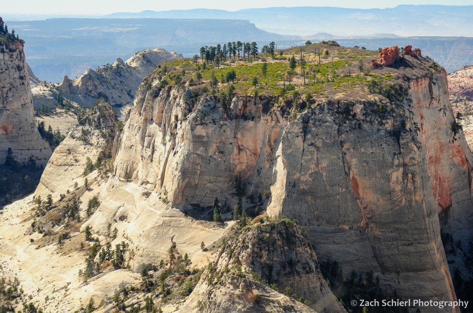
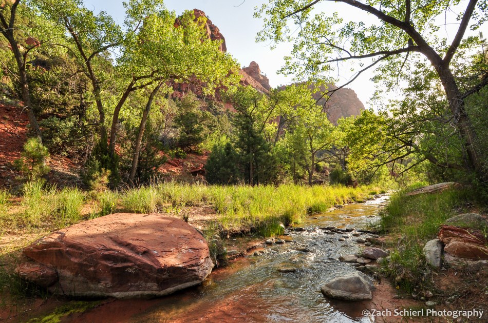
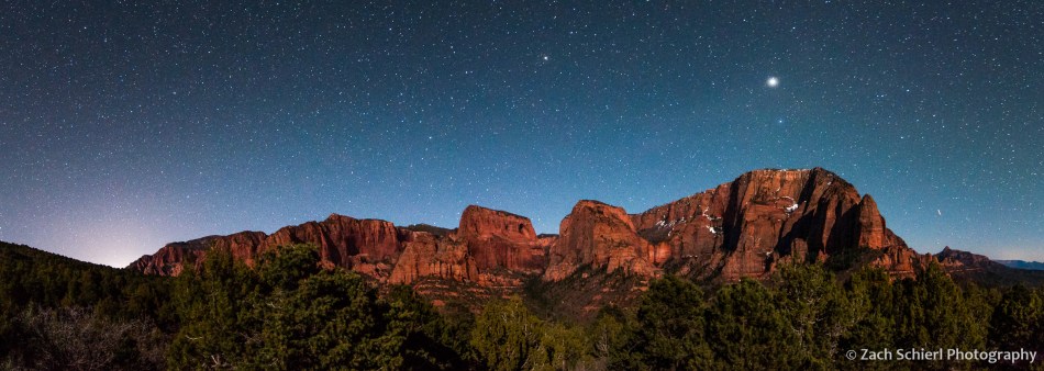
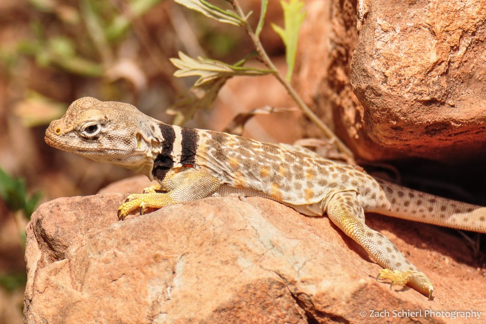
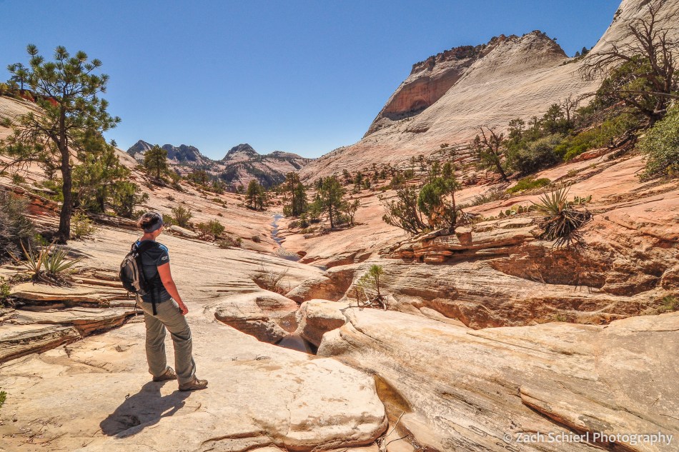
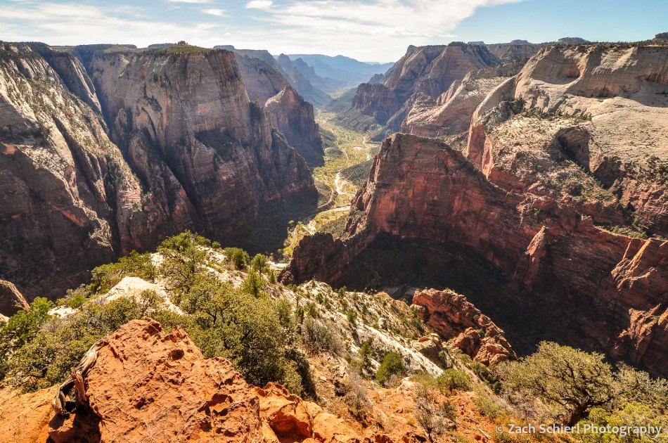
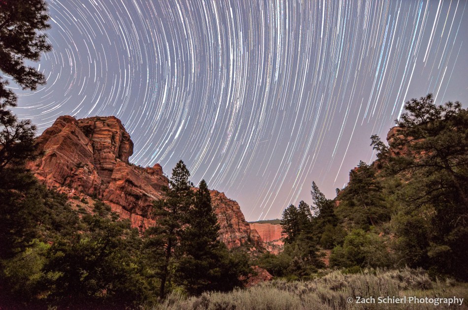
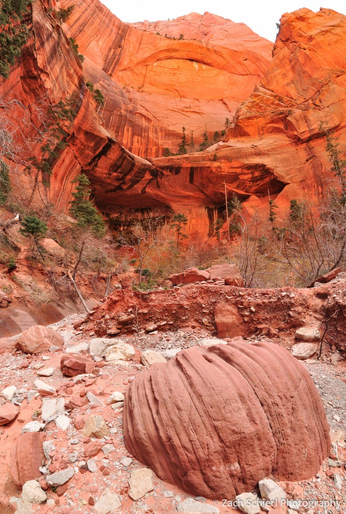
While I post only a tiny fraction of the photos that I take here, looking back through the archives, I’ve noticed one especially glaring omission over the past few years: Zion National Park. Zion is one of my favorite landscapes on Earth, and for a little over three years we lived just 20 minutes from the north end of the park. I was surprised to discover that I haven’t shared any images from Zion since I started this website and blog almost a decade ago. In order to rectify that, here’s a look back at some of my favorite photos from Zion National Park: