From Washington to Zion

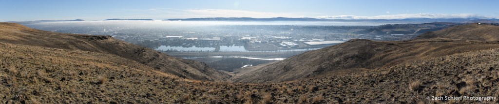
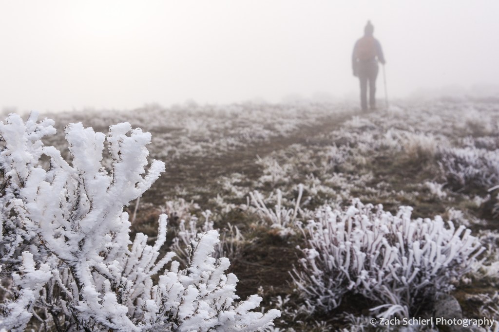
Between work, weather, and the ongoing pandemic, my camera has seen relatively little use the last few months. Here in central Washington, it is inversion season. Atmospheric inversions occur when relatively warm air passing over the Cascade Range traps colder air below in the valleys of the Columbia River Basin. These pools of cold air can persist for weeks, bringing cold temperatures, freezing fog, and poor air quality. Fun, fun, fun! Here’s what things have looked like in recent days:
Stuck inside, I’ve been working on a project to organize and categorize over a decade’s worth of photos. It’s been fun to come across long forgotten gems and months and months of photos that I never even got around to editing in the first place. I plan to post some of the highlights as I come across them.
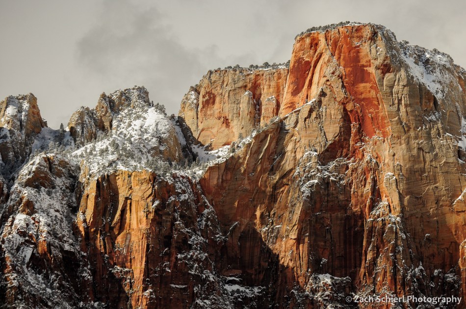
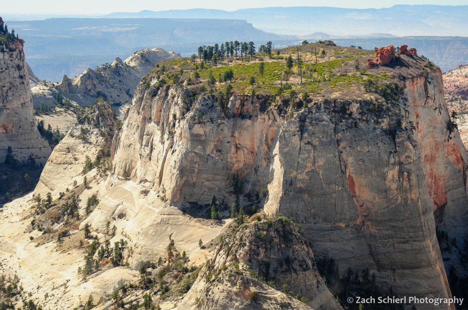
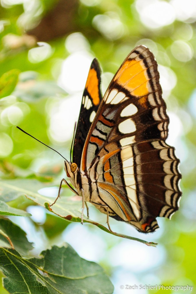
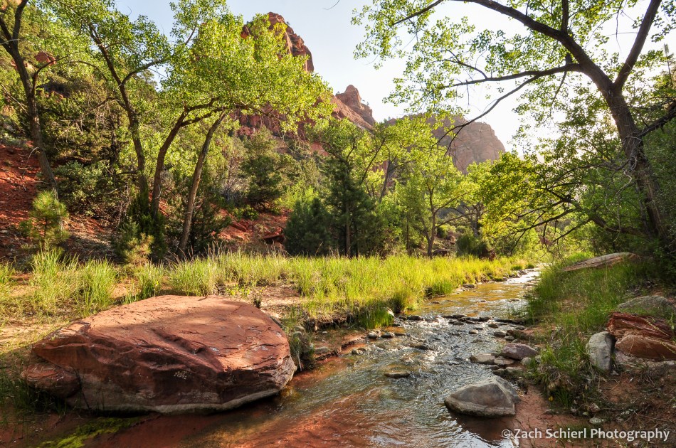
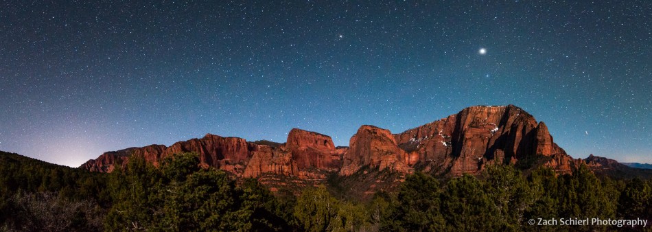
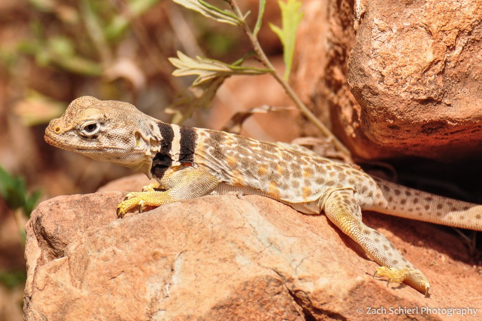
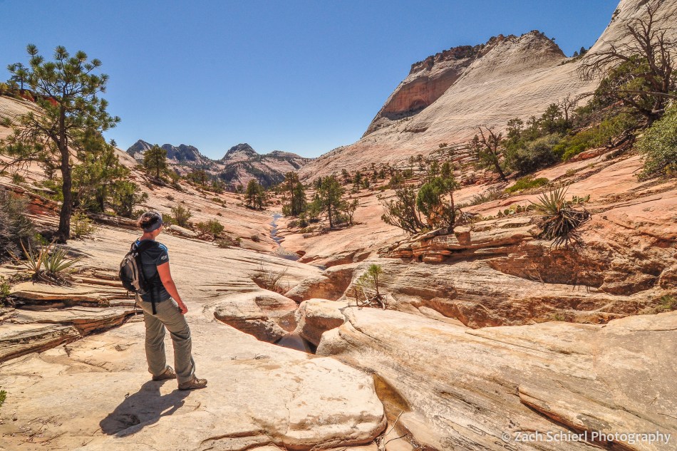
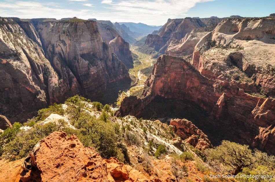
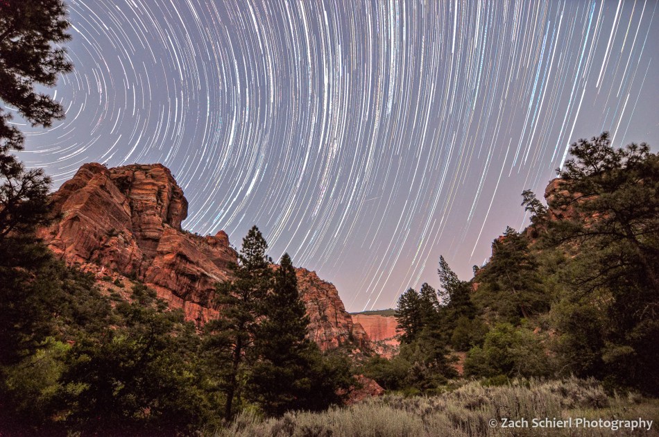
While I post only a tiny fraction of the photos that I take here, looking back through the archives, I’ve noticed one especially glaring omission over the past few years: Zion National Park. Zion is one of my favorite landscapes on Earth, and for a little over three years we lived just 20 minutes from the north end of the park. I was surprised to discover that I haven’t shared any images from Zion since I started this website and blog almost a decade ago. In order to rectify that, here’s a look back at some of my favorite photos from Zion National Park:


The Heart of Utah: Capitol Reef National Park


Hickman Natural Bridge, Capitol Reef National Park, Utah
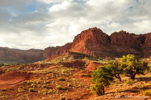
The least visited and most isolated of Utah’s five national parks, Capitol Reef hosts what is perhaps the quintessential Utah landscape. It is as if someone took small portions of the other four parks and mashed them into one; here you can find a plethora of arches and natural bridges, deep snake-like canyons, soaring Navajo and Wingate Sandstone cliffs, and even a few hoodoos thrown in for good measure.

Looking east across the Waterpocket Fold toward the Henry Mountains, the last mountain range in the lower 48 to be mapped and named, and their high point: 11,522′ Mt. Ellen.
The skinny sixty mile long park was originally established as a national monument in 1937, but became a national park in 1971. The odd shape stems from the inherent nature of the feature it protects: the Waterpocket Fold, a 100+ mile-long kink in the Earth’s crust known as a monocline. Creeks and rivers have dissected the fold over millions of years to reveal what is quite possibly the most colorful and diverse array of rock layers in Utah.
Capitol Reef is far from just about everywhere (which made the flat tire we experienced on the way that much more annoying). To the east and south lie the last major mountain range and river, respectively, to be mapped and added to the map of the lower 48 states. Not until the 1960s did a paved highway cross the Waterpocket Fold through Capitol Reef. In the northern part of the park, the Fremont River slices a narrow canyon through the Waterpocket Fold, its water creating one of the few habitable areas in the entire region. Petrogylphs attest to the importance of this year-round water source to ancient inhabitants. In 1880, Mormon settlers established the settlement of Fruita along the banks of the Fremont. The remains of this historic farming community and the abundant, lush green orchards and fields seem out of place in the otherwise stark central Utah canyonlands but add to the allure of the park.

Early morning in the Fruita orchards and pastures

Bighorn sheep petrogylphs along the Fremont River, Capitol Reef National Park, Utah
Here are some of the sights from our quick trip to Capitol Reef this past weekend:

On a hike through Capitol Gorge, we encountered a bed within the Navajo Sandstone with some unbelievably complex and colorful patterns:

For the most part, the landscape at Capitol Reef is quite open, allowing vast views and superb light at sunset:
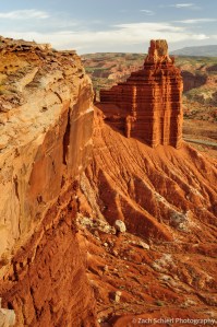
Chimney Rock, a tower of soft Moenkopi Formation mudstone capped by harder sandstone belonging to the Shinarump Member of the Chinle Formation

Late afternoon scene along the Chimney Rock Trail, Capitol Reef National Park, Utah
More sunset scenes

Hiking among crumbling cliffs of Wingate Sandstone, Capitol Reef National Park, Utah

A nearly full moon made it hard to do much stargazing at Capitol Reef, which is world-renowned for dark night skies.
Not far from the park campground and visitor center are the remnants of an old trail leading up a sandy wash, then up a short but steep talus slope before arriving at a hidden basin containing hoodoos and other strange rock formations. Unfortunately it was just about noon and the light was about as direct and harsh as possible, but it was cool to explore an area off-the-beaten path yet still in sight of the tour buses below:

Ascending the talus…

Gravity-defying hoodoos were the reward!

Hoodoos in the Chinle Formation at Capitol Reef National Park, Utah
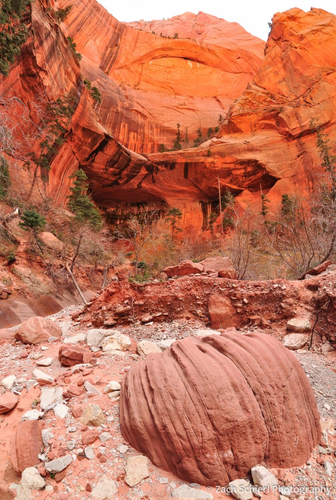
Coyote Gulch in Pictures


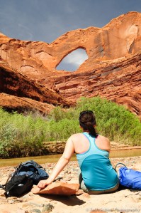
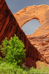
Jacob Hamblin Arch and a series of deep alcoves cut into the Navajo Sandstone are the highlights of a trip through Coyote Gulch.
This past weekend we made our first foray into the interior of the Colorado Plateau since moving to Utah. Our destination was Coyote Gulch, a well-known tributary of the Escalante River that straddles the boundary of Grand Staircase-Escalante National Monument and Glen Canyon National Recereation Area. Below are some photos from the trip:
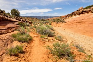
The hike begins with a nearly six mile slog through the desert along, and often in, Hurricane Wash. Toward the end it gets interesting, but mostly it looks like this. Nice, but nothing to write home about.
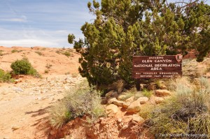
After about three miles of walking along Hurricane Wash, the trail leaves Grand Staircase-Escalante National Monument and enters Glen Canyon National Recreation Area. It is here that things start to get more interesting.
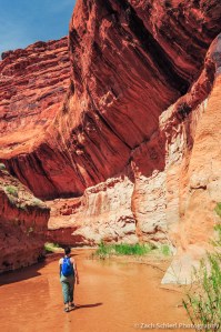
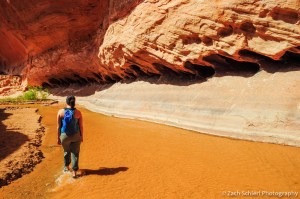
Soon, cliffs of Navajo Sandstone begin to rise up along the wash and become progressively higher as you head downstream. Eventually a small stream appears in the canyon bottom, after passing through several short sections of dry narrows like this one.
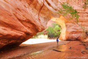
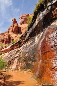
Eventually, Hurricane Wash meets Coyote Gulch, which is perhaps best known for a series of enormous undercuts carved into the smooth and sheer walls of pink Navajo Sandstone.

This was the largest alcove we encountered and we were fortunate enough to be able to camp in its shadow. For most of the trip, the air was incredibly calm and still and standing inside these alcoves felt like being inside a great rotunda or cathedral.
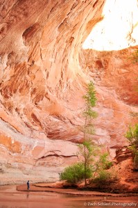
The scale of the alcoves is truly incredible and difficult to grasp without being there. Note Michelle for scale in the lower left.

A group camped directly beneath the alcove on our first night spent several hours messing around with some extremely bright flashlights and spotlights. It was rather annoying when we were trying to fall asleep, but it actually made the star-trail sequence I was shooting come out rather nice.

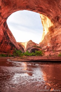
Just a few hundred yards downstream from the large alcove where we camped was Jacob Hamblin Arch (also see photo at top of page). The creek makes a tight meander around the fin of rock containing the arch, allowing it to be seen from both sides.
On day two, we day-hiked from our campsite near Jacob Hamblin Arch down to the confluence of Coyote Gulch and the Escalante River, a distance of about 13 miles round trip. One of the many attractions en route was Coyote Natural Bridge.

It was mid-April and the canyon was incredibly lush and green. Many of the stream terraces alongside the creek were resplendent with green grasses and wildflowers.
Numerous springs emerge from the canyon walls along Coyote Gulch. Do you see the “T-Rex” in the upper left?
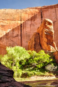
Moving downstream, Coyote Gulch leaves the Navajo Sandstone behind and carves into deeper and older layers of rock. Near the confluence with the Escalante River, the canyon walls are in the bright orange Wingate Sandstone.

Looking downstream along the Escalante River at its confluence with Coyote Gulch.
A ford of the waist-deep Escalante and a short walk upstream from the confluence reveals the impressive Stevens Arch high on the canyon wall.
Another view of Stevens Arch.

The surface elevation of Lake Powell when full is about 3,700 feet, almost exactly the elevation at the confluence of Coyote Gulch and the Escalante River, as shown by this Bureau of Reclamation benchmark.
At various times in Lake Powell’s history, most recently in the 1980s, the lake surface rose just high enough to flood the lowest reaches of Coyote Gulch and inundate the confluence under shallow water. The remnant water level lines are still faintly visible in lower Coyote Gulch.
The hike to the Escalante and back was a long one, but views like this around pretty much every bend made it seem shorter!
As a final note, Coyote Gulch has, for good reason, become an extremely popular destination over the years. We actually had some second thoughts about going after reading guidebooks that implored us not to visit on a holiday weekend in the spring (it was Easter) and after the BLM employee who issued our permit told us we would be “joining a party.” In the end, we found the over-crowding hype to be somewhat overblown. While there were more folks down there than you might expect to find in such a remote location, it could hardly be called a party. We camped in the most popular half-mile section of the gulch and couldn’t see anyone else from our site along the banks of the creek. We met just a handful of other groups on our hikes in and out of the gulch, and only occasionally encountered other people on our all-day hike down to the Escalante River and back. If you are seeking complete and total solitude or isolation, this is probably not the place for you. But we didn’t feel like the crowds detracted from the experience much if at all.
The increase in visitation to Coyote Gulch certainly creates challenges for the future. Hikers are now required to carry out all human waste, which seems to be a step in the right direction. However challenging keeping the gulch in pristine condition might be, I tend to believe that this situation is better, in the long-term at least, than the alternative. Coyote Gulch has been described as one of the last remaining echos of Glen Canyon, a small remnant of the scenic wonders that were submerged after the construction of Glen Canyon Dam and the filling of Lake Powell in the 1960s. Glen Canyon was lost ultimately because it was “the place no one knew.” The same cannot be said of Coyote Gulch. It is one of those places where the term “loved to death” gets thrown around, but ultimately we only fight to protect places that we love and value and it is hard to truly appreciate a place like Coyote Gulch solely through pictures. Hopefully the more people that go to Coyote Gulch and experience its majesty first-hand, the more people there will be to stand-up for it against future threats that are assuredly to come.

