Some Statistics From 15 Years of Photography

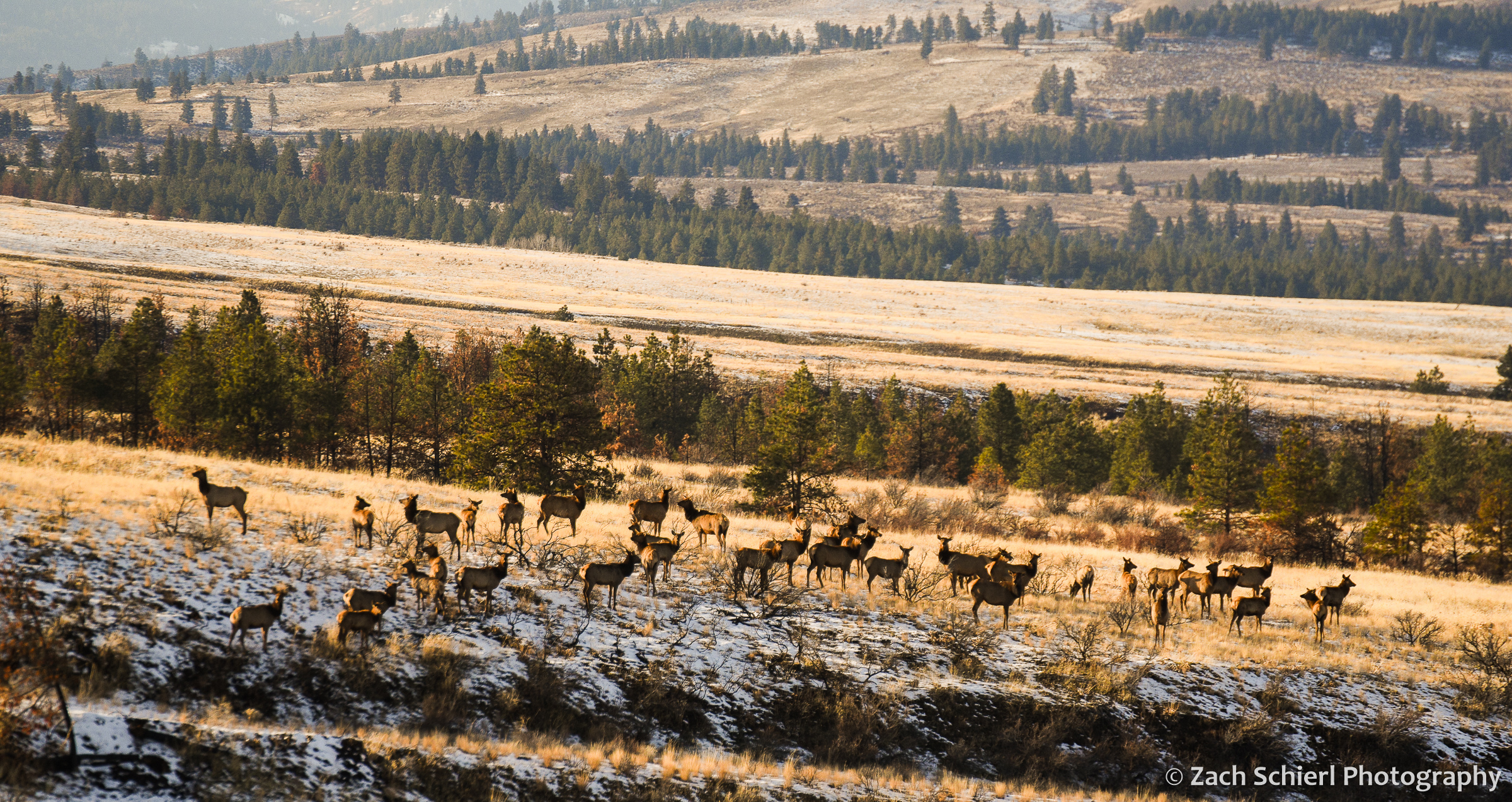
A herd of elk in Washington’s Wenas Valley.
Back at the beginning of the pandemic, I embarked on a project to finally organize and categorize my extensive photo collection. I have nearly 100,000 photos in Lightroom, but as I generally try to spend as little time as possible in front of the computer screen, I had never bothered to organize them in any meaningful way. The initial decision to fix this was a function of both time (I was stuck at home…) and practicality. I use my images extensively in my job as a community college astronomy and geology instructor, and finding that one specific photo of a rock or lunar eclipse has always been sort of a nightmare if I didn’t happen to remember exactly when it was taken.
The project started off quickly (when I was stuck at home…) but as we re-emerged into the world a few months later, progress soon slowed, and I am just now finishing the project almost two years after I began. While tedious at times, it has also been a joy to rediscover many long forgotten photos. I hope to post many of these in the coming months. As a statistics nerd, it’s also been interesting to examine some of the data on where and when I’ve taken the most photos. For example, here is a graph showing the number of images I’ve taken each year, going back to 2007 (almost 15 years ago!) when I purchased my first digital camera:
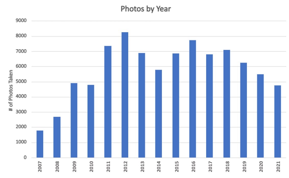
It looks like it may have taken me a few years to fully internalize that, with digital, I could take as many photos as I wanted and not have to worry about the cost of film! As you can see, I’ve taken fewer photos this year than I have since 2008, a fact which I was acutely aware of even before making this graph. The drop-off from 2018-2020 is a little harder to explain, as we traveled quite extensively in those years (albeit closer to home in 2020 due to the pandemic). I’d like to think it’s because I’ve gotten better at capturing a good shot on the first attempt, but who knows…
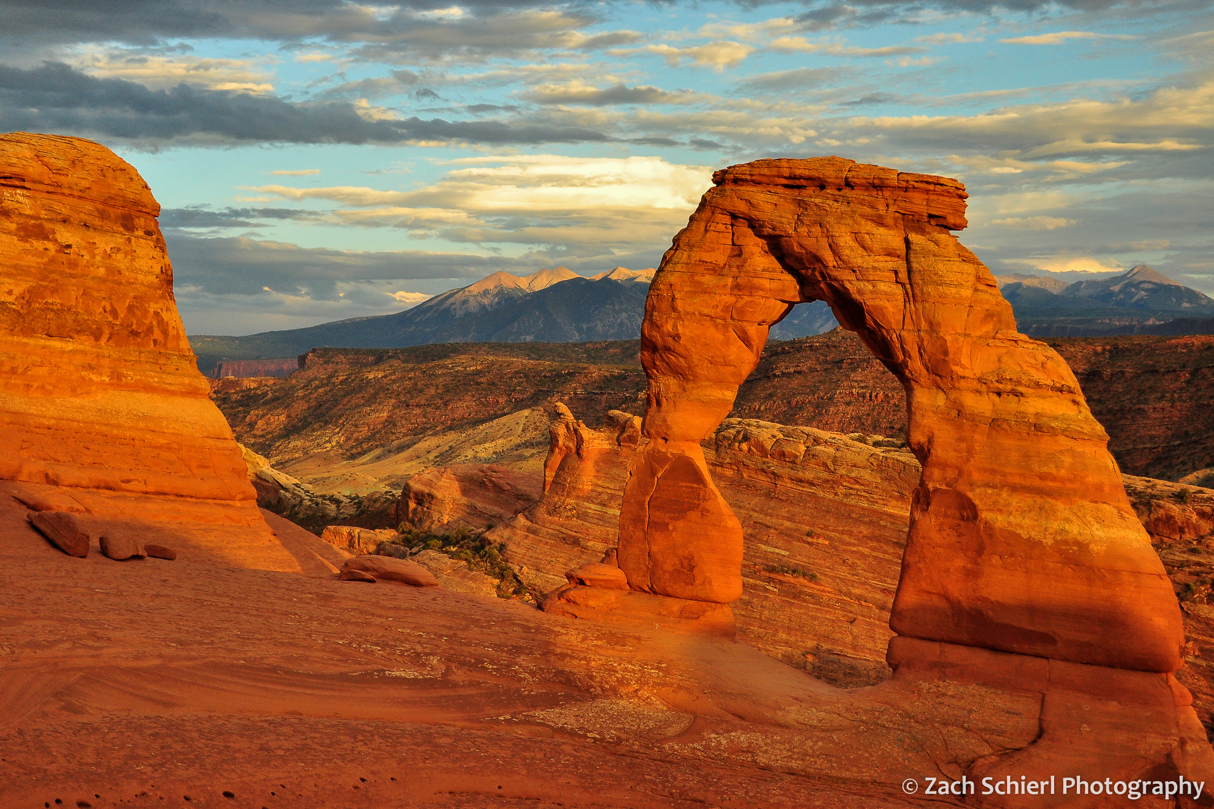
A sunset view of Delicate Arch from 2012. While a somewhat cliché shot, it is also one that’s getting harder and harder to capture as crowds at popular viewpoints get larger and larger.
My project also involved sorting photos by location. As of Dec 2021, here are the top five states in which I’ve taken the most photos:
| State | Photos Taken |
| Washington | 21,154 |
| Utah | 17,188 |
| Colorado | 13,642 |
| Arizona | 8,959 |
| California | 3,779 |
No surprises here: I’ve lived in Washington for most of my adult life, with brief stints in Utah and Colorado. Arizona is where I grew up (and frequently return), while my now-wife lived in California during the early years of our relationship.
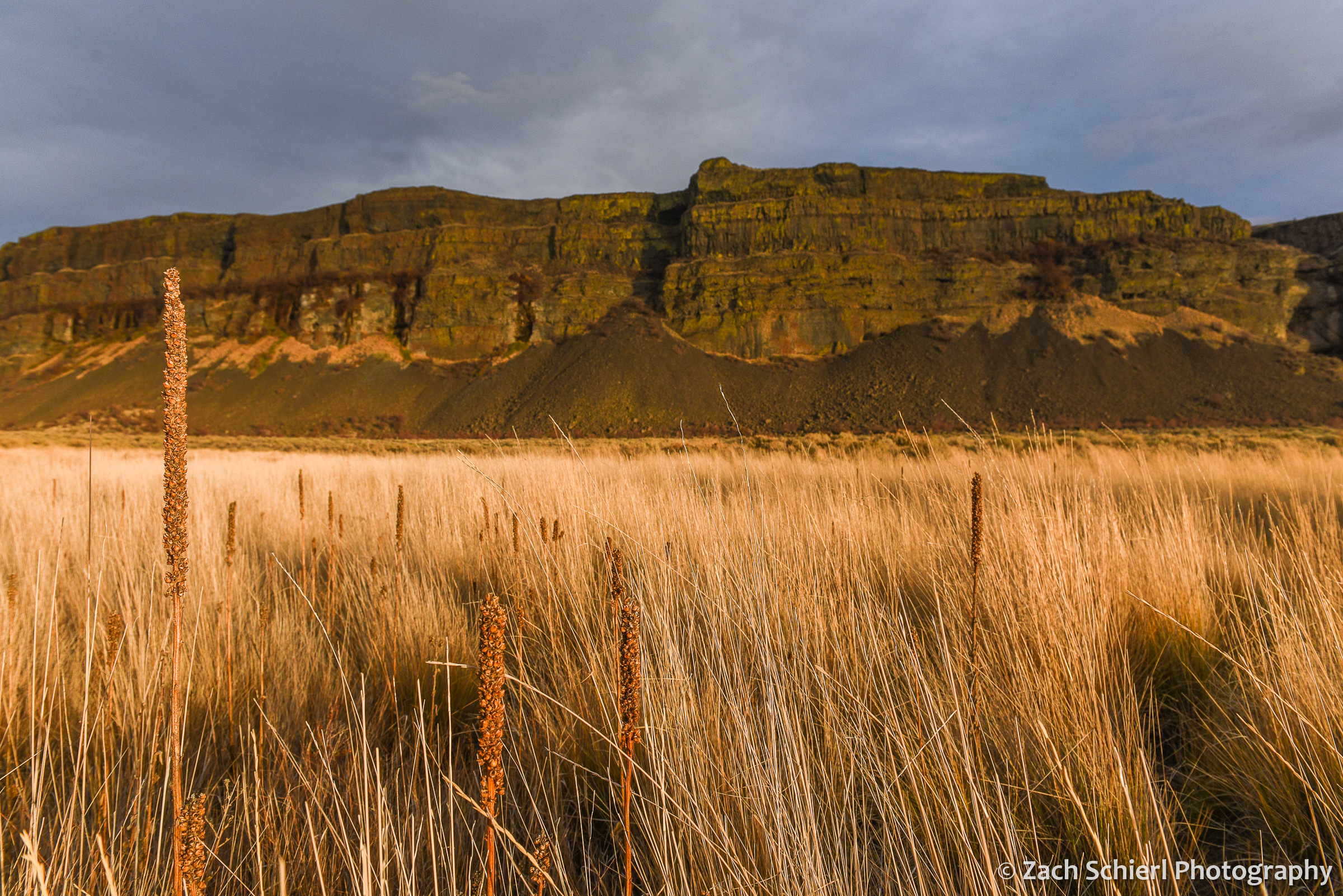
Basalt cliffs in Grand Coulee, Washington
Breaking things down a bit more, the specific locations where I’ve taken the most photos are also all found in one of the five states from above:
| Location | Photos Taken |
| Dixie National Forest, UT | 2779 |
| Cedar Breaks National Monument, UT | 2757 |
| Black Canyon of the Gunnison National Park, CO | 2703 |
| Wenatchee National Forest, WA | 2122 |
| Zion National Park, UT | 2014 |
| Rocky Mountain National Park, CO | 1768 |
| San Juan Mountains, CO | 1695 |
The Dixie National Forest covers a pretty wide swath of southern Utah, so its presence in the top spot is perhaps a little misleading. Cedar Breaks and Black Canyon, while relatively small parks, are places that I worked for several summers or years. I was a little surprised to see Zion National Park so high on this list. While we lived close to Zion during our time in Utah, it was generally a place we tried to avoid most of the year, given the crowds and heat. Apparently we ended up there more than I remembered!
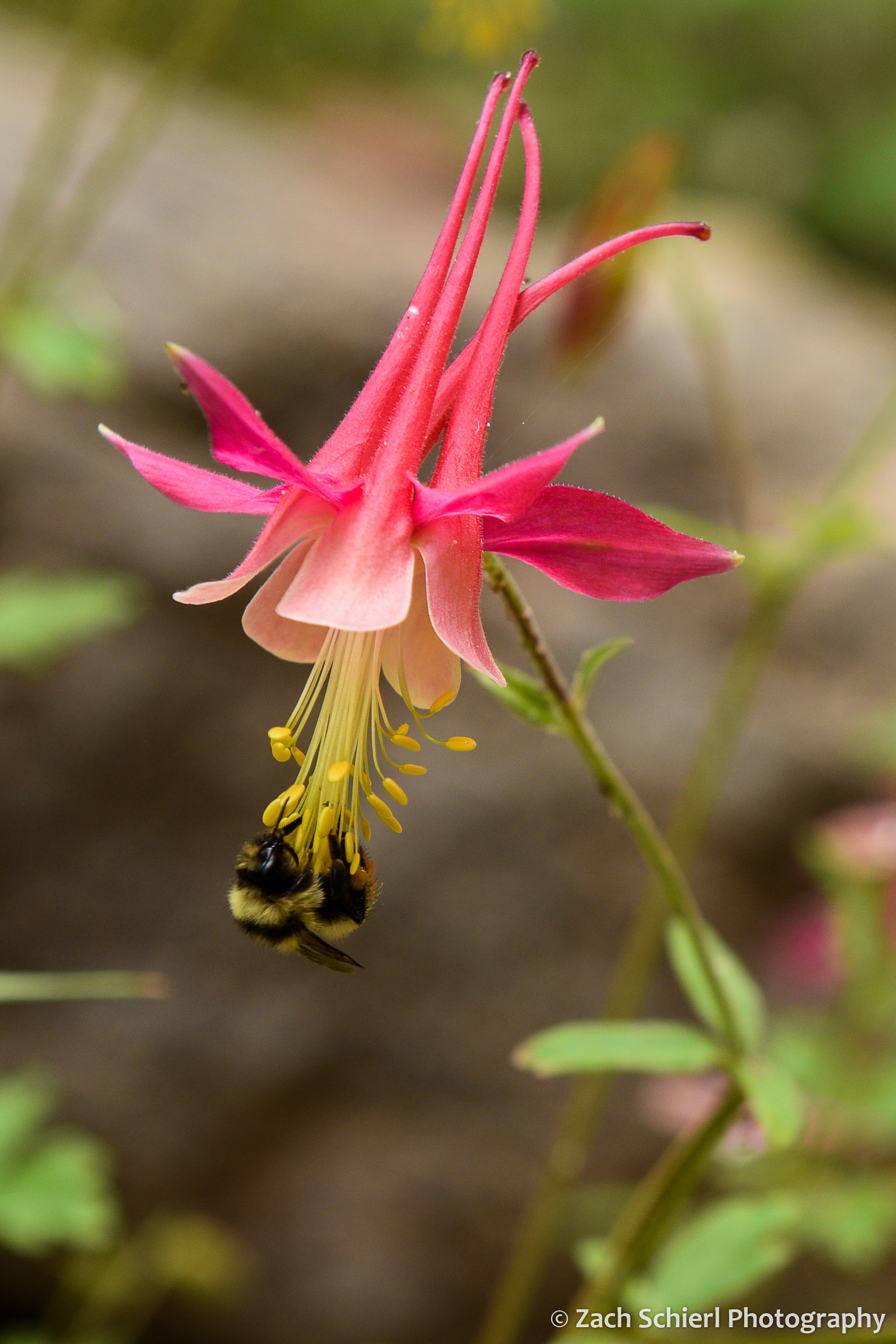
A rare pink specimen of red columbine (Aquilegia formosa) in the Dixie National Forest, Utah.
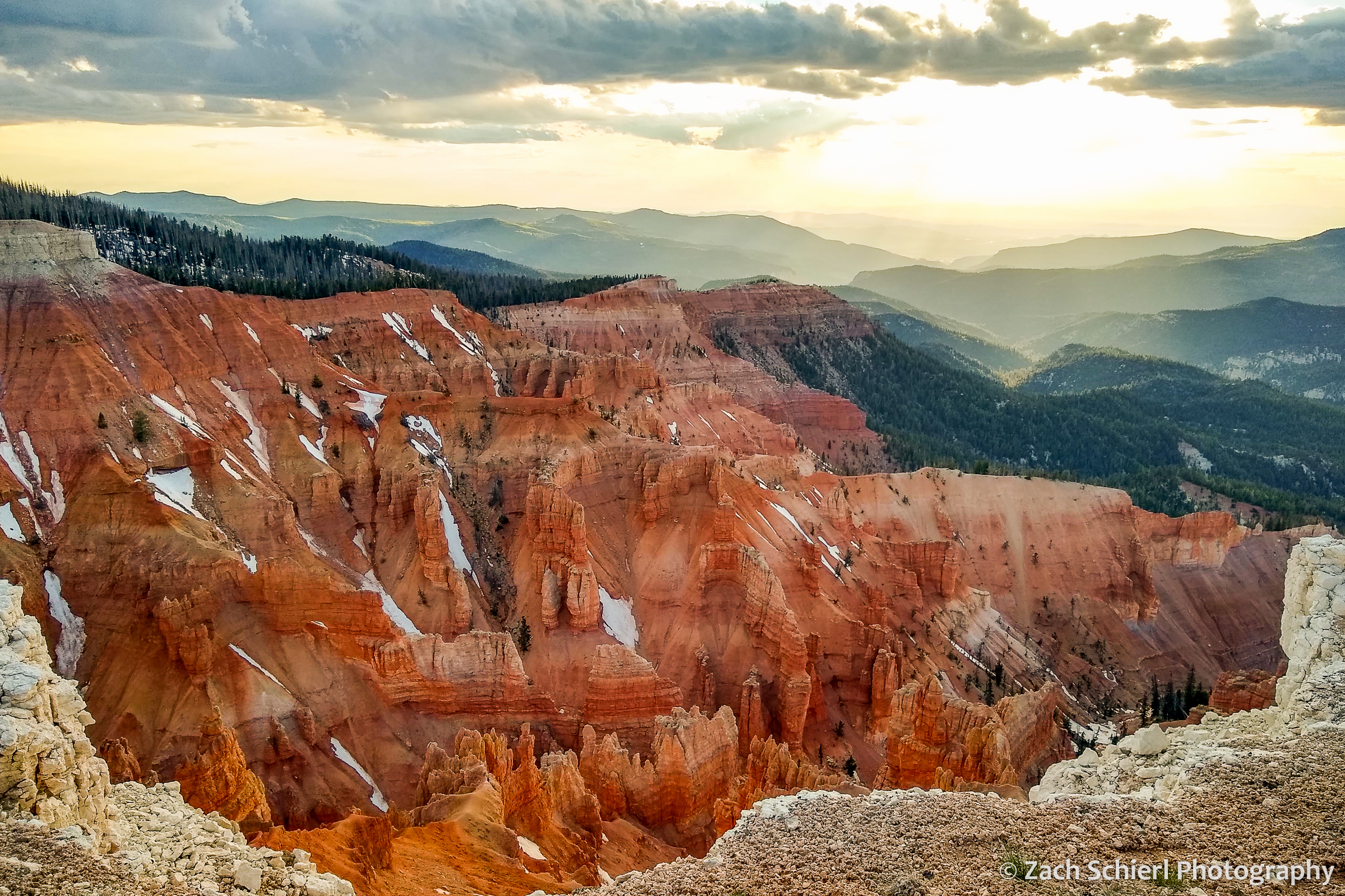
Sunset from Point Supreme in Cedar Breaks National Monument, UT. (I’m not 100% sure, but I think this may be the first cell phone photo I’ve ever posted on this site…)
In nearly 15 years of photography, I have taken 300+ individual images in one day just three times. Below is a list of my most “productive” (measured by sheer volume that is) days of photography:
| Date | Photos Taken | Occasion/Location |
| 6/11/2012 | 342 | First visit to Great Sand Dunes NP in Colorado |
| 8/7/2009 | 327 | Backpacking trip to Havasu Canyon, Arizona |
| 5/16/2015 | 316 | Black Elk Peak and Custer State Park, South Dakota |
| 4/20/2019 | 282 | Backpacking trip to Willow Gulch, Utah |
| 7/9/2012 | 279 | Yankee Boy Basin, San Juan Mtns, Colorado |
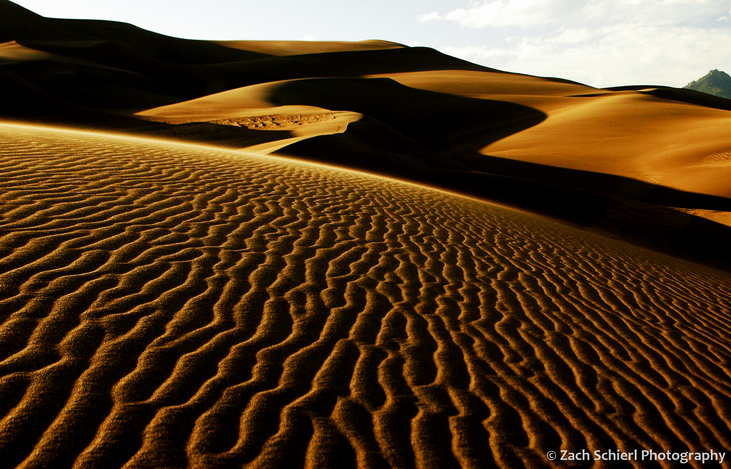
Sunset in the dunes at Great Sand Dunes National Park in Colorado. This was definitely a memorable day; the patterns of light and shadows I witnessed that evening are vivid even 10 years later.
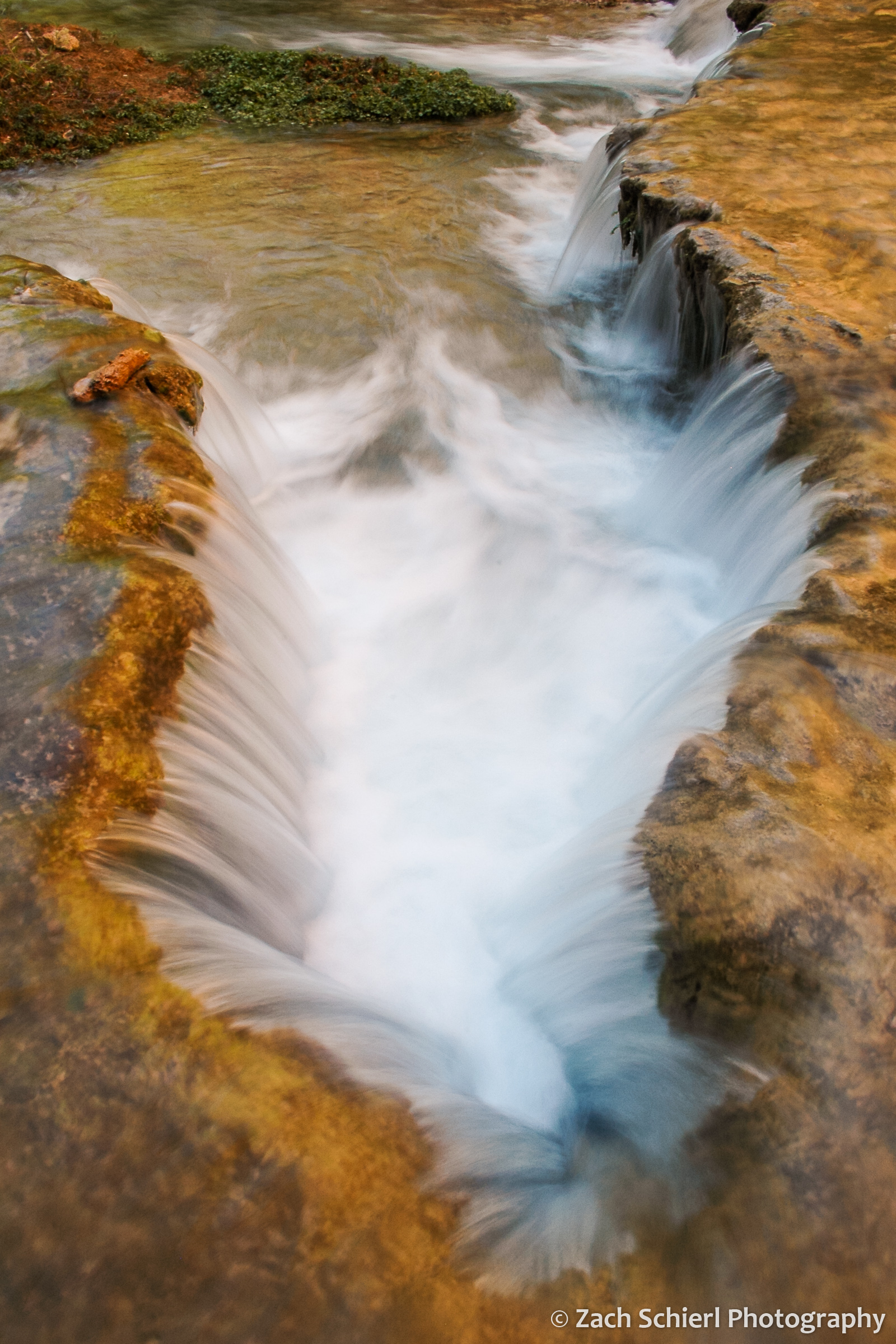
A small cascade along Havasu Creek, Arizona.
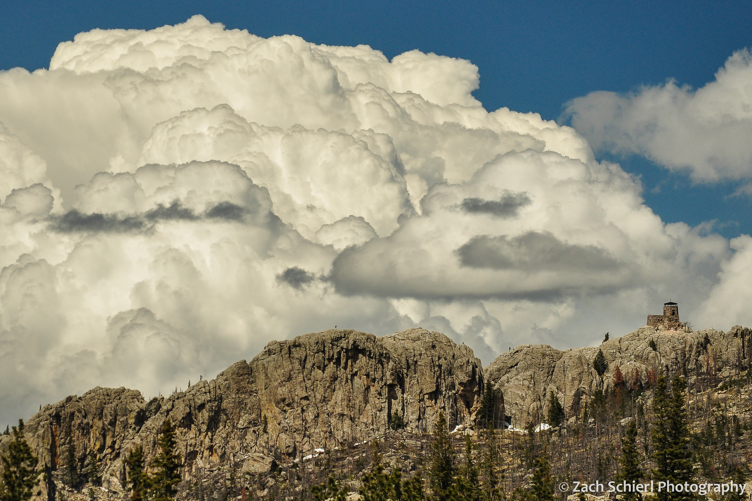
Cumulonimbus clouds tower over Black Elk Peak, the highest point in South Dakota.
As far as animate objects, I have taken more photos of bighorn sheep (Ovis canadensis) than any other animal (followed by elk, yellow bellied marmots, mule deer, mountain goats, and, in an aquatic twist, ochre sea stars.) The sheep were a fixture of our drives to and from Estes Park and Rocky Mountain National Park while living on the Front Range of Colorado.

Rocky Mountain Bighorn Sheep, Big Thompson Canyon, Colorado
I could bore you with a detailed breakdown of the geologic features that I’ve photographed, but perhaps that is best saved for another day…
Mountains of Summer

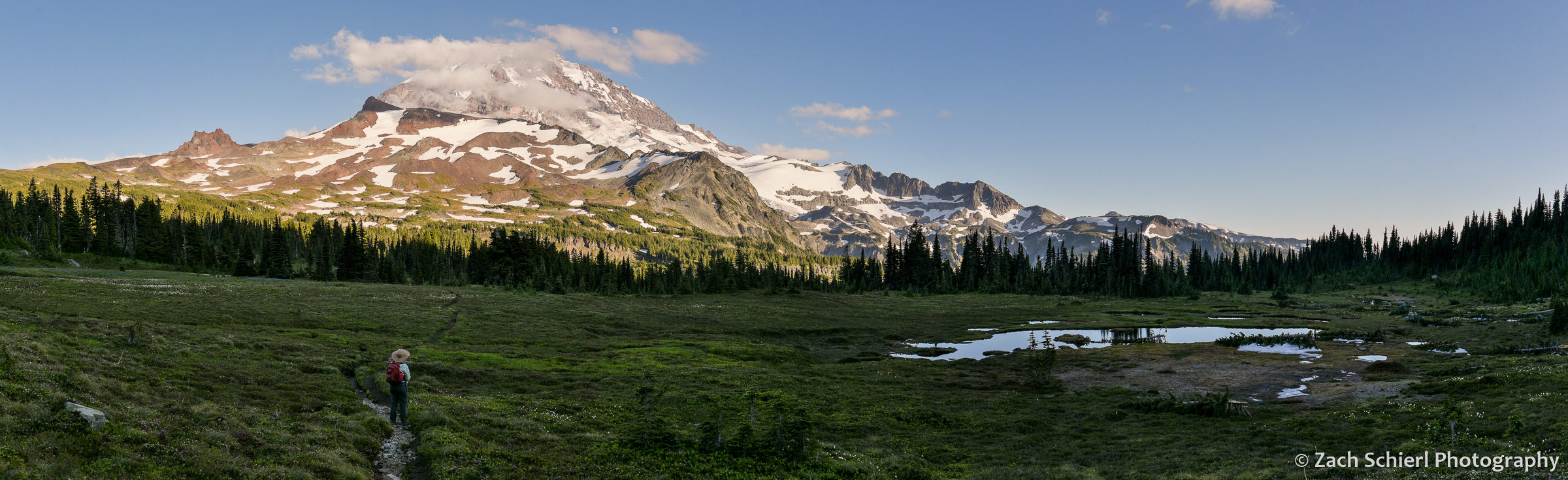
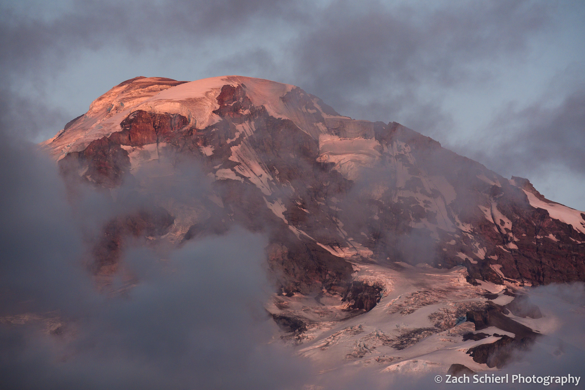
Tahoma dominates the skyline as seen from a ridge above Spray Park in the northwest corner of Mt. Rainier National Park. The boggy area in the lower right was filled with splintered tree trunks, likely the results of a good-sized avalanche this past winter.
As temperatures and cloud covers takes a decidedly fall-like turn here in central Washington, I’ve been looking back on photos from a whirlwind summer. While we were on the road for a good portion of the summer, we were able to make time for a few brief excursions to our “backyard” mountains: Mt. Rainier, Mt. Adams, and the Goat Rocks. Here are some of my favorite images from those trips:
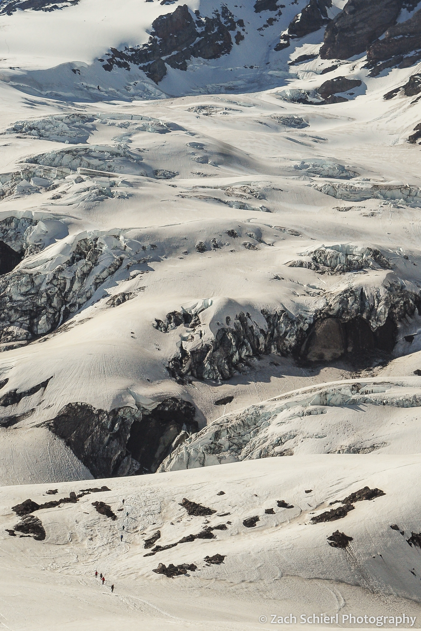
Traversing the Nisqually Glacier on the south side of Mt. Rainier in early summer. I had the opportunity to take a basic mountaineering course this past spring, which culminated in a beautiful day on the ice in mid-June. A great way to kick-off the summer!
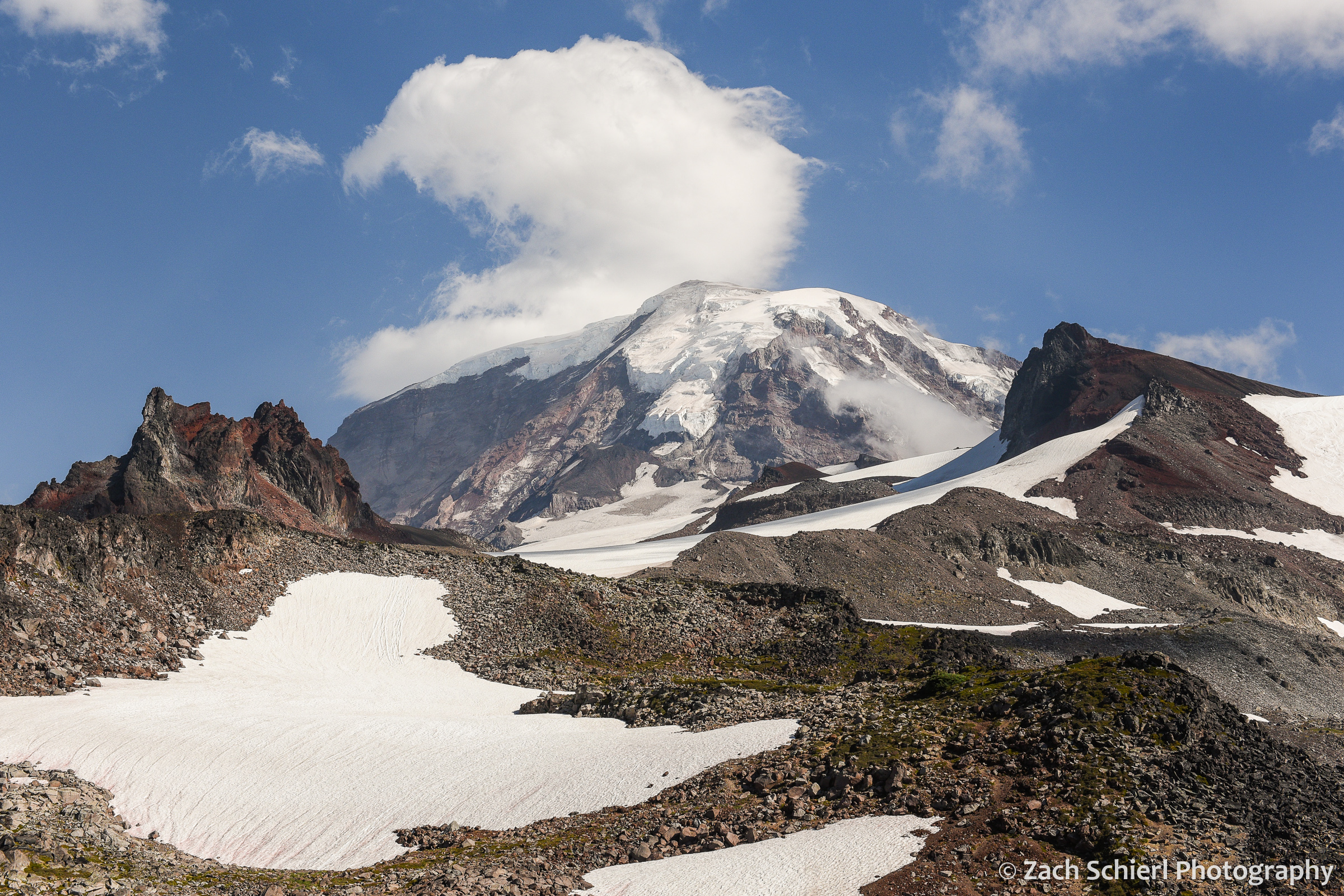
A view of Mt. Rainier from upper Spray Park, framed by Echo Rock (left) and Observation Rock (right).

A lone glacial meltwater pool on the slopes of Mt. Rainier.
Sunset light on the summit of Mt. Rainier, as seen from the Spray Park Trail.
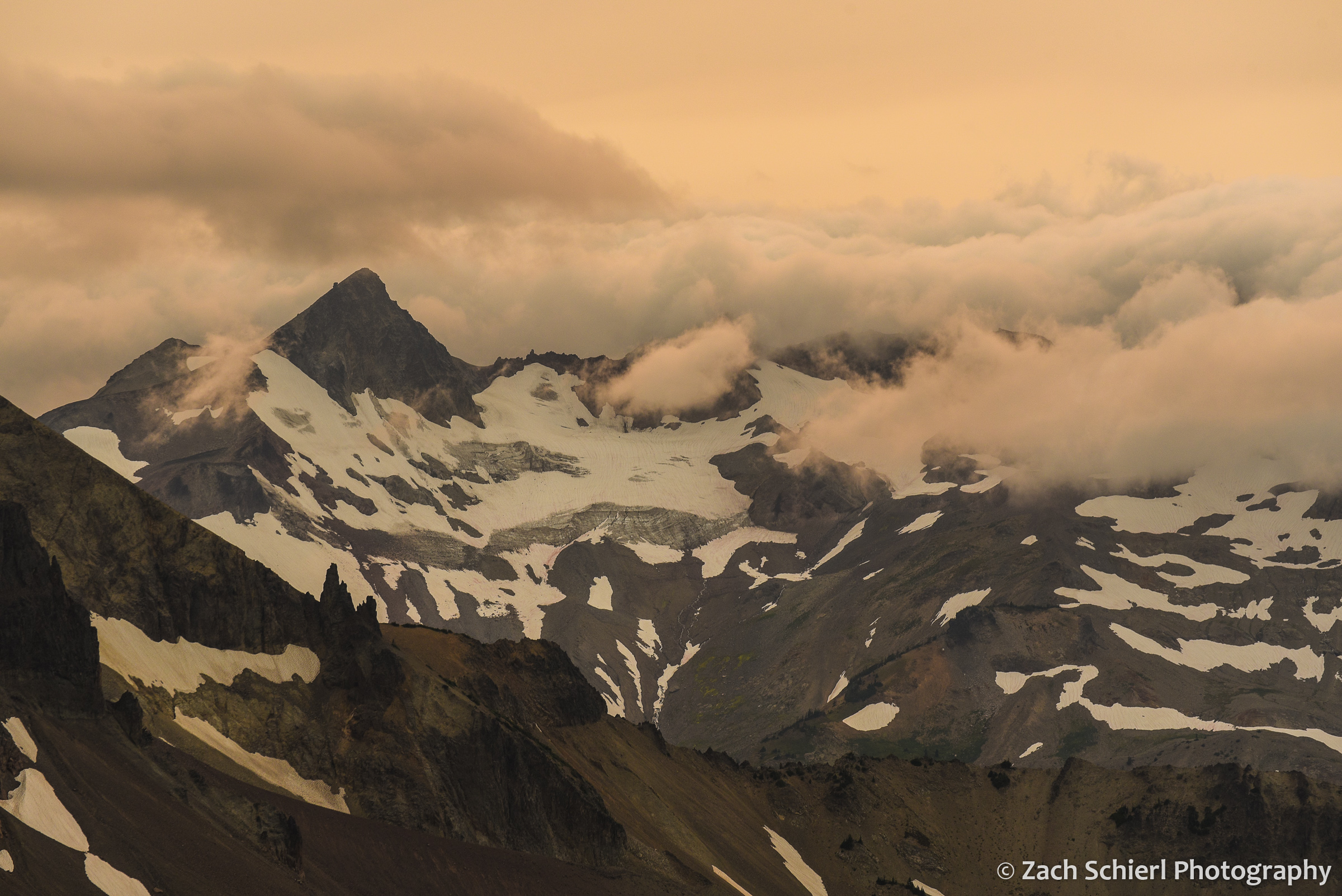
Ives Peak in the Goat Rocks Wilderness, flanked by clouds rolling in from the west and a sky made pale-orange by abundant wildfire smoke.
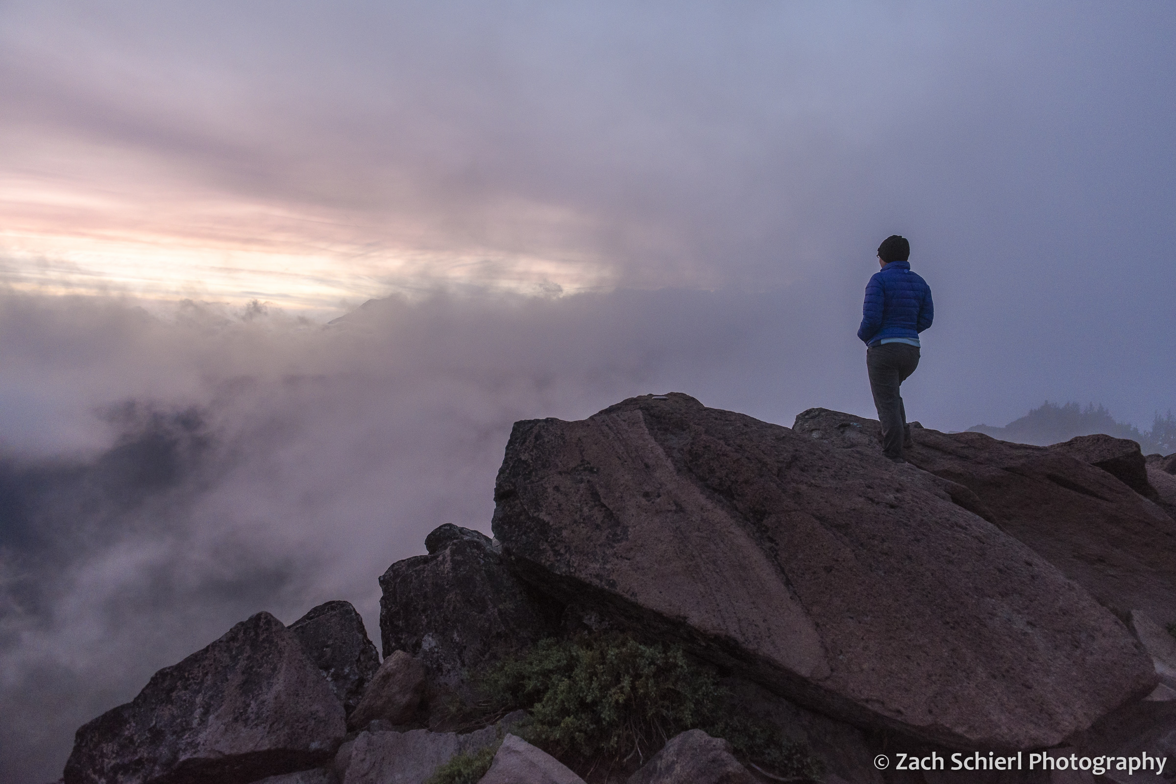
We spent a mostly cloudy and damp evening camped on Bear Creek Mountain in the Goat Rocks Wilderness. Every 15 minutes or so, there would be a momentary gap in the low clouds passing over the peak, allowing fleeting glimpses toward the west. Here, the outline of Mt. Rainier is barely visible through the clouds at left.

Mt. Adams at sunset as seen from the burn scar of the 2015 Cougar Creek Fire. A small cap cloud hovers over the summit.
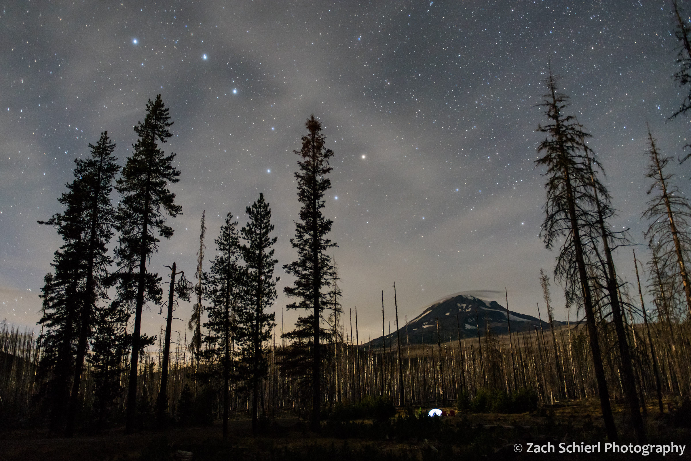
The Big Dipper over Mt. Adams.
From A(storia) to B(rookings) Down the Oregon Coast

As another summer comes to a close, I am enjoying looking back at some photos from the past few months. In mid-August we had the chance to spend two weeks in Oregon, most of which we spent along the spectacular Oregon Coast. While not my first trip to the coast, this was my first time visiting some of the more remote southern sections of the coast, and over the course of the two weeks we were actually able to drive the entire Oregon section of Highway 101, all the way from Washington to California.
We began the trip in Astoria, gazing at the mouth of the Columbia River in Fort Stevens State Park and visiting the site of Fort Clatsop, quarters for the Lewis & Clark Expedition during the winter of 1805-1806. From there we travelled south to visit with friends in Rockaway Beach for several nights before continuing on to Newport and then heading inland for other adventures. A few days later we returned to the coast at the mouth of the Rogue River in Gold Beach, just 45 minutes or so north of the California border. After a quick drive into the Golden State, we began moving north, through Coos Bay, Bandon, Florence, and the Oregon Dunes before returning to Newport. After a final few days in the Lincoln City area, it was back up the Columbia River Gorge to Washington and back to work! Here are some of my favorite images from the trip, arranged from north to south:

Late afternoon light on the beach in Rockaway Beach, Oregon. The northern third of the Oregon Coast is characterized by long stretches of wide, sandy beach. Sand is relatively abundant here thanks to the Columbia River, though the supply has been greatly diminished since dams started popping up on the Columbia beginning in the mid 1900s.

I had been hoping to do some night sky photography from the beach, but despite relatively benign daytime weather, most nights looked something like this, with dense mist and fog enveloping the shore. Here, lights from Rockaway Beach illuminate the fog.

Sunset from Rockaway Beach, Oregon.
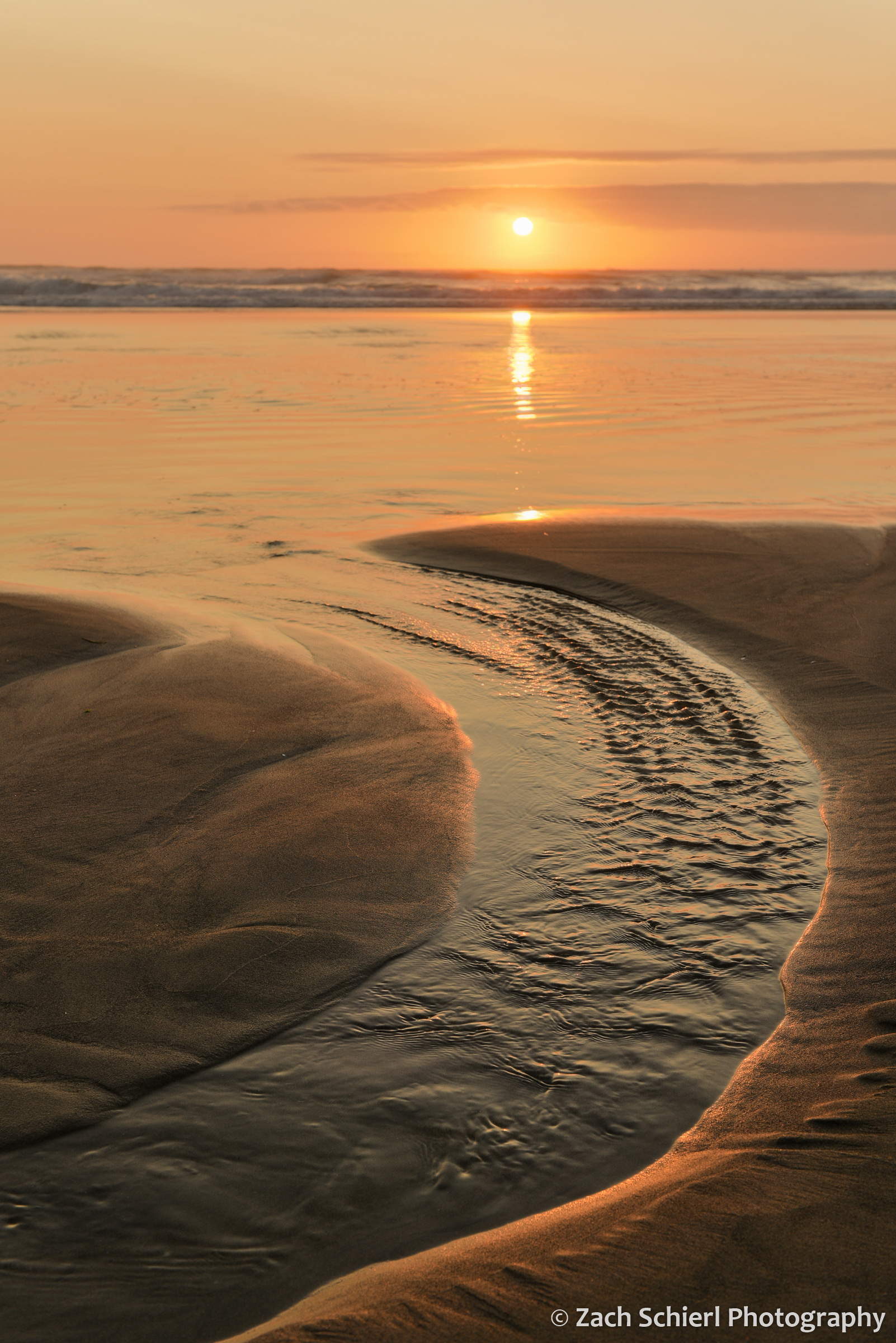
Sunset from Rockaway Beach, Oregon.
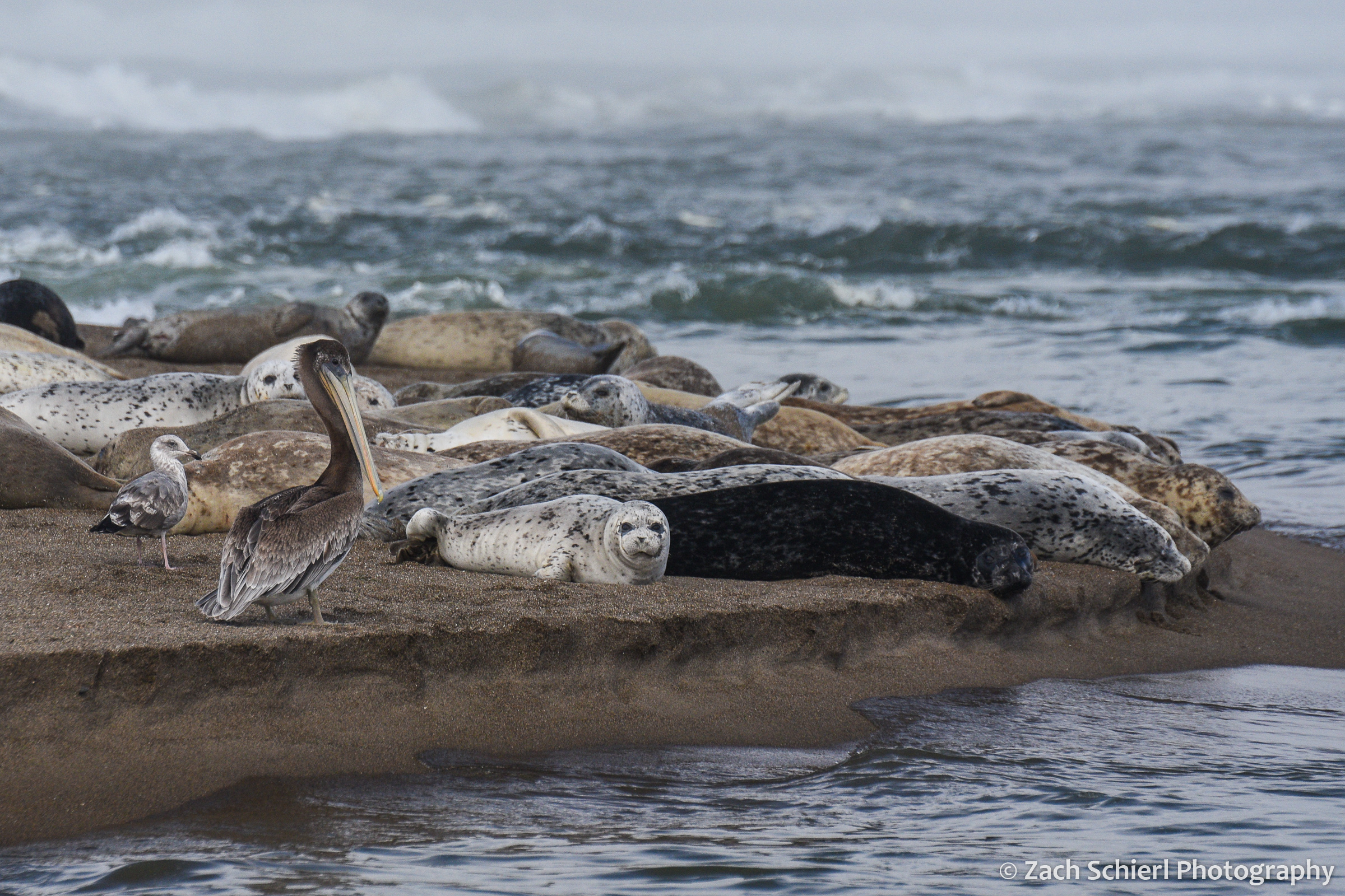
Brown pelican (Pelecanus occidentalis) and Pacific harbor seals (Phoca vitulina) on Salishan Spit near Lincoln City, Oregon.
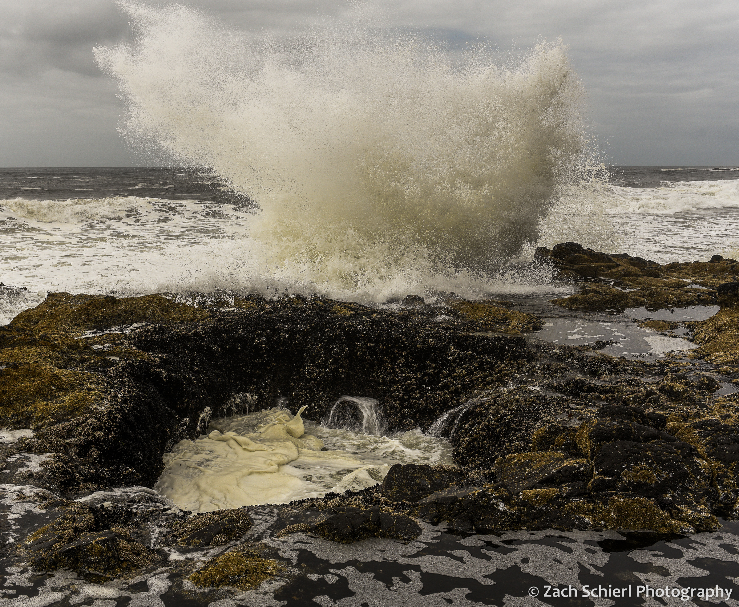
Thor’s Well is an interesting feature within the Cape Perpetua Scenic Area near Yachats. A ~10 foot wide hole in the rocky coastline, the Well connects to the open ocean via a small cave. The well alternately drains and fills as the waves roll in and out. Watching the water roll into the Well and waves crashing against the rocks was a mesmerizing experience.

Scattered bogs along the Oregon Coast host rare patches of Darlingtonia californica, the California Pitcher Plant. One of the few species of carnivorous plants native to the Pacific Northwest, the translucent patches on the leaves supposedly confuse insects trying to escape from inside the plants.

Darlingtonia californica
What at first glance appear to be rocks sticking up out of the water are actually the remains of a massive tree stump in Sunset Bay near North Bend. Large concentrations of dead trees, often partially buried in sand, are found all up and down the Oregon Coast, and are often referred to as “Ghost Forests”. Some of these trees, particularly the ones found in coastal estuaries, appear to have been killed by rapid subsidence associated with large earthquakes along the Cascadia Subduction Zone just offshore. Analysis and dating of these trees have revealed that large “megathrust” earthquakes are a regular occurrence in the Pacific Northwest. In the case of the trees seen here in Sunset Bay, it appears to be unclear if earthquakes or more run-of-the-mill processes (such as coastal erosion) are the culprit.

These tilted rocks at Shore Acres State Park near North Bend have appeared in many a geology textbook! Shore Acres is home to one of the world’s most striking examples of what geologists call an “angular unconformity,” where flat-lying sedimentary rocks (visible in upper left) rest directly on top of older, tilted sedimentary rocks. The boundary between the flat rocks and the tilted rocks represents a large chunk of geologic time missing from the rock record. Several hundred years ago, geologists recognized angular unconformities as some of the first strong evidence of the Earth’s immense age, as they require multiple cycles of sediment deposition, burial, uplift, and erosion in order to form.
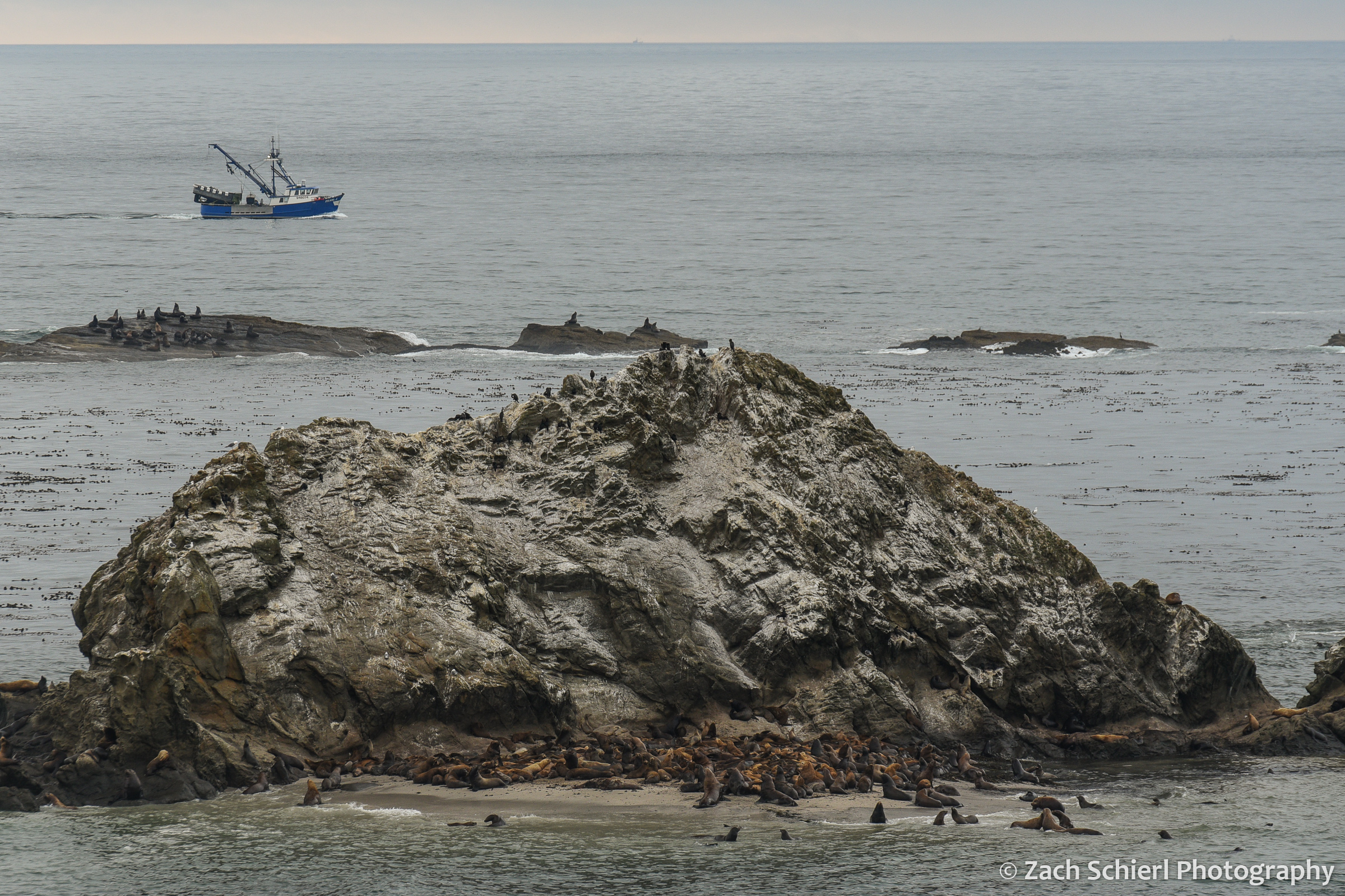
Sea lions and seals hauled out on Shell Rock near Simpson Reef. Interpretive signs at this overlook proclaimed that this is the largest haul-out site for sea lions on the Oregon Coast.
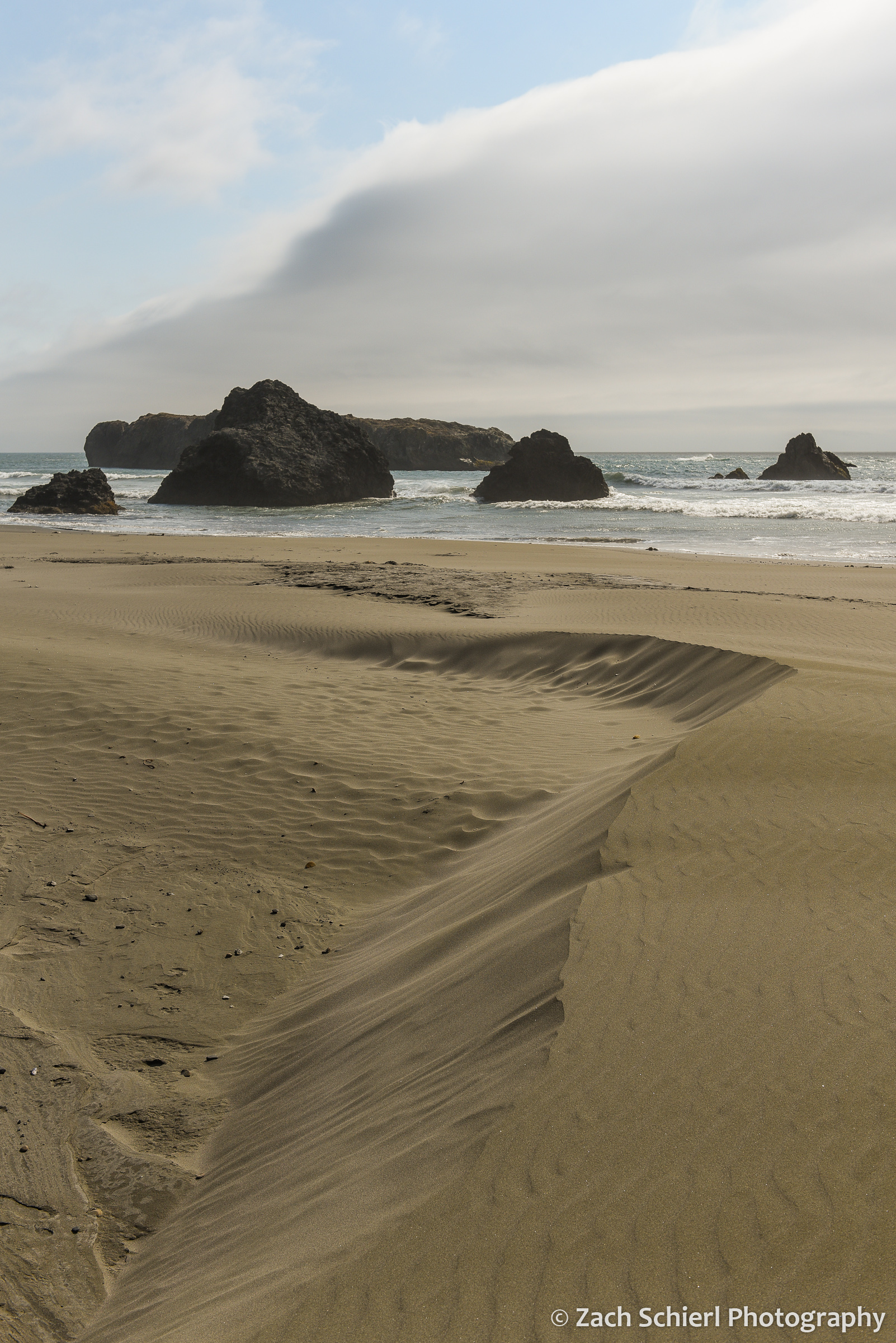
Coastal sand dunes mirror the clouds at Myers Creek Beach south of Gold Beach, Oregon

Sunset at Arch Rock, between Brookings and Gold Beach, Oregon
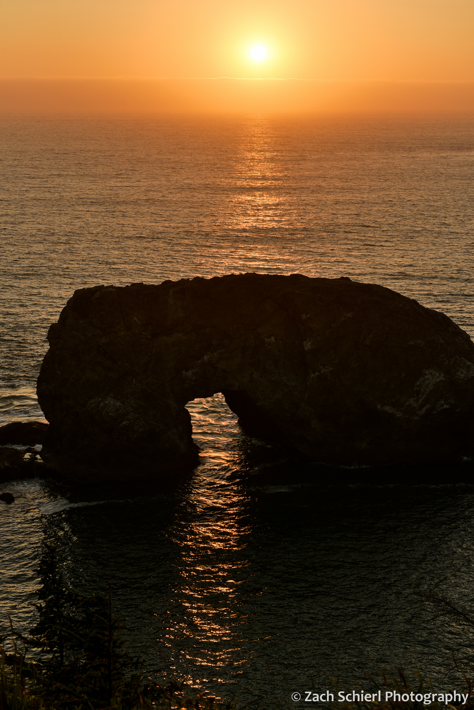
A closer view of Arch Rock.

The first quarter moon hovers over sea stacks along the Oregon Coast south of Gold Beach, Oregon.

A late afternoon view of Lone Rock Beach and Twin Rocks from the Cape Ferrelo Viewpoint near Brookings, Oregon.
