2024 GSA Calendars


I’m excited to announce that one of my photos was chosen for the cover of the Geological Society of America’s annual calendar! The image is of a blue meltwater pool on the west slopes of Mt. Rainier that I took a few years back. Here’s what it looks like on the calendar:
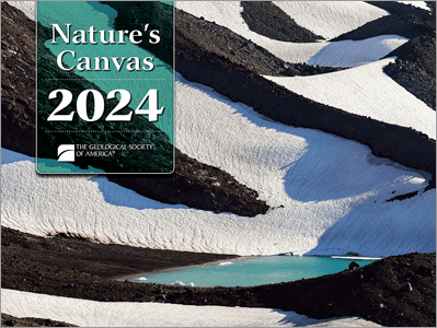
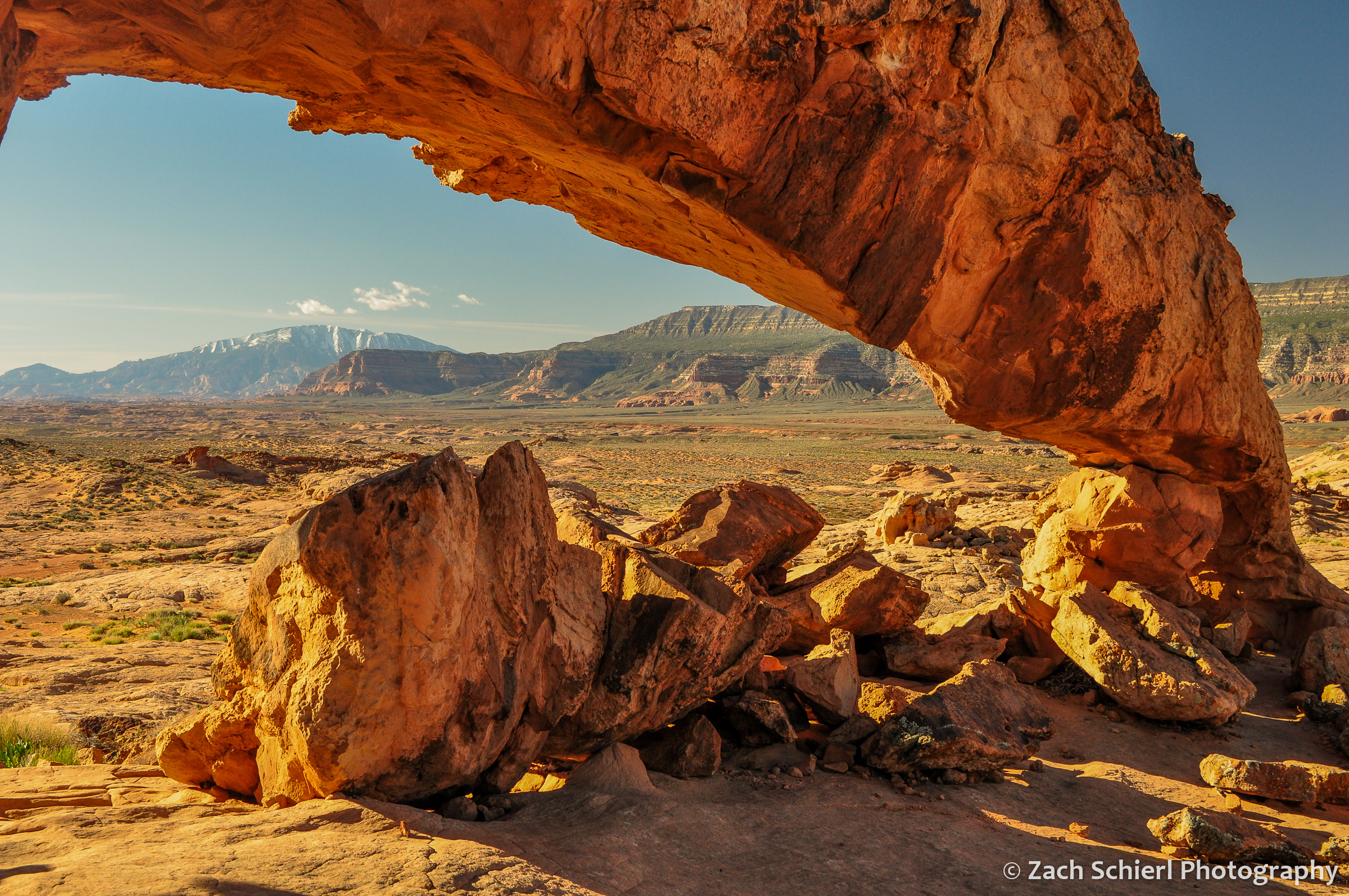
I had a photo of Sunset Arch in Grand Staircase-Escalante National Monument chosen for the inside of the calendar a few years back, but this is my first time on the cover. I received some sample copies of the calendar yesterday and the images are top-notch throughout.
You can order a copy of the calendar here for the low, low price of just $9.95! (It’s possible the price may be higher if you are not a member of GSA, I’m not positive…)
Merry Christmas and Happy New Year!
Mountains of Summer

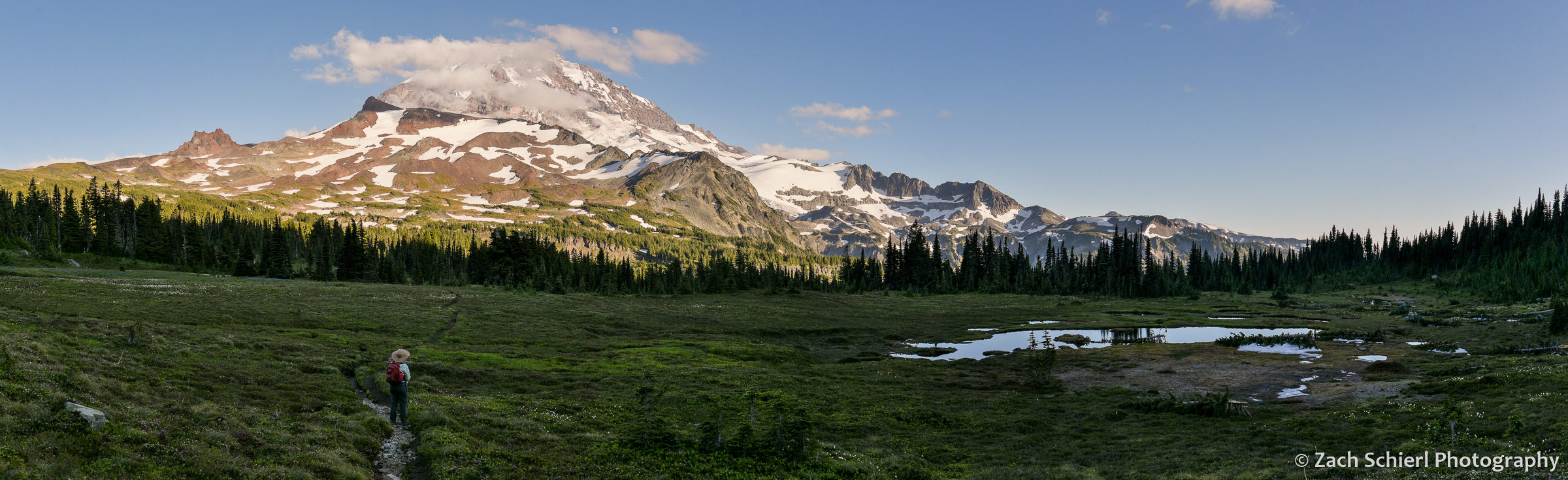
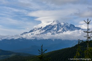
Tahoma dominates the skyline as seen from a ridge above Spray Park in the northwest corner of Mt. Rainier National Park. The boggy area in the lower right was filled with splintered tree trunks, likely the results of a good-sized avalanche this past winter.
As temperatures and cloud covers takes a decidedly fall-like turn here in central Washington, I’ve been looking back on photos from a whirlwind summer. While we were on the road for a good portion of the summer, we were able to make time for a few brief excursions to our “backyard” mountains: Mt. Rainier, Mt. Adams, and the Goat Rocks. Here are some of my favorite images from those trips:
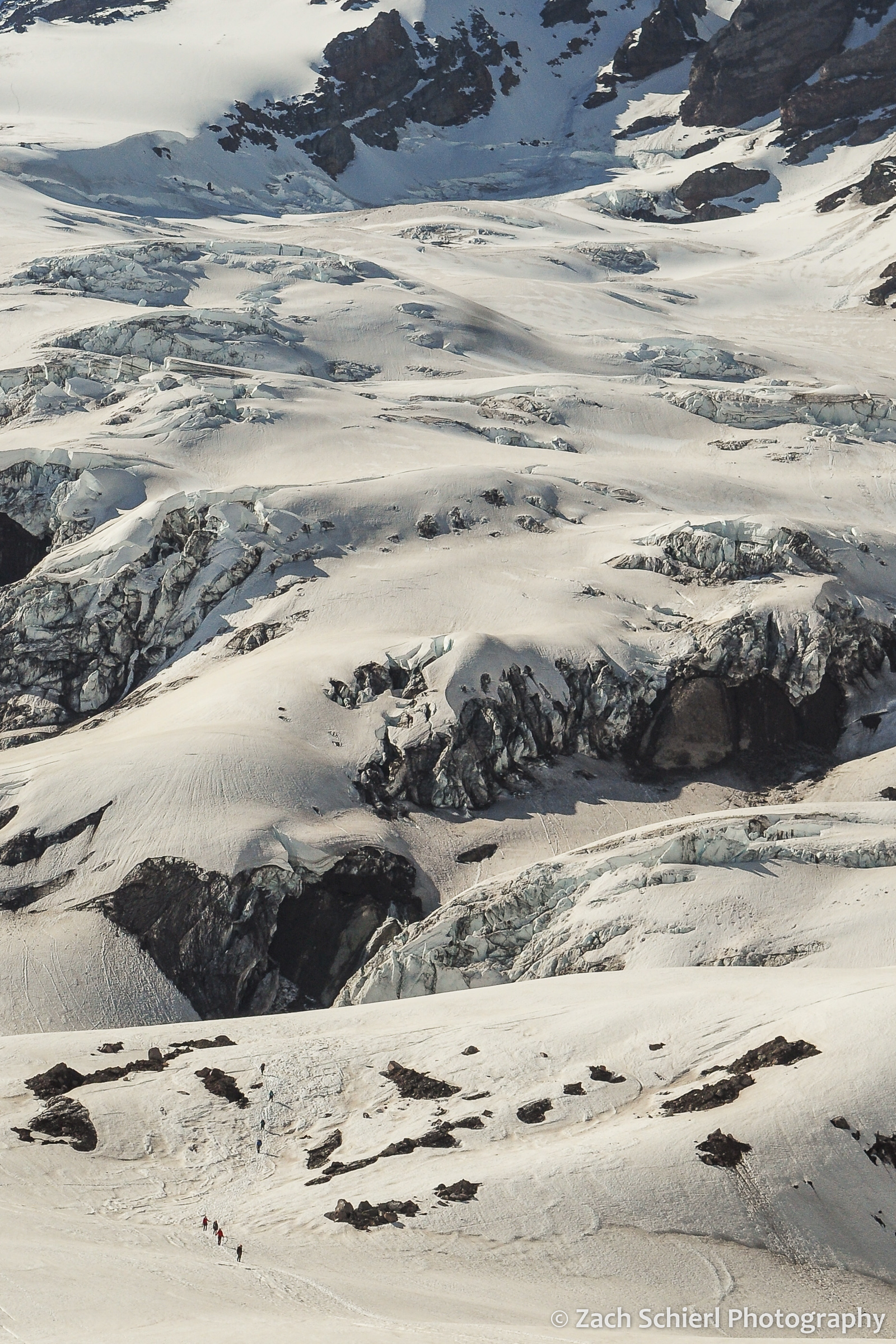
Traversing the Nisqually Glacier on the south side of Mt. Rainier in early summer. I had the opportunity to take a basic mountaineering course this past spring, which culminated in a beautiful day on the ice in mid-June. A great way to kick-off the summer!
A view of Mt. Rainier from upper Spray Park, framed by Echo Rock (left) and Observation Rock (right).

A lone glacial meltwater pool on the slopes of Mt. Rainier.
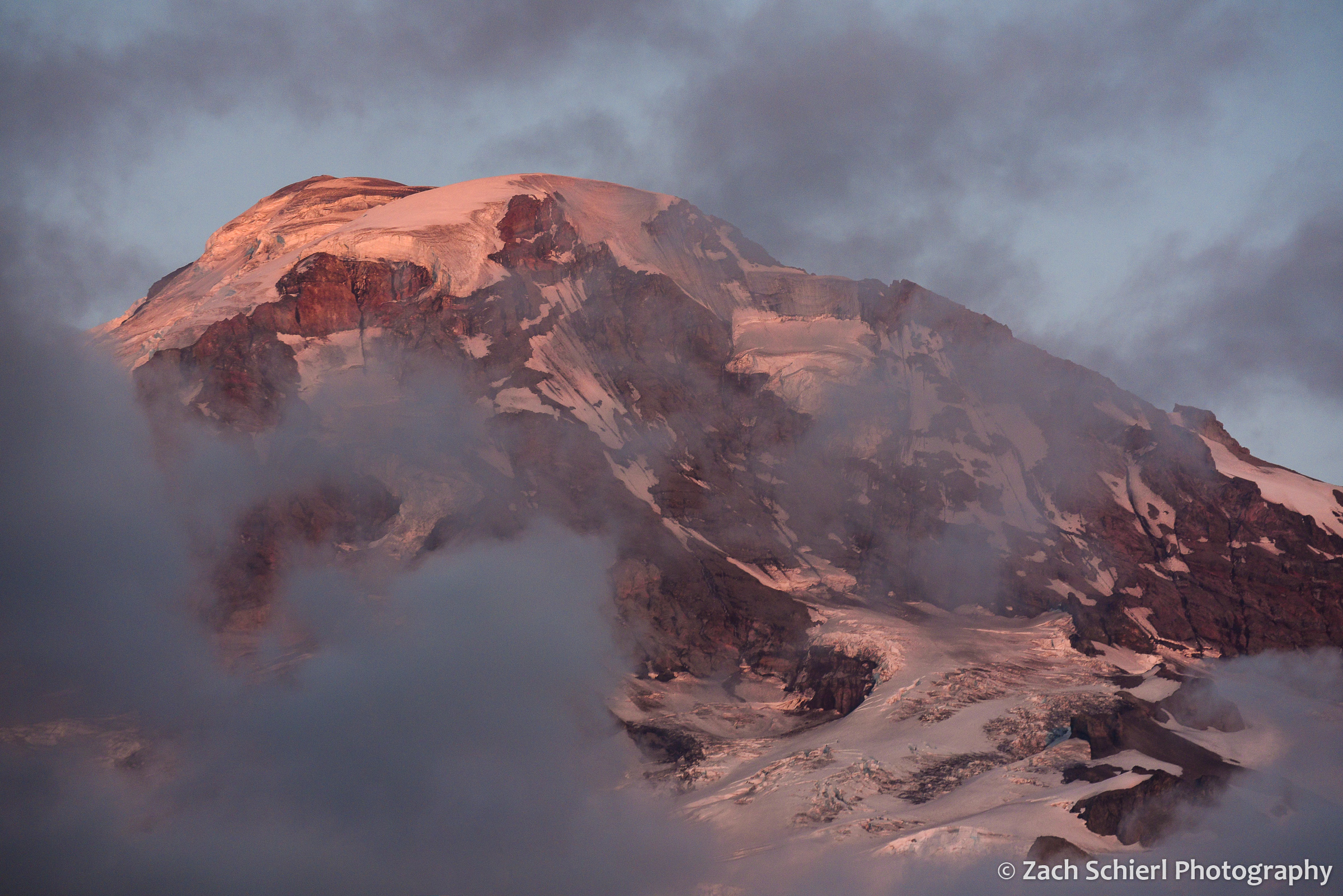
Sunset light on the summit of Mt. Rainier, as seen from the Spray Park Trail.
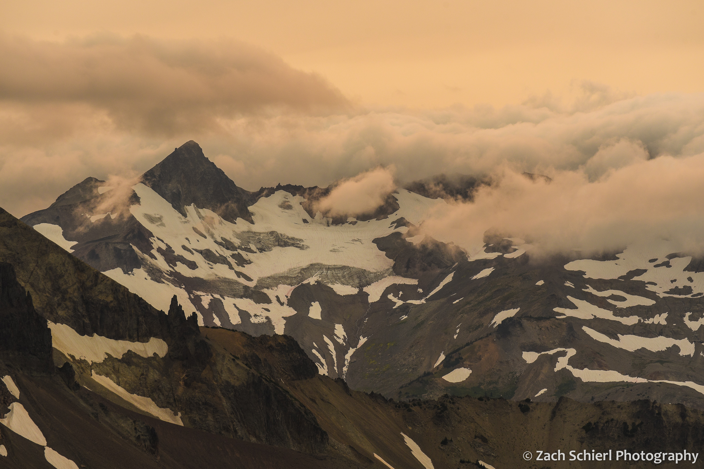
Ives Peak in the Goat Rocks Wilderness, flanked by clouds rolling in from the west and a sky made pale-orange by abundant wildfire smoke.
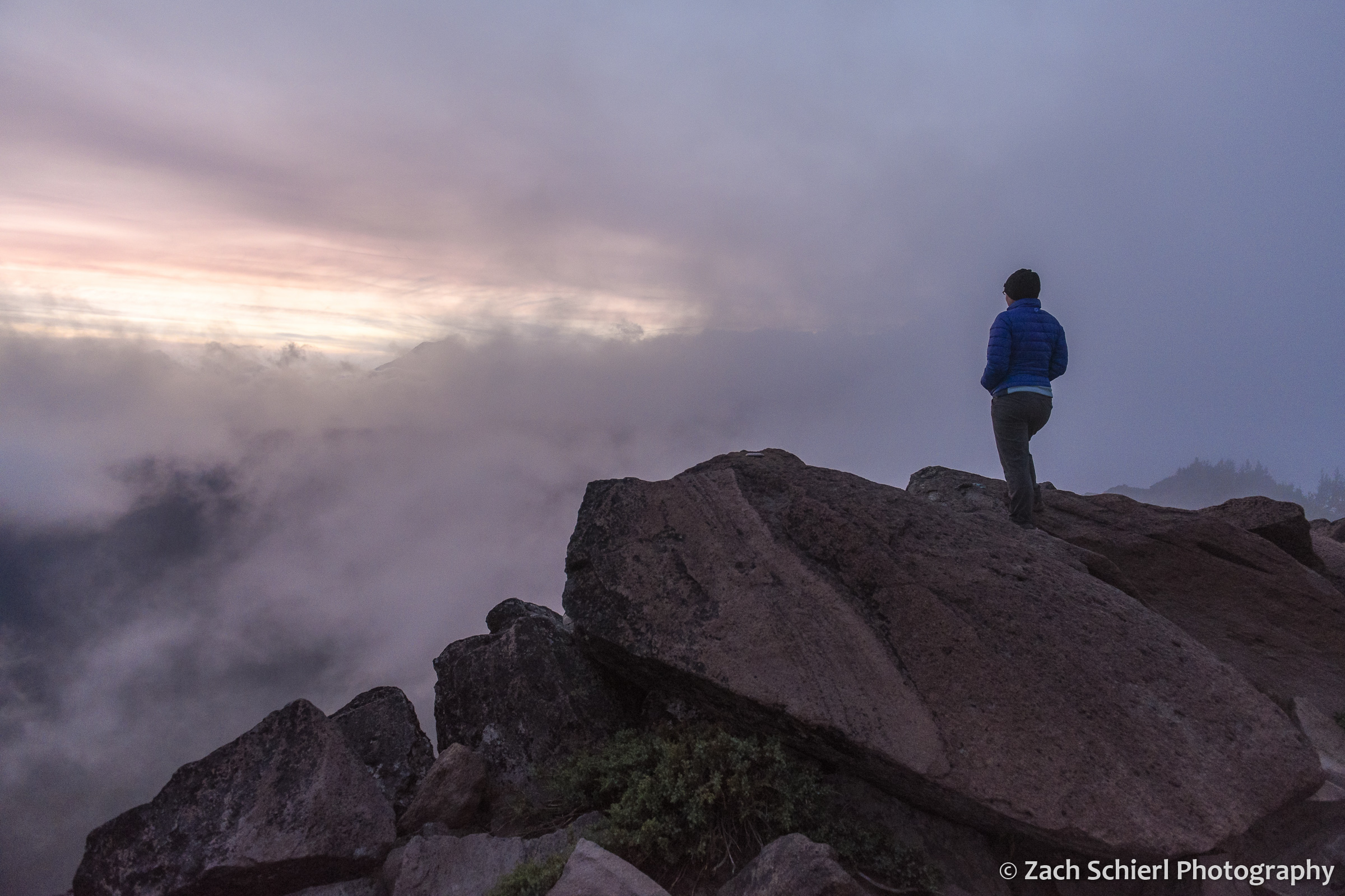
We spent a mostly cloudy and damp evening camped on Bear Creek Mountain in the Goat Rocks Wilderness. Every 15 minutes or so, there would be a momentary gap in the low clouds passing over the peak, allowing fleeting glimpses toward the west. Here, the outline of Mt. Rainier is barely visible through the clouds at left.

Mt. Adams at sunset as seen from the burn scar of the 2015 Cougar Creek Fire. A small cap cloud hovers over the summit.
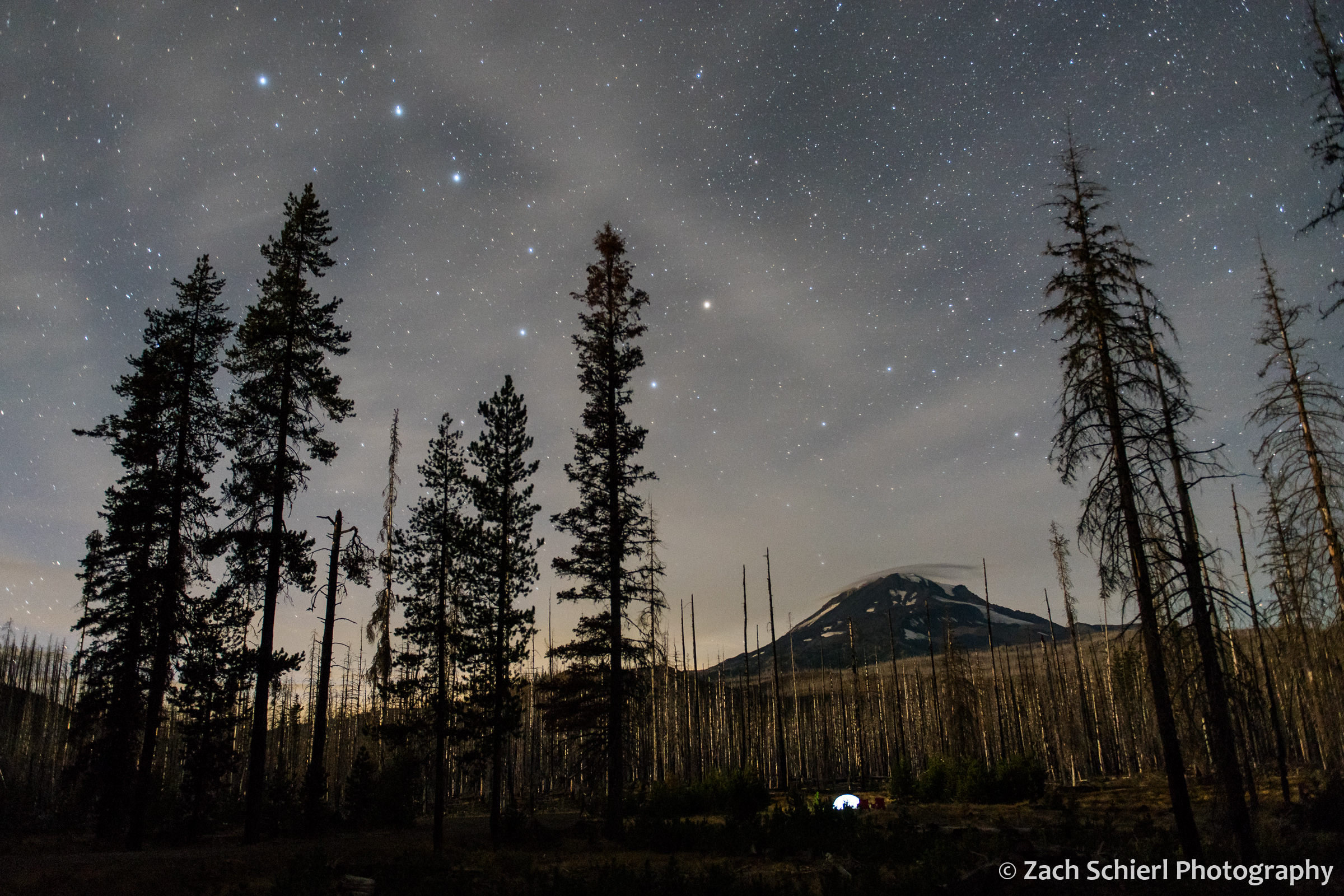
The Big Dipper over Mt. Adams.
Views of Tahoma


Light from a nearly full moon illuminates the glaciers and icefields on the summit of Mount Rainier.
At 14,411 feet, Mount Rainier is the highest peak in Washington and in the entire Cascade Range. British naval officer Peter Rainier never even saw the mountain that now bears his name, but he had a friend that did. Clearly, it paid to have connections in the 1700s. Oddly, Rainier did fight against the Americans during the Revolutionary War, making the fact that we continue to utter his name when referring to this grand peak all the more peculiar. Mount Rainier was originally known as Tahoma or Tacoma by the Salish-speaking indigenous tribes of the Pacific Northwest. There are periodic rumblings about renaming the peak, much like the name of Alaska’s Mount McKinley was officially reverted to Denali in 2015. Hopefully that will indeed happen someday…
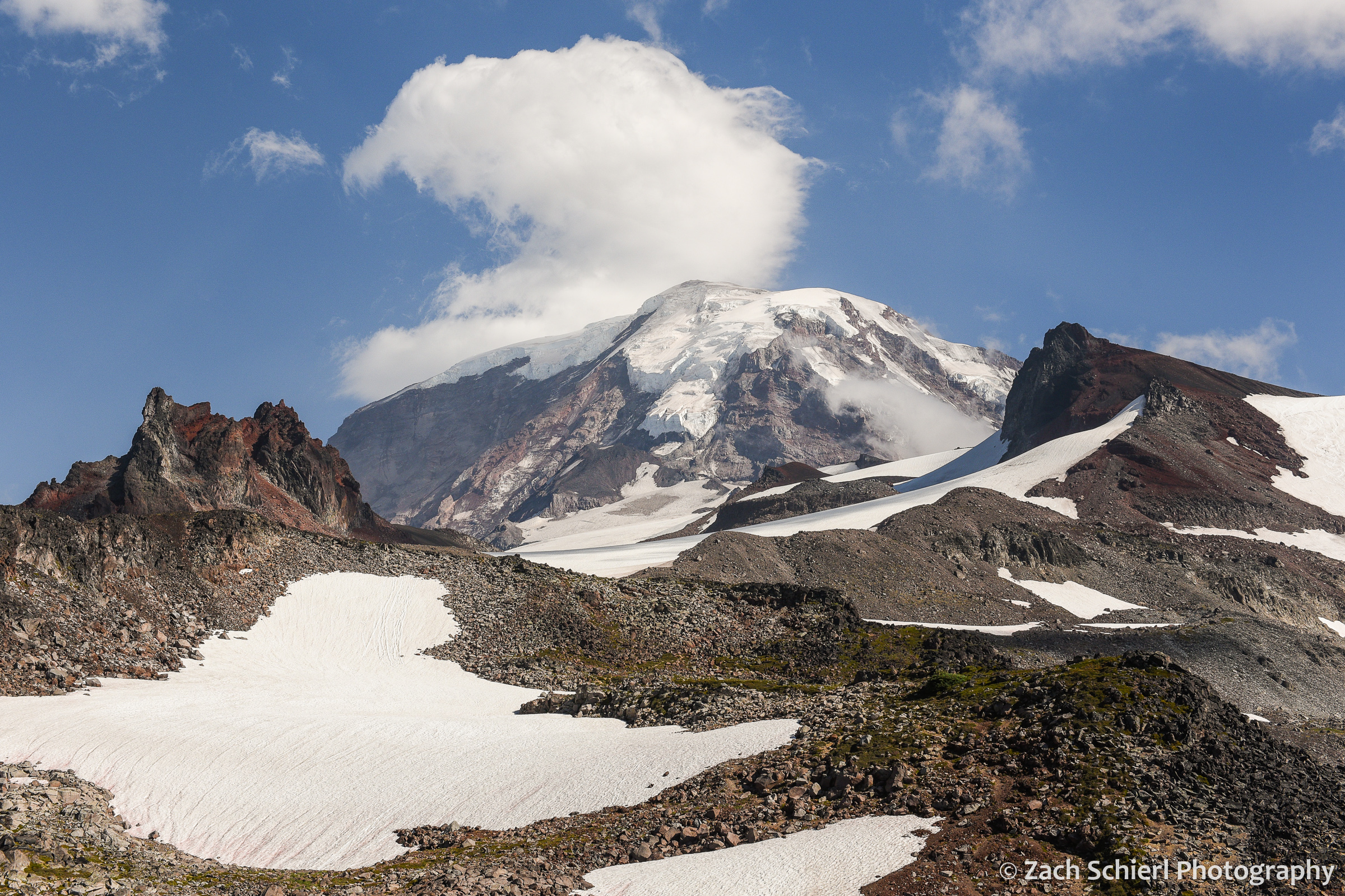
Irrespective of name, Tahoma dominates the skyline from Seattle and much of the Puget Sound region. Tacoma and other towns to the south of Puget Sound are literally built on layers of debris deposited by gigantic lahars (volcanic mudflows) that periodically race down its flanks, filling river valleys on their way to the sea. The threat of future lahars and volcanic activity looms over those who live in its shadow. From my vantage point in the Yakima Valley of central Washington, the foothills of the Cascades obscure all but the uppermost few hundred feet of its glacier-clad summit (and which will, thankfully, block any future lahars). Obtaining a better view requires venturing into the mountains. Recently, we spent a weekend camping high on a ridge about a dozen miles to the south of the volcano’s summit. Our campsite in an old clear cut provided stellar, if slightly obscured views of Tahoma’s bulk.
The weather was quite variable throughout the weekend, ranging from mostly clear (but hazy) upon arrival, to partly cloudy, to overcast, to bouts of dense fog. Our view of the mountain was constantly changing. One evening I decided to capture a time-lapse of cloud movement and formation in the two hours leading up to sunset:
Sadly I did not notice the beer can stuck on top of the tree in the foreground until it was too late. Oh well. On another evening, a spectacular stack of lenticular clouds developed over the summit:

A series of stacked lenticular clouds above Mt. Rainier.
Closer view of the stacked lenticular clouds.
A nearly full moon provided sufficient light for photographing the mountain after dark:

Tahoma bathed in the light of a nearly full moon.
Not to be outdone by Tahoma, the pinnacle of High Rock just to our west also put on quite the show at sunset, with the light of the setting sun casting an amazing shadow of the peak and it’s summit lookout tower on the foreground mists:

Sunset, High Rock, Gifford Pinchot National Forest, Washington
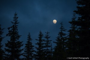
A nearly full moon rises over the forests of the Cascade Mountains.
After this trip and our stunning view of Mt. Adams a few weeks ago, our goal for the summer is now to camp in the shadow of all of Washington and northern Oregon’s stratovolcanoes. Next up: Mt. St. Helens!
