Greyrock Trail Loop, Poudre Canyon, Colorado


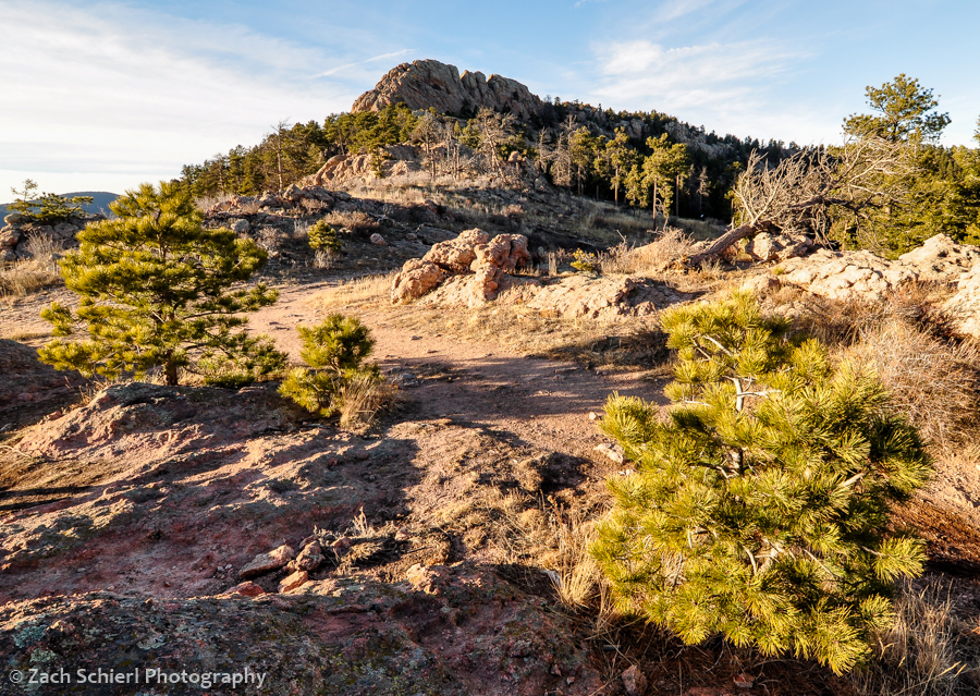
Greyrock Mountain and Greyrock Meadow
And now for a few more photos from before winter roared back into Colorado this past week:
Earlier this winter we took a day trip up Poudre Canyon, about a half hour northwest of Fort Collins. One of the more popular trails here is a ~5.5 mile loop combining the Greyrock Trail and the Greyrock Meadows Trail. A short spur trail heads up to the summit of Greyrock Mountain (pictured above) near the apex of the loop but we opted to pass on this route due to icy conditions and dwindling daylight. Despite ranging in elevation from 5,500-7,000 feet, the trail was surprisingly snow free, save for the lower sections that were well-shaded by the canyon walls.
The highlight of the hike is most certainly the spectacular granitic rock formations surrounding Greyrock Mountain. I say granitic because the rock here is actually not granite but what geologists call quartz monzonite; essentially granite with slightly less quartz and slightly more feldspar (hence the pinkish color). A seemingly trivial difference perhaps but an important one to geologists trying to unravel the history of the rocks. The steep, smooth faces of Greyrock Mountain wouldn’t look out of place amongst the granite domes of Yosemite National Park. There’s also some good sized pegmatite dikes that criss-cross the area. We found some very large and attractive quartz and feldspar crystals poking around the meadows that surround Greyrock Mountain.

Standing on a large pegmatite dike looking down into Greyrock Meadow. The continuation of the dike can be seen as the prominent vertical pink stripe on the hillside just beyond the meadow.
On a non-geology note, the trails winds through several different burn scars, apparently of different ages based on the amount of regrowth in different areas. Many of these burned areas are likely due to the High Park Fire of 2012, one of the largest wildfires in Colorado’s history which ravaged the lower sections of Poudre Canyon. There had apparently been a large windstorm here recently, as there were numerous downed trees, some dead snags but some still very much green and alive, strewn across the trail:

One of many large, recently downed Ponderosa Pines on the Greyrock Meadow Trail.
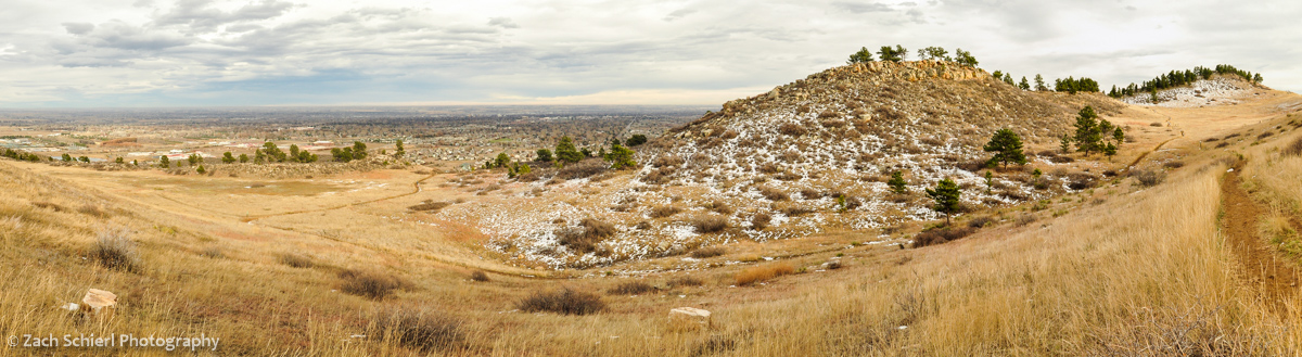
On the hike back down to the trailhead (on the Greyrock Meadows Trail), we were treated to a spectacular sunset over Poudre Canyon as well as views of the distant Mummy Range in Rocky Mountain National Park.

Golden hour light looking east down Poudre Canyon

Sunset over Poudre Canyon
Fun in the Fort Collins Foothills

Horsetooth Rock, a famous Fort Collins landmark, is composed of hard Precambrian pegmatite.
It is currently snowing so hard I can barely see across the street. Fortunately, I haven’t been able to say this very often this winter, and I strongly suspect it won’t even be true 10 minutes from now. After six winters in the Pacific Northwest, once again residing somewhere where “warm” and “dry” are not mutually exclusive weather conditions has been quite refreshing. The mild weather has made hiking and all the other outdoorsy things that are practically a prerequisite for obtaining a Colorado driver’s license quite enjoyable. I’ve written about some of my adventures up to Rocky Mountain National Park but have yet to share any photos of our more immediate surroundings here in Fort Collins.
Fort Collins itself, lying at the extreme western edge of the Great Plains, is…well…flat. The only sledding hill I’ve yet seen here is a pathetic 20 foot run down the side of a large pile of gravel in the corner of the college football stadium parking lot. (As you’ll notice though, there is very little snow in any of these photos, so this is sort of a moot point.) Immediately west of town though lie the foothills of the Rocky Mountains, a beautiful landscape of ridges and valleys that mark the boundary between the plains and the Rockies.
Overlooking Fort Collins just before sunset from cuestas (ridges) between town and Horsetooth Reservoir.

Colorful lichens coating sandstone ledges of the Cretaceous-age Lytle Formation, Coyote Ridge Natural Area.
Geologically speaking, the foothills are fascinating (though geologists find just about any landscape fascinating…heck even Iowa has one of the largest asteroid impact craters on Earth lurking just beneath its surface) because they represent where the Rocky Mountains pushed their way up through the crust. Prior to the uplift of the Rockies, this portion of Colorado was covered in a thick, continuous stack of colorful but more or less flat-lying sedimentary rock layers, much like one sees at the Grand Canyon today. Eventually, the Rockies thrust their way upward through the sedimentary rock, forcing the formerly flat layers to tilt toward the east. Over time, the softer sedimentary layers were (relatively) easily eroded away, forming long north/south trending valleys. Other layers were harder and resistant to erosion, forming dramatic sloping ridges known as cuestas and hogbacks that parallel the valleys.
The resulting pattern of alternating ridges and valleys is striking and has practical uses as well. In many places, streams flowing out of the mountains have been dammed at the point where they slice through the ridges, forming long, slender reservoirs that flood the valley bottoms. Horsetooth Reservoir, which provides some drinking water for Ft. Collins and irrigation water for the plains, is perhaps the best example.

Devils Backbone, a nearly vertical hogback of Dakota Sandstone south of Fort Collins.
Slightly further west, the landscape changes as the sedimentary layers give way to the igneous and metamorphic rocks that compose the bulk of the Rockies, forming famous local landmarks such as Horsetooth Rock (above) and Arthur’s Rock.
The plethora of city, state, and county parks that protect large swaths of the foothills are increasingly important as the cities below the foothills encroach on wildlife habitat. Mammals like deer, elk, bobcat, and bear are abundant in the foothills. As the cities below continue to push up against, and even into, the foothills, it’s not uncommon to read stories in the local newspaper about a moose, bear, or mountain lion wandering into town.

Mule Deer, Maxwell Natural Area

Black-tailed prairie dog, Coyote Ridge Natural Area

Cottontail rabbit, Coyote Ridge Natural Area
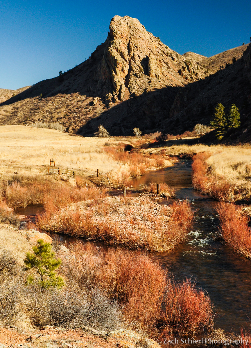
Eagles Nest Rock and the North Fork of the Cache la Poudre River

Mahoney Park, Bobcat Ridge Natural Area
(Petrified) Forests of Stone


Despite being comprised almost entirely of quartz, trace amounts of elements like iron and manganese give petrified wood its myriad of colors.
I grew up about 90 minutes away from Petrified Forest National Park and, aside for a quick lunch stop about 10 years ago, had never visited before last week. While this is nowhere near as inexcusable as living in Arizona for decades and never visiting the Grand Canyon (yes, such individuals exist…I’ve met many), it still seemed like a bit of an oversight on my part. Or it could simply be a reflection of the inordinate number of outdoor activities that exist in northern Arizona; even living in the area for 10+ years isn’t enough time to hit everything. Either way, after finally venturing into the Petrified Forest, I can emphatically say that it should be mentioned with the best that northern Arizona has to offer.
Located amongst the vast Painted Desert of northeastern Arizona, the main attraction of Petrified Forest is of course the petrified wood. The formation of petrified wood is initiated when downed trees are quickly buried by sediment. Once entombed in the sediment, the lack of oxygen prevents the logs from decaying as they normally would when exposed directly to the atmosphere. In this case, the logs (none of which remain standing, despite the name “Petrified Forest”) were likely brought here in massive logjams along an ancient river system that existed during the Triassic period. A combination of sediment from the river and ash from nearby volcanoes buried the logs, not to be seen again for more than 200 million years. During this time, as the logs became buried under an increasingly deep pile of overlying sediment, dissolved silica began to crystallize in the pore spaces of the wood as quartz, eventually replacing all of the organic material while maintaining the original shape and structure of the log.

A brilliantly colored petrified wood fragment.
Petrified wood is not particularly rare. Good examples abound in Yellowstone National Park, Washington state, Utah, Colorado, Oregon, Alberta, New Zealand…the list goes on and on. What makes Petrified Forest National Park unique is the quantities found here. Due to the aforementioned Triassic log jams, large quantities of wood were concentrated in small areas. In a location known today as Jasper Forest (see photos below), movement was not possible without walking over a nearly uniform carpeting of small petrified wood fragments and frequently having to clamber over 2-3 foot diameter logs. Truly stunning!

Petrified wood in the Jasper Forest, Petrified Forest National Park.

Overlooking the Jasper Forest at sunset.
Another unique aspect of Petrified Forest is the colorful canvas on which the wood is found. The wood is eroding out of a rock unit known as the Chinle Formation, which essentially consists of all of the river sediment and volcanic ash the buried the trees in the first place. More than 1000 feet thick in the park, the Chinle Formation is composed primarily of extremely soft mudstones, clays, and volcanic ash. Water is able to easily sculpt the soft rock into fantastically colored and oddly shaped badlands that make a spectacular backdrop for the logs.

The soft muds and clays of the Chinle Formation are easily eroded, forming badlands-like topography throughout the Painted Desert.

Colorful badlands in the Chinle Formation at Blue Mesa.
Petrified Forest National Park faces an issue not encountered by most other national parks, namely, the wholesale theft of the very resource it was established to protect. For this reason, the park is only open during daylight hours (from 8-5 in the winter) to minimize opportunities for looting. It strike me as very sad that such measures are necessary. With a little geological perspective, it becomes clear how incredibly lucky we are to experience a landscape like Petrified Forest at this moment in time. So easily eroded is the Chinle Formation that in many locations, several inches of it are removed each year. This may not sound like much, but geologically speaking, that’s a veritable bullet train of erosion. While it took tens of millions of years for the Chinle to be deposited, it will be erased from our planet by the unceasing forces of weathering and erosion in a tiny fraction of that. The petrified logs, being comprised mostly of silica, are harder and will last a little longer, but are still brittle and will eventually be washed into the Little Colorado River and swept downstream along with the colorful Chinle badlands.
What all this means is that the colorful Painted Desert/Petrified Forest landscape we see today is one that is extremely temporary. While this is true of most landscapes we see on Earth today—our planet likes to re-build, re-arrange, re-shape, and remove constantly—the Painted Desert is even more ephemeral than most. While mountain ranges comprised of harder, erosion-resistant granite or quartzite (like most of the Rockies) can stand the test of time to some degree, the longevity of the Painted Desert, its soft sediments, and its brittle petrified wood is comparatively brief. Stealing this treasured natural resource only abbreviates our time with the Petrified Forest even more.

Pieces of petrified wood accumulate in small hollows in the extensively gullied Chinle Formation.

The soft sediment surrounding the logs is easily transported away by small streams and washes.

Relatively hard chunks of petrified wood and quartz protect the softer sediment of the Chinle Formation from erosion, forming pedestals small…

…and large!
