Fun in the Fort Collins Foothills

It is currently snowing so hard I can barely see across the street. Fortunately, I haven’t been able to say this very often this winter, and I strongly suspect it won’t even be true 10 minutes from now. After six winters in the Pacific Northwest, once again residing somewhere where “warm” and “dry” are not mutually exclusive weather conditions has been quite refreshing. The mild weather has made hiking and all the other outdoorsy things that are practically a prerequisite for obtaining a Colorado driver’s license quite enjoyable. I’ve written about some of my adventures up to Rocky Mountain National Park but have yet to share any photos of our more immediate surroundings here in Fort Collins.
Fort Collins itself, lying at the extreme western edge of the Great Plains, is…well…flat. The only sledding hill I’ve yet seen here is a pathetic 20 foot run down the side of a large pile of gravel in the corner of the college football stadium parking lot. (As you’ll notice though, there is very little snow in any of these photos, so this is sort of a moot point.) Immediately west of town though lie the foothills of the Rocky Mountains, a beautiful landscape of ridges and valleys that mark the boundary between the plains and the Rockies.

Overlooking Fort Collins just before sunset from cuestas (ridges) between town and Horsetooth Reservoir.

Colorful lichens coating sandstone ledges of the Cretaceous-age Lytle Formation, Coyote Ridge Natural Area.
Geologically speaking, the foothills are fascinating (though geologists find just about any landscape fascinating…heck even Iowa has one of the largest asteroid impact craters on Earth lurking just beneath its surface) because they represent where the Rocky Mountains pushed their way up through the crust. Prior to the uplift of the Rockies, this portion of Colorado was covered in a thick, continuous stack of colorful but more or less flat-lying sedimentary rock layers, much like one sees at the Grand Canyon today. Eventually, the Rockies thrust their way upward through the sedimentary rock, forcing the formerly flat layers to tilt toward the east. Over time, the softer sedimentary layers were (relatively) easily eroded away, forming long north/south trending valleys. Other layers were harder and resistant to erosion, forming dramatic sloping ridges known as cuestas and hogbacks that parallel the valleys.
The resulting pattern of alternating ridges and valleys is striking and has practical uses as well. In many places, streams flowing out of the mountains have been dammed at the point where they slice through the ridges, forming long, slender reservoirs that flood the valley bottoms. Horsetooth Reservoir, which provides some drinking water for Ft. Collins and irrigation water for the plains, is perhaps the best example.

Devils Backbone, a nearly vertical hogback of Dakota Sandstone south of Fort Collins.
Slightly further west, the landscape changes as the sedimentary layers give way to the igneous and metamorphic rocks that compose the bulk of the Rockies, forming famous local landmarks such as Horsetooth Rock (above) and Arthur’s Rock.
The plethora of city, state, and county parks that protect large swaths of the foothills are increasingly important as the cities below the foothills encroach on wildlife habitat. Mammals like deer, elk, bobcat, and bear are abundant in the foothills. As the cities below continue to push up against, and even into, the foothills, it’s not uncommon to read stories in the local newspaper about a moose, bear, or mountain lion wandering into town.

Mule Deer, Maxwell Natural Area

Black-tailed prairie dog, Coyote Ridge Natural Area

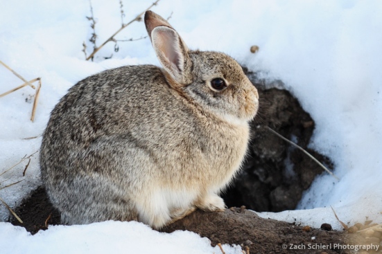
Cottontail rabbit, Coyote Ridge Natural Area

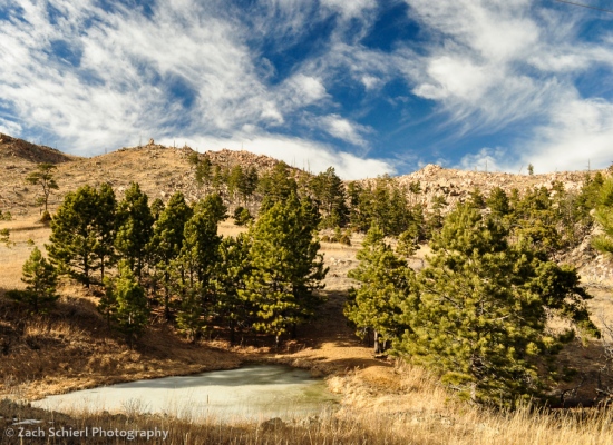
Mahoney Park, Bobcat Ridge Natural Area

