Exploring the Mt. Adams Wilderness


Mt. Adams is the largest (by volume) and second highest volcano in the Cascade Range of Washington. Often overshadowed by its neighbors, Mt. Rainier, Mt. St. Helens, and Mt. Hood, we’ve taken a liking to Adams in part because its trails tend to be relatively deserted and in part because we have a fantastic view of the mountain’s east face from our neighborhood in the Yakima Valley. Recently we had the chance to complete a short backpacking trip on the north flank of the mountain which allowed us vantage points that far surpass anything we’ve seen on previous day hikes.
Our hike began and ended at a trailhead (Killen Creek) that is, as the crow flies, just 57 miles from our front door, but takes more than three hours to reach by car, giving some sense as to the relative remoteness of this area. Most of our ~20 mile loop was within the Mt. Adams Wilderness, a 48,000 acre wilderness area designated in 1964 with the original passage of the Wilderness Act.

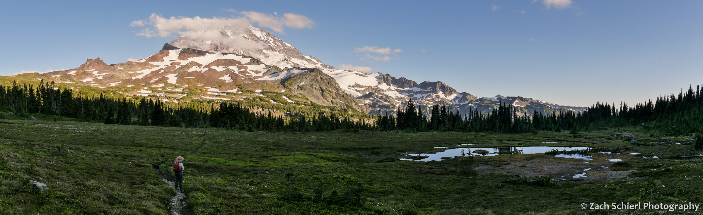
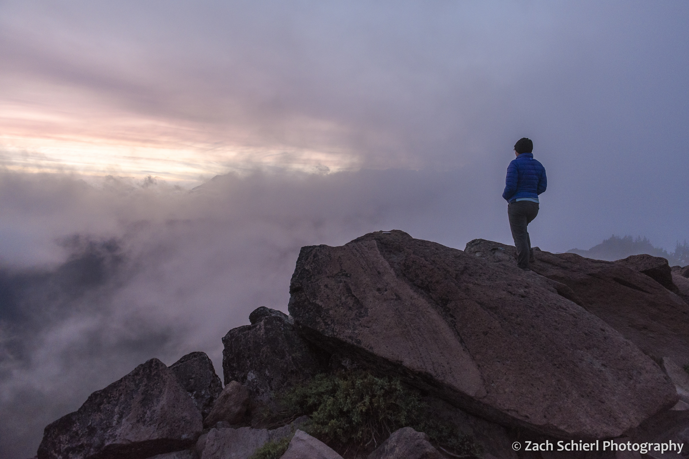
On our first night, we camped at just under 7,000 feet on the north flank of the mountain in one of the most spectacular alpine meadows I’ve seen. No matter which way I turned, the views were extraordinary. To our south, the crumbling volcanic edifice of Mt. Adams loomed large, with the Adams Glacier descending in a stunning icefall from the summit plateau. To the north, broad expanses of dense evergreen forest stretched off into the distance, leading the eye to the massive Mt. Rainier and the rugged skyline of the Goat Rocks on the horizon. To the west, the truncated cone of Mt. St. Helens was backlit by the setting sun. Several lingering snowfields surrounded our campsite, providing a nice source of clear, cold water. A variety of diminutive alpine wildflowers were in full bloom, and the low rumble of rock and ice fall high on the mountain occasionally punctuated the silence, with clouds of dust the only clue as to their location. While this location is reachable by a long day hike, spending the night and being able to explore and photograph in the late afternoon and evening light is one of my favorite things about backpacking!


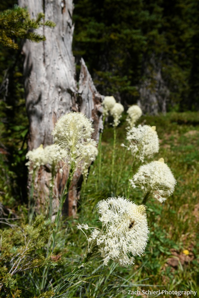
On Day 2, we descended to the Pacific Crest Trail before working our way around to the northeast side of Mt. Adams, passing through a series of wildflower-filled meadows and crossing several inviting streams cascading down from melting snowfields and glaciers higher on the mountain. These meadows also hosted a robust population of mosquitos and other biting insects….not unexpected for the Cascades in July, but an annoyance nonetheless, especially for an Arizona-born desert rat like me!
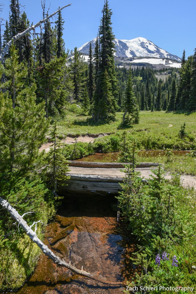

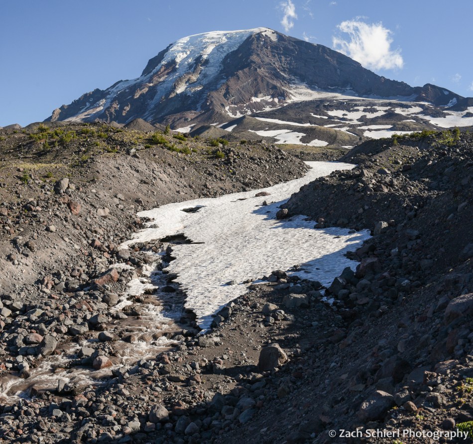
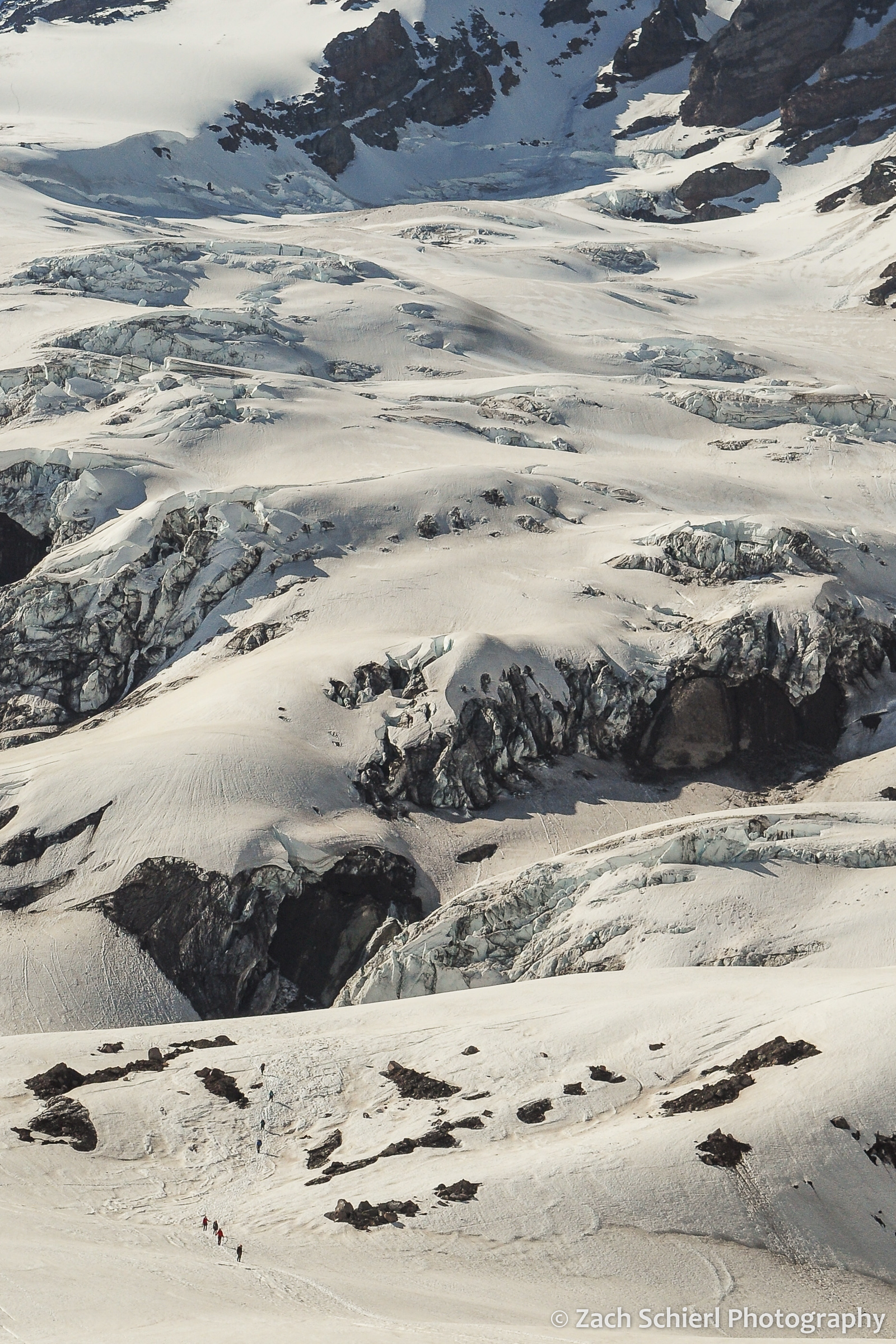
We had shared the trail with quite a few other hikers and backpackers on Day 1, but saw only a few other people from this point forward. Camp on night two was in a small clump of trees on the edge of a relatively recent lava flow. In contrast to the verdant alpine meadows of night one, this landscape was much more rugged, barren, and stark. After setting up our tent, we proceeded up the trail (with much lighter packs!) to find a spot for dinner. We quickly arrived at a stream crossing that we didn’t feel comfortable fording, so we left the trail behind and proceeded to pick our way up the rubbly bank until we arrived at a small knob with a spectacular view of the glaciers on Mt. Adams’ northeast face (Lava, Lyman, and Wilson). Here we enjoyed a delicious meal of instant mashed potatoes mixed with green chiles and an entire bag of bacon bits while listening to the roar of the creek.
Our best wildlife sighting of the trip actually occurred on the drive to the trailhead, when we happened upon a young barred owl sitting in the road. As we approached it flew into a nearby tree where it watched us warily for a few minutes before fleeing deeper into the forest:

Aside from this, we saw surprisingly little wildlife on this trip (unless you count mosquitos): only a few birds, chipmunks, squirrels, and a single marmot and mountain goat in the far distance from our first camp.
From our second camp, we were in a great position to catch sunrise on the final morning of our trip. There aren’t many things I’ll get up at 5:15 am for, but a Mt. Adams sunrise is definitely one of them!

After packing up, we hiked the eight downhill miles back to our car and drove back into the 100 degree blast furnace that is the Yakima Valley in late-July. We are thankful to have beautiful places like Mt. Adams so close to escape the heat this time of year!
Mountains of Summer

Tahoma dominates the skyline as seen from a ridge above Spray Park in the northwest corner of Mt. Rainier National Park. The boggy area in the lower right was filled with splintered tree trunks, likely the results of a good-sized avalanche this past winter.
As temperatures and cloud covers takes a decidedly fall-like turn here in central Washington, I’ve been looking back on photos from a whirlwind summer. While we were on the road for a good portion of the summer, we were able to make time for a few brief excursions to our “backyard” mountains: Mt. Rainier, Mt. Adams, and the Goat Rocks. Here are some of my favorite images from those trips:
Traversing the Nisqually Glacier on the south side of Mt. Rainier in early summer. I had the opportunity to take a basic mountaineering course this past spring, which culminated in a beautiful day on the ice in mid-June. A great way to kick-off the summer!
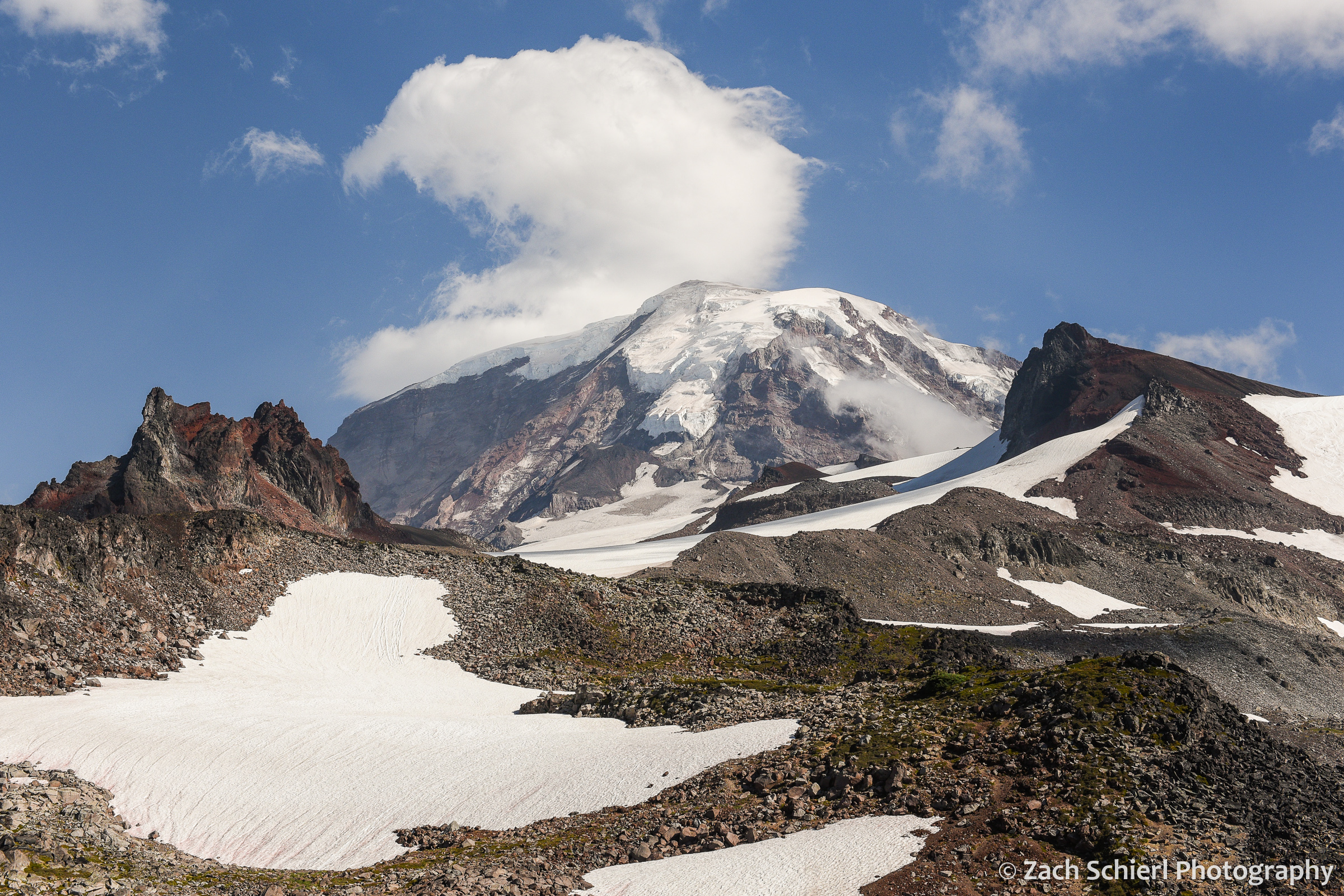
A view of Mt. Rainier from upper Spray Park, framed by Echo Rock (left) and Observation Rock (right).

A lone glacial meltwater pool on the slopes of Mt. Rainier.
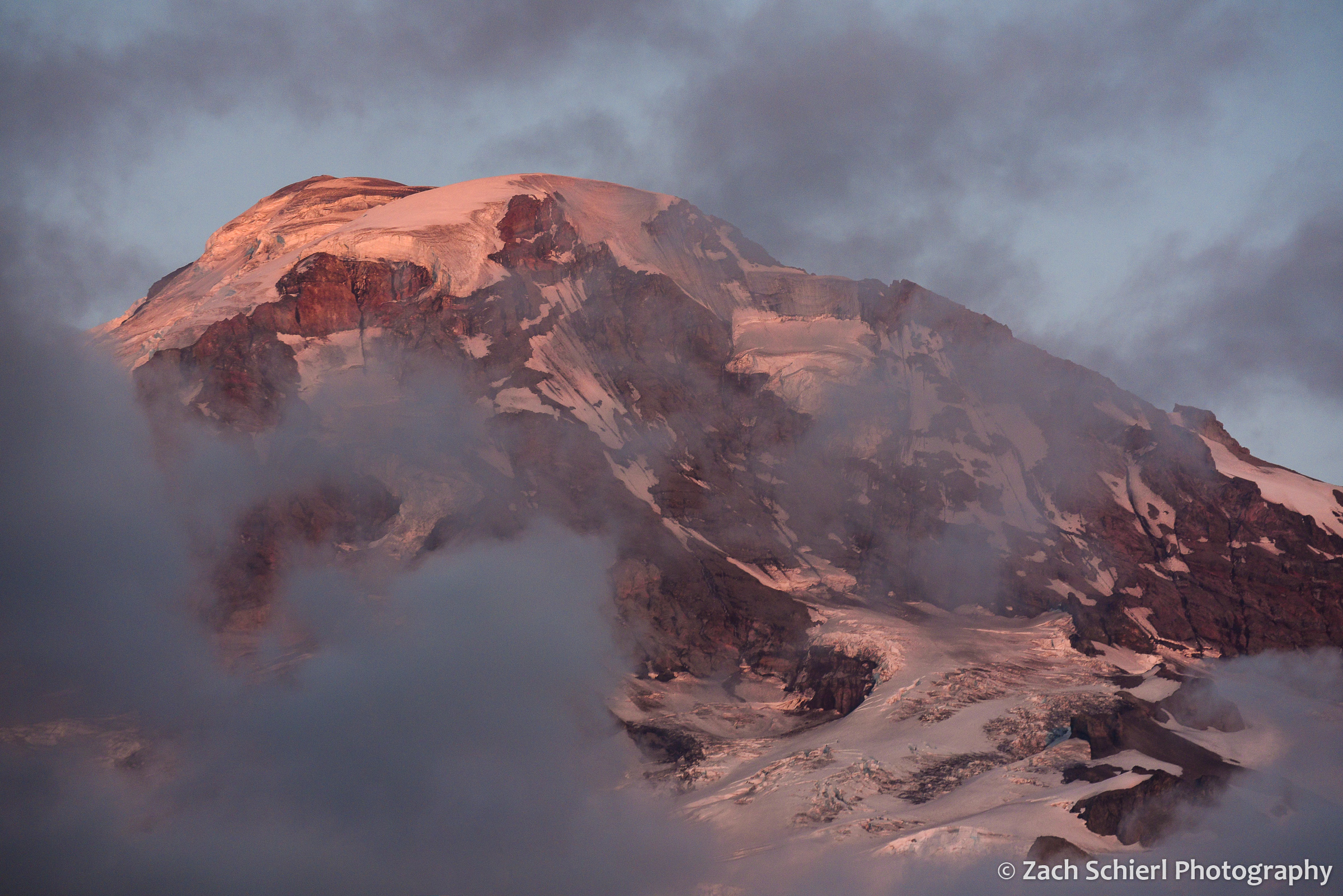
Sunset light on the summit of Mt. Rainier, as seen from the Spray Park Trail.
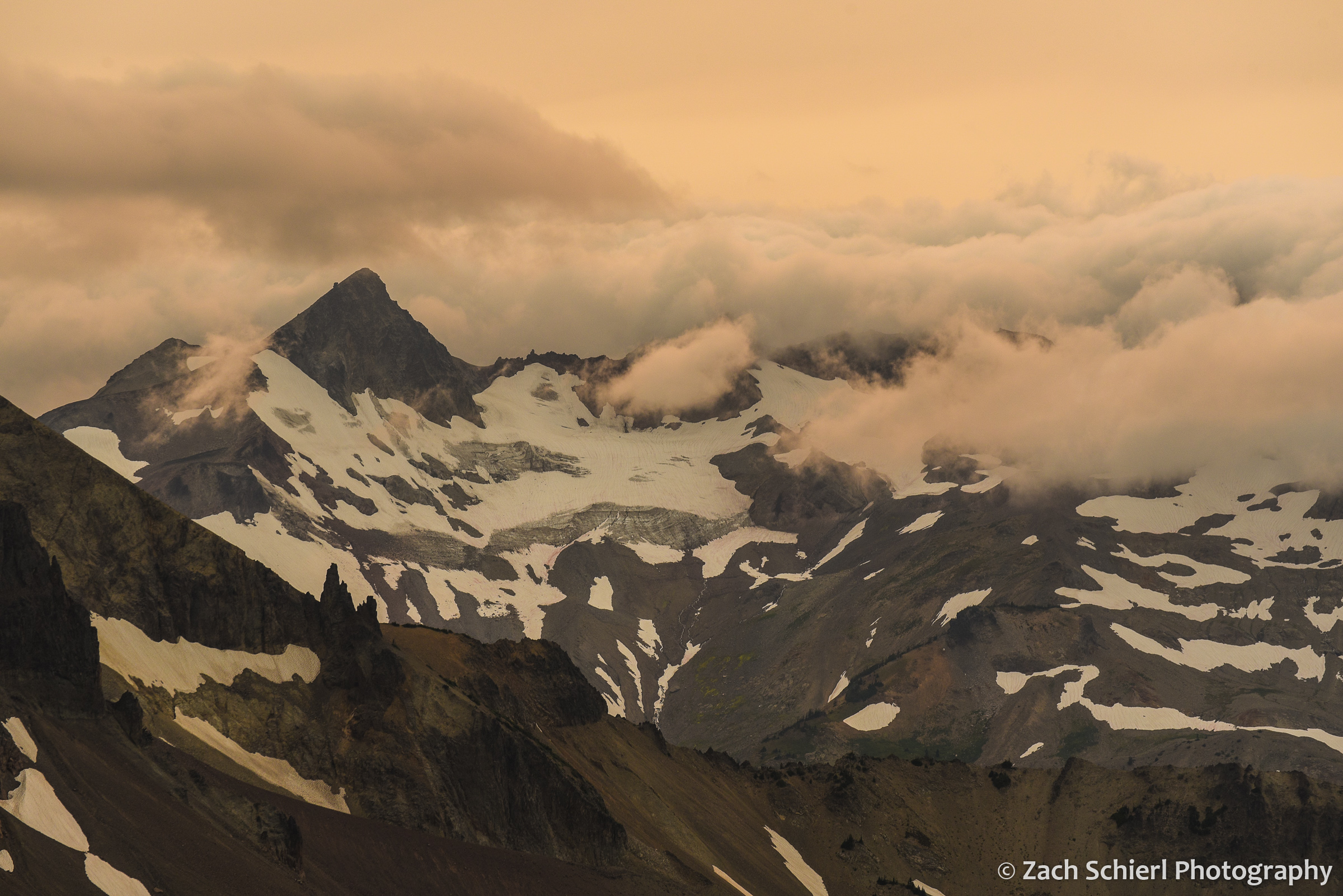
Ives Peak in the Goat Rocks Wilderness, flanked by clouds rolling in from the west and a sky made pale-orange by abundant wildfire smoke.
We spent a mostly cloudy and damp evening camped on Bear Creek Mountain in the Goat Rocks Wilderness. Every 15 minutes or so, there would be a momentary gap in the low clouds passing over the peak, allowing fleeting glimpses toward the west. Here, the outline of Mt. Rainier is barely visible through the clouds at left.

Mt. Adams at sunset as seen from the burn scar of the 2015 Cougar Creek Fire. A small cap cloud hovers over the summit.
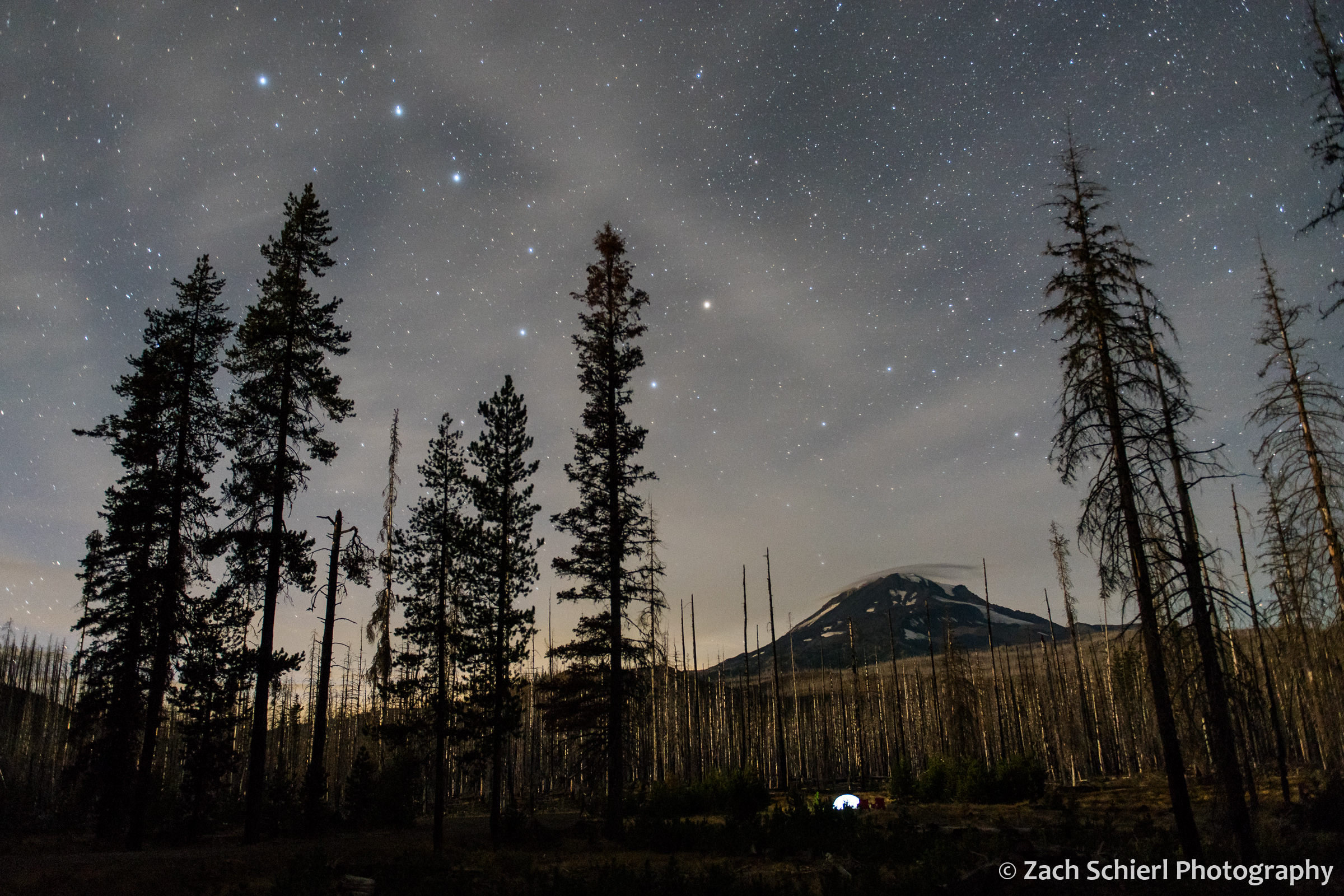
The Big Dipper over Mt. Adams.
Mt. Adams, Mosquitoes, and the Milky Way

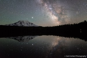
Bright Jupiter rises above the summit of Mt. Adams, with the summer Milky Way reflected in the calm surface of Takhlakh Lake, Gifford Pinchot National Forest, Washington.
Mt. Adams is a striking feature of the western skyline from here in the Yakima Valley of Central Washington. Here’s what it looked like from our neighborhood at sunrise a few months back:
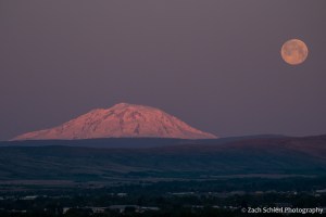
A setting full moon and sunrise light on Mt. Adams as seen from the Yakima Valley.
The towering volcanic cone looks close enough to touch, but in reality, reaching the base of Washington’s second highest peak requires a nearly three hour drive down a labyrinth of Forest Service roads. We’ve been wanting to explore the Mt. Adams area since we returned to Washington last year. With winter’s grip beginning to ease in the higher elevations of the Cascades, earlier this week we finally got the chance.
Mostly clear skies, calm wind, and a dark moon made for some great photo opportunities. While it may be debatable, I think some of these were worth their weight in mosquito bites. Several small ponds dot the lower flanks of Mt. Adams and snowdrifts still lingered in the shadier patches of forest, making the entire landscape somewhat damp. Consequently, the mosquitoes were ferocious! Sadly, our mosquito “repellent” only seemed to attract more. I was quickly reminded that a vastly underrated aspect of living in the southwest is the lack of bugs!

Mt. Adams reflected in Takhlakh Lake, Gifford Pinchot National Forest, Washington. (Not pictured: immense swarms of mosquitoes.)

White avalanche lily (Erythronium montanum), one of the first wildflowers to emerge from the swampy ground as the snow melts away.

Mt. Adams reflected in Takhlakh Lake at sunset.

The forests just to the west of Mt. Adams happen to be located nearly in the center of the four large active stratovolcanoes of the south Cascades: Mt. Adams, Mt. Rainier to the north, Mt. St. Helens to the west, and Mt. Hood just across the Columbia River to the south in Oregon. A variety of relatively short but steep hikes in the area ascend lesser peaks, resulting in fantastic views of all four volcanoes, plus the dense forests of the Cascades:
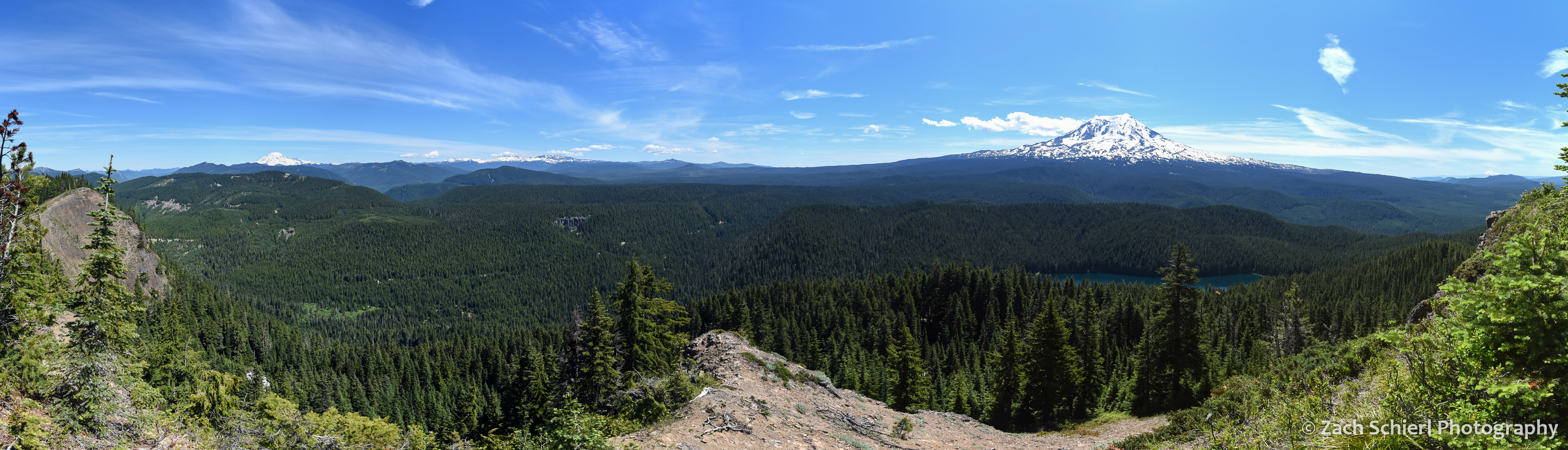
Panorama from Council Bluffs. Three Cascade Range stratovolcanoes (and the remains of a fourth) are visible (click to enlarge): Mt. Rainier (far left), the remains of the Goat Rocks volcano (center left), Mt. Adams (right), and Mt. Hood (far right). The upper portion of Mt. St. Helens’ eviscerated cone was also visible through the trees to the west.

The dense forests on the west flanks of Mt. Adams. Council Lake at bottom.
The real fun came after nightfall. Dark skies are much harder to find in Washington than in Utah, and this was my first good look at the Milky Way since last summer. The calm weather allowed me to capture the Milky Way’s reflection in Takhlakh Lake. Jupiter was kind enough to rise directly above the summit of Mt. Adams. And I got lucky and captured the brightest meteor of the evening in one exposure. This was certainly a case of being in the right place at the right time! (One might argue that the “right time” would have been a few months from now, when all the mosquitoes are dead, but then the Milky Way would not have been positioned so perfectly.)
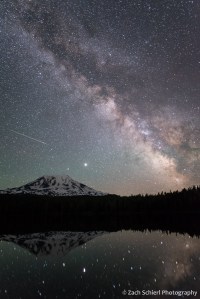
A meteor takes aim at Jupiter as Mt. Adams and the Milky Way are reflected in Takhlakh Lake.

The Milky Way begins to emerge from evening twilight.
