Exploring the Earth and Sky of the West

Latest

A Hidden Geologic Gem: Ashdown Gorge

alcove along ashdown gorge

Inside a spectacular alcove along Ashdown Creek. Alcoves such as these are numerous along Ashdown Gorge where the stream has eroded laterally into soft rocks near the canyon bottom. The perspective here makes the alcove appear a little deeper than it actually is, but the entire creek bed lies beneath the overhanging cliffs.

Not far from the increasingly overrun splendors of Bryce and Zion is a canyon frequently overlooked when discussing the many attractions of Southern Utah. The stunning Ashdown Gorge lies just a few miles from Cedar City off of Highway 14, yet I’ve seen a grand total of three other people on a pair of weekend hikes up the gorge this summer & fall. The solitude likely stems from the fact that there is no marked trail or trailhead for this hike; Ashdown Creek is the trail for a spectacular jaunt up the canyon. One must also scramble down the steep toe of an active landslide strewn with old vehicles, guardrail fragments, and asphalt chunks just to reach the creek bed from the highway. Once this has been accomplished though, it is fairly easily walking for many miles up the gorge as the water in the creek is typically only ankle deep except during spring snow melt and after heavy rains.

colorful scene along ashdown gorge

Beautiful colors in a narrow section of Ashdown Gorge.

Ashdown Gorge has a very different character than many canyons in Southern Utah, starting with the color of its walls. Not red or pink – the famous layers of Zion and Moab are well below the surface here – but rather varied shades of grey, tan, and yellow. The majority of the gorge is carved into the Cretaceous Straight Cliffs Formation, an impressive unit formed when southwestern Utah was a swampy coastal plain trapped between a disintegrating mountain range to the west and the shallow Cretaceous Interior Seaway to the east. Periodic but short lived rises in sea level are marked by occasional beds that contain almost nothing but fossilized oysters and other marine organisms.

Ripple marks on boulder, Ashdown Gorge

Not far from the junction of the gorge and Highway 14 is a gigantic boulder of the Straight Cliffs Formation displaying some of the best preserved ripple marks I’ve ever seen!

Ashdown Gorge is not quite a slot canyon, although it tries in places. Despite this, the walls for much of its length are several hundred feet high and there are many locations where you would NOT want to find yourself during a flash flood, so take a close look at the weather forecast before attempting to explore the gorge! Unlike the relatively hard sandstone that forms most of Utah’s famous slot canyons, the Straight Cliffs Formation is rather soft and crumbly. The creek has taken advantage of this by eroding laterally in many places. The result of this erosion is perhaps most spectacular around the outside edges of the many tight meanders of Ashdown Creek. Here the creek has carved into soft layers near the canyon bottom, undercutting harder layers of sandstone near the rim, creating vast alcoves that completely cover the creek bed.

Another alcove along ashdown gorge

Inside another alcove further downstream. Beneath this one were a plethora of large, partially pulverized blocks of grey rock that had clearly fallen quite recently (they had not yet been covered in the orange mud like most of the rocks in the creek bed) from the overhang above. We chose not to stick around in this one for long…

While walking along the creek, one thing that is striking is the color of the boulders upon which you walk. Not grey and tan like the canyon walls, but rather varying shades of orange, pink, and red. This is because Ashdown Creek drains the vast amphitheater of Cedar Breaks National Monument upstream to the east. The soft limestones and siltstones of Cedar Breaks are easily eroded, and Ashdown Creek can turn bright orange during even minor rains.

Flanigan Arch from Ashdown Gorge

Flanigan Arch from Ashdown Gorge

Another highlight of a hike up Ashdown Gorge is a good view of Flanigan Arch, an impressive span (reputable estimates of its length are hard to find, but most seem to say ~60 feet) that is difficult to access or even see from any other location.

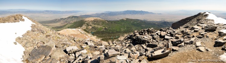
In addition to the lack of crowds, the high elevation of Ashdown Gorge (7000-8000′) makes it a wonderful day hike (or potential overnight trip) for escaping the heat in summer (just watch for flash floods…) Ponderosa Pine, spruce, and fir are the most commonly seen large trees in the gorge which has a very “mountainous” feel to it. When we hiked it in late October, the temperatures were actually getting a little too cool to fully enjoy the numerous required stream crossings. In June when it was 80 degrees, the creek crossings were heaven!

Ripples in the creek in Ashdown Gorge

Some small riffles along Ashdown Creek.

small waterfall along ashdown gorge

Hiking up the gorge is fairly easy, a few small riffles and waterfalls can be easily scrambled around.

Fall Color in Southern Utah

Ridge of golden aspens near Brian Head, UT

A ridge coated in aspens near Brian Head, UT begins to turn color in the early fall. The view from the Markagunt Plateau is truly expansive; in the background are ranges and valleys in the Great Basin of western Utah, and on a clear day one can clearly see Wheeler Peak in eastern Nevada

Another autumn is upon us, and once again we find ourselves becoming familiar with the surroundings of a new home, this time in Southern Utah. Why this neck of the woods, with its famous expanses of colorful slickrock, isn’t more well known for fall color, I do not understand. Near Fish Lake is the largest single aspen colony in the world, which also happens to be the worlds heaviest known organism period.

A bit closer to home for us is the Markagunt Plateau, which reaches elevations of over 11,000 feet and contains expansive reaches of aspen that rival, and to be honest probably beat, any we experienced in Colorado. The weather has been fairly mild for the last month or so, with few storms and little wind, allowing the leaves to put on an extended show:

Colorful aspens in lava flow, Markagunt Plateau, UT

One of the unique features of the Markagunt Plateau are a number of expansive and recent (<10,000 years) lava flows that coat much of the landscape above 9000 feet. The stark lava flows provide a stunning backdrop for the brilliant fall colors that occupy pockets of soil within their midst.

Colorful aspens dot lava flows on the Markagunt Plateau, UT

Aspens and lava flows, Markagunt Plateau, UT

Golden aspens on the Rattlesnake Creek Trail, Utah

A beautiful grove of aspens on the Rattlesnake Creek Trail near Brian Head, UT. This trail has clearly been a popular route for quite some time; we found inscriptions on some of these aspens dating back to 1903! (Along with many more recent ones sadly…)

Red aspen leaves near Duck Creek, Utah

This pocket of trees near the Duck Creek Campground possessed the most vividly red leaves I’ve ever seen on aspen trees.

Golden aspens on the Markagunt Plateay

Golden aspens coat the flanks of Hancock Peak, a small cinder cone on the Markagunt Plateau. This view was obtained from the summit of Brian Head Peak, 11, 312 feet above sea level. In the distance is the western escarpment of the Paunsaugunt Plateau, home to Bryce Canyon National Park.

Aspens in fog, Markaguny Plateau, Utah

I pass this grove of aspens several times per week on my way to work. I had been keeping an eye on this particular tree for weeks, and on this foggy day I finally pulled the car over to snap a photo.

Colorful Aspens in the Fog, Markagunt Plateau, UT

More aspens in the fog, Markagunt Plateau, Utah

Escape to the Snake Range: Great Basin National Park

light from the full moon illuminates Wheeler Peak in Great Basin National Park

Wheeler Peak by full moonlight, Great Basin National Park, Nevada

At first glance, Nevada’s Snake Range is just one out of the hundreds of long, skinny mountain ridges that comprise the Basin and Range Province of the western United States. Clarence Dutton, a geologist associated with John Wesley Powell’s geographic and geologic surveys of the western United States in the late 1800s, once referred to the Basin & Range as “an army of caterpillars marching toward Mexico,” referring to the seemingly interminable landscape of north/south trending mountain ranges and intervening valleys that dominate Nevada, southern California, and western Utah & Arizona.

It is the presence of one of our nation’s least visited national parks, Great Basin, in the southern portion of the range that provides the first indication that the Snake Range might be somehow unique from its brethren. And indeed it is. Rising more than 7,000 feet above the surrounding terrain, the Snake Range is home to four of the five tallest peaks in the state of Nevada, culminating in 13,065′ Wheeler Peak, the second highest point in the state. The altitude and the lush spruce, fir, and aspen forests clinging to its slopes makes the area feel suspiciously like a piece of Colorado thrust up into the middle of the Nevada deserts.

Wheeler Peak just after sunset

Wheeler Peak just after sunset on the summer solstice

Sky pilot and Wheeler Peak

Abundant sky pilot (Polemonium viscosum) in a glacial cirque beneath Wheeler Peak, Great Basin National Park

Panorama from summit of Wheeler Peak

Looking north along the Snake Range from the summit of Wheeler Peak (13,065′) on a beautiful June day

Great Basin National Park is also famous for the groves of Great Basin bristlecone pine (Pinus longaeva) found on rocky slopes near treeline. Currently believed to be the longest-living non-clonal organism on Earth, many of the bristlecones in the park exceed 3000 years in age. In an infamous 1964 incident, a Snake Range bristlecone felled by a researcher (the area had not yet been designated as a national park at the time) was posthumously determined to be nearly 5000 years old, which would have made it the oldest known tree on earth were it not for the fact that the tree was now quite dead. More recently however, a bristlecone estimated to be 5,065 years old was found in the White Mountains of eastern California, slightly surpassing the age of the doomed Great Basin tree.

bristlecone pine, Great Basin National Park

A twisted and contorted Great Basin bristlecone pine (Pinus longaeva) on the slopes of Wheeler Peak, Great Basin National Park

In the final hour of my recent drive across western Utah to reach Great Basin NP, I encountered only a single other vehicle before arriving at the park entrance. The relative isolation of the park leads to perhaps its most unique attribute; Great Basin National Park is by many measures the darkest national park in the U.S., and one of the darkest locations in the country period. Sadly, my visit coincided with a full moon which, while preventing me from experiencing a light pollution-free night sky, did make for some good nightscape opportunities:

Ful moonlight over Wheller Peak and Stella Lake

Light from the rising full moon illuminates Wheeler Peak and Stella Lake, Great Basin National Park

A Western Tiger Swallowtail pollinates and feeds from a crimson columbine

A Western Tiger Swallowtail (Papilio rutulus) feeds from a crimson columbine (Aquilegia formosa) along Baker Creek, Great Basin National Park

If you get sick of exploring the surface world, Great Basin also harbors a subterranean spectacle, the ornately adorned limestone cavern known as Lehman Caves. With alpine peaks, caves, ancient trees, and inky black night skies, it may seem miraculous that Great Basin remains one of the least visited national parks in the country. In 2015, Great Basin was visited by 98% fewer people than that big hole in the ground known as the Grand Canyon. Hopefully the photos on this page encourage you to stay far, far away 🙂