Wonderful Waters of the Escalante


Lower Calf Creek Falls sits on a tributary of the Escalante River. It’s not everyday you find a waterfall this large in the desert!
The Escalante River in south central Utah was supposedly the last river in the continental United States to be “discovered” and mapped. You don’t have to spend too much time with it to see why. First of all, it’s not large. “River” is a bit of an overstatement for most of the year, when it is easily forded on foot. Only during torrential summer monsoon storms does it resemble anything that the rest of the world would call a river. Secondly, even the most easily accessible stretches of its ~90 mile course take some time to get to. The Escalante is crossed by a grand total of one paved highway, a remote stretch of Utah Highway 12 that is among the most scenic drives in the west.
The lower reaches of the Escalante’s sinuous canyon pose even more of a challenge, reached only by boat on Lake Powell, or via a combination of hellish dirt roads and long hikes, something we undertook on a backpacking trip a few years back when we entered the Escalante via one of its tributaries, Coyote Gulch.
Upper portions of the canyon are far more accessible, if not as imposing, requiring only an occasional wade across the river to see sights such as the Escalante Natural Bridge:

Escalante Natural Bridge, more than 100 feet in length, blends in well with its surroundings.

Streaks of light mud and dark desert varnish coat towering cliffs of Navajo Sandstone in the upper Escalante River canyon.


A cliff dwelling and pictographs in a high alcove along the Escalante River. This alcove looked thoroughly inaccessible from below, but the relatively modern graffiti visible through the telephoto lens sadly indicated otherwise.
One of the most significant tributaries of the upper Escalante River is Calf Creek, best known for a pair of waterfalls that are refreshingly out of place in a place not generally known for its aqueous wonders. Lower Calf Creek Falls, the larger of the two cascades, is reached via a ~3 mile hike along a broad canyon carved by the creek:

Enjoying a peaceful and relatively uncrowded visit to Lower Calf Creek Falls.


Desert varnish is a common sight throughout the southwest, but the palette of colors on the cliffs flanking Calf Creek seemed especially varied.

One of the few wildflowers left standing in late September: a single desert paintbrush (Castilleja chromosa)
A few miles north, reaching the smaller Upper Calf Creek falls requires a short but steep scramble down a slickrock slope into the depths of the canyon:

The 3rd quarter moon sets over sandstone rock formations in the Upper Calf Creek drainage.

Enjoying the solitude at Upper Calf Creek Falls.

Clumps and mats of moss and other plants coat the cliffs beneath Upper Calf Creek Falls.
Surrounded by some of the least developed land in the continental United States, the night sky from the Escalante canyons is a prime attraction as well!

The summer Milky Way sets over the southern horizon near Escalante, Utah. No light pollution in sight!
Caught Between the Seasons

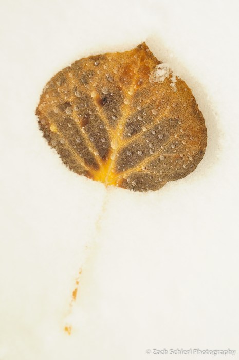
Winter has arrived in the high country of Utah. Fortunately for photographers, autumn was still very much in progress when the snow started to fly. The contrast between the mid-winter wonderland and vestiges of fall color made for some great photo opportunities over the past few weeks:

Vibrant red and gold aspen leaves after a fresh snowfall, Webster Flat, Utah.

Young aspens on a foggy, snowy fall day, Webster Flat, Utah.
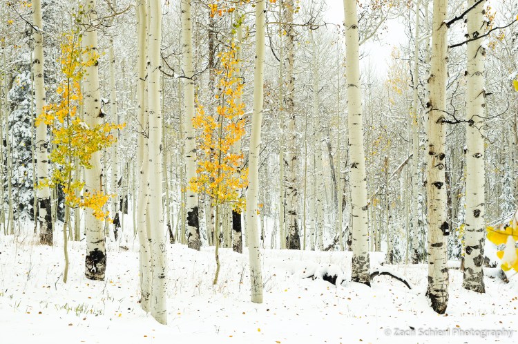
Webster Flat, Utah
Webster Flat, Utah

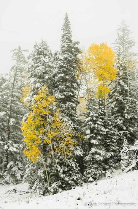
Colorful aspens among snow-covered firs on the south slopes of the Markagunt Plateau, looking south toward Kolob Terrace and Zion National Park.
Two golden aspens surrounded by snowy conifers, Cedar Canyon, Utah.

Markagunt Plateau, Utah
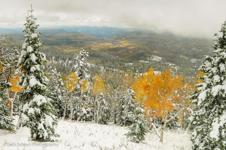
Markagunt Plateau, Utah
Another Hidden Utah Gem: Pine Park


Panorama overlooking Pine Park at sunset.
Tucked away at the terminus of a winding gravel road in the Dixie National Forest near the Utah/Nevada border, Pine Park would probably be a beloved national monument or state park were it located literally anywhere other than Southern Utah. We’ve been fortunate to come across quite a few places that fit this profile: stunning, unique, reasonably accessible, and—here’s the big one—empty. Places like Zion National Park may be bursting at the seams, but vast swaths of Southern Utah remain deliciously deserted. On a warm and beautiful weekend in early May, we had Pine Park pretty much all to ourselves!

Large Ponderosa Pines complement the smooth knobs of white tuff.
The main draw at Pine Park are the spectacular rock formations carved into the Tuff of Honeycomb Rock. Tuff is a deposit of consolidated volcanic ash combined with rock, mineral, and glass fragments that forms only in very explosive volcanic eruptions. Pine Park sits on the margin of some of the most voluminous and expansive deposits of tuff in the world. Collectively, the thousands of feet of tuff scattered across large swaths of Nevada and western Utah represent a time when, for lack of a better descriptor, all hell was breaking loose across what is now the Great Basin. The Tuff of Honeycomb Rock is just a hair under 12 million years old, and thus one of the youngest deposits from this intense and violent episode of volcanism.
While the backstory of the tuff is intriguing, the real allure is the wonderland of creamy white spires, domes, and hoodoos emerging from the otherwise nondescript juniper, ponderosa, and piñon pine forest. Weathering and erosion have sculpted a masterpiece at Pine Park. In many places, the architecture almost resembles Bryce Canyon, albeit whitewashed, and with no maintained trails (several Forest Service trails wind through this area, according to the official map, but we had difficulty following them for any more than a hundred yards past the trailhead) the many pockets of eroded tuff are truly a blast to explore.

The Ponderosa’s don’t require much soil to gain a foothold in small depressions between ridges of tuff.

This species of lupine (Lupinus aridus?) seemed to love the gravelly, sandy soil produced by weathering of the tuff.

Fantastic rock formations immediately adjacent to our campsite.
The tall, stately Ponderosas and a small stream give Pine Park a high-altitude feel, but in reality it sits at just 5700 feet above sea level, plenty low and warm enough for a plethora of wildflowers to be in full bloom during our visit:

Bitterroot (Lewisia rediviva) are abundant on long-ago burned slopes above Pine Park, now home to open grasslands.

A claret cup cactus (Echinocereus triglochidiatus) in full bloom. I’m fully aware that the color appears somewhat enhanced on this photo, but it’s not; the claret cup flower really is that brilliant!

The lupines were everywhere.

Everywhere!

Multicolored boulders litter a chute in the Tuff of Honeycomb Rock.
