Into the Valley of Death (Part 1)


Death Valley and Badwater Basin seen from Dante’s View, over 5,500 feet above the valley floor
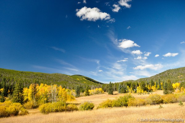
Badwater Basin in Death Valley, the lowest (and hottest) point in North America at 282 feet below sea level, has long been on my list of places to visit in person. In part because of the superlative involved but also because Death Valley on the whole is a geological Mecca of sorts. A few weeks ago, I finally got to make my pilgrimage, but not without a few surprises. First of all, I never expected to be wearing four layers (including thermal underwear) and a winter hat when taking my picture next to the famous Badwater sign. I also didn’t expect visiting Badwater to be one of the least interesting things that I saw in Death Valley. This is not a knock against Badwater, but rather a testament to the fact that even after visiting 32 of the 59 national parks in the US, I can honestly say that Death Valley was one of the most spectacular and diverse I have been fortunate enough to spend time in.
With a week off before Christmas, we were looking for someplace “warm” to camp. We had originally planned to head to southern New Mexico and Texas to check out the Big Bend and Guadalupe Mountains area. However, in the days leading up to our departure, the forecast lows plunged into the low 20s. It wouldn’t kill us, but we figured we could do better. Heading to Death Valley turned out to be a good audible as the lows were only in the low to mid 40s, quite pleasant by December standards. Oddly enough it was a bad experience during the depths of winter in 1849-50 that gave Death Valley its foreboding name. One member of a lost and ragged group of prospectors is said to have quipped “goodbye Death Valley” as they finally departed the basin that had given them such torment. Today though, armed with an automobile and several large water jugs, winter is an ideal time to take in the spectacular sights of Death Valley. After several days in the park, saying “goodbye” was the last thing I wanted to do.

Sunset at Zabriskie Point, Death Valley National Park
The first thing to know about Death Valley: it’s big. Nearly 3,000 square miles big. The national park that protects it and the surrounding mountains covers upwards of 3.3 million acres—about the size of Yellowstone and Grand Canyon National Parks combined—making it the largest national park in the U.S. outside of Alaska. It takes awhile to get around and the character of the valley varies wildly along its 100+ mile length. All parts of the valley share some common characteristics though: heat (average July high: 116.5 F), aridity (2.3 inches in a good year), and low elevation (over 500 square miles of the valley lie below sea level).
Death Valley has been low for a long time but the dryness is a comparatively recent development. During the last glacial maximum (geologist-speak for “ice age”) 12,000-30,000 years ago, the surrounding mountains received so much precipitation that Death Valley turned into an 100 mile-long lake known as Lake Manly. Since Death Valley is bordered on all sides by mountains, streams draining out of the mountains had no easy way out. Over time, as the climate dried and the lake evaporated, thick layers of salt were deposited on the valley bottom. This is why most of the valley floor appears white. With the encouragement of the rangers, I tasted it and can confirm that it is indeed salt!

Salt formations at Badwater, Death Valley National Park
In many locations (in particular a spot known as “Devil’s Golf Course”), the salt grows into some fantastical yet potentially dangerous formations. The valley here is a wonderland of 1-2 foot high irregular mounds of salt & mud, all encrusted with razor sharp blades and daggers made of salt crystals (see photos below). While the salt is relatively brittle, falls are still to be avoided at all cost. Walking around Devil’s Golf Course reminded me of the time I completed shredded a brand new pair of leather hiking boots in one week of doing geology field work on fresh, sharp a’a lava flows in Hawaii. The only difference was the a fall here would quite literally rub salt in your wound, not a pleasant thought at all.

Devil’s Golf Course, Death Valley National Park

Close-up of the salt formations at Devil’s Golf Course.
Near Badwater Basin are some spectacular and very colorful badlands sculpted out of young, soft, clay-rich sedimentary rocks. We arrived in Death Valley our first day just in time to catch sunset over the badlands (photo at top of page) and then hiked through them the next day after we started to desiccate from walking around on the salt flats too much.
Late afternoon light on Manly Beacon in the badlands near Furnace Creek. Note hiker for scale.
If salt daggers, ancient lakes, and badlands aren’t enough excitement for one day, you’ll be happy to know that the northern end of Death Valley has experienced some volcanic activity within the past few thousand years. In a stark contrast to the bleak white salt flats of the southern valley, the valley landscape here is shrouded in dark black cinders and volcanic cones. The centerpiece is a large hole known as Ubehebe Crater, a type of volcanic feature known as a “maar.” Maars are the result of “phreatomagmatic eruptions” (your new scrabble word for the day; it will just take you a few turns and some incredibly good luck to be able to play it…), which occur when magma beneath the Earth’s surface comes into contact with groundwater. The heat from the magma causes the groundwater to flash into steam, creating a violent explosion, and, as so often happens with violent explosions, a large hole in the ground. The red and white sedimentary rocks that existed prior to the eruption still appear beneath the volcanic cinders in places creating a beautiful palette of colors.

Ubehebe Crater, at the north end of Death Valley, at sunset
More photos of sand dunes, mountain canyons, and the spectacular geology of Death Valley to come!
Summer Fades, Winter Enters

While the snow may be falling and the vegetation dying, I am still alive and well here in Northern Colorado. This past spring, I somewhat rapidly went from working zero hours per week to working 50-70 hours per week which, as they say, “crimped my style” when it comes to photography.
We’ve had a glorious month of unseasonably warm fall weather here in Colorado and I was fortunate to get the chance to take several trips into the high country over the past few weeks to photograph fall colors. The presence of a leaf blight on many aspens in Northern Colorado (due to a fungus that took hole during our spring & early summer deluge) led to dire speculation that this season’s leaf show would be a letdown. Indeed, I did come across occasional unsightly stands of aspen with leaves that looked as though they been crisped by a torch. But many other locations appeared completely unaffected and lived up to the annual hype. Enjoy the photos!
Note: 2016 photography calendars will be available soon! Details to come…

Aspens along the lower Roaring River, Rocky Mountain National Park, Colorado
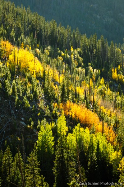
A bright palette of red, yellow, and green aspens in Wild Basin, Rocky Mountain National Park. Nature’s stoplight! Just not quite in the correct order…

Pennock Pass, Colorado
Pennock Pass, Colorado
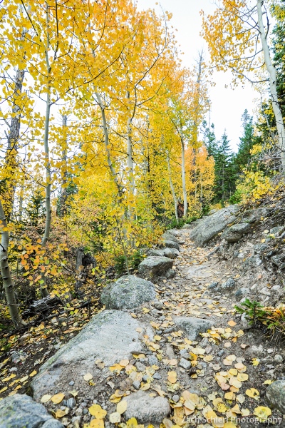
Fallen leaves litter a trail in Wild Basin, Rocky Mountain National Park, Colorado

Aspens aren’t the only plant that change color in the fall! Poison ivy (Toxicodendron rydbergii) can often have colors to match.
Top 10 from 2014
As in past years, with the coming of the New Year I decided to take a look back at all the photos I took in 2014 and select some of my favorites to share with you here on the blog. Between finishing graduate school (yippee!) and making a permanent (for now) move from the Pacific Northwest to Colorado, I had less time to devote to photography than in previous years. Nevertheless, picking out my favorite photos was difficult as usual and a good reminder that I was fortunate to have the opportunity to experience and photograph a a number of new places in the past year, from the coasts of Olympic National Park to remote alpine basins in the Rocky Mountains.
Without further ado, here are my ten favorite photos from 2014 in chronological order. Here’s wishing you all a healthy and happy new year!
1. Tulip Fields at Sunset, Skagit Valley Tulip Festival, Washington

Held annually in April, the Skagit Valley Tulip Festival is a must see for any spring visitor to NW Washington, photography buff or not. On weekends, especially sunny ones, the tulip fields that spread out across the Skagit Valley about an hour north of Seattle are overrun, making photography difficult. Fortunately, I lived only about a half hour away and was able to visit on a less-busy weekday evening in order to photograph the picture-perfect bulbs in their prime and without the crowds.
2. American Bison, Yellowstone National Park

I’m going to come clean: this is the only photo on this list taken from the confines of my car! I was departing Yellowstone at the end of an impromptu day-trip to the park while attending a geology conference in Bozeman when I spotted this solitary bison along the road. Fortunately, no vehicles were coming up behind me so I was able to grab my camera and capture the glow of the late afternoon sunlight and the diffuse reflection of the bison in a pool of late-season snow melt.
3. Milky Way, Airglow, and Light Pollution from Hurricane Ridge, Olympic National Park, Washington

Living near Seattle doesn’t exactly do wonders for one’s chances of observing rare celestial events. What’s one to do? Get above the clouds of course! I was thrilled to be visiting Olympic National Park during the peak of the Cameleopardalids meteor shower in May. In order to get an unobstructed view, we made the drive up to Hurricane Ridge just before midnight in hopes of catching some meteors. As you may recall, the meteor shower fizzled spectacularly but all was not lost: I was able to capture this panorama of the summer Milky Way emerging from the disgusting Seattle light dome (over 50 miles away as the crow flies) as it rose in the west. Despite the light pollution, I also managed to capture the ghostly green glow of an atmospheric phenomenon known as “airglow” (which I’ve written about previously) and the low lying clouds smothering the Elwah River Valley several thousand feet below.
4. Giant Green Anemone (Anthopleura xanthogrammica), Olympic National Park

I developed a slight infatuation with seeking out and photographing marine life during my two years in Western Washington. Timing trips to the coast with some of the lowest tides of the year helped me discover a wide variety of anemones, nudibranchs, sea stars, urchins, and much more. Anemones were perhaps my favorite group to photograph, their neon-colored and delicate tentacles waving back and forth in the surf.
5. Panorama from Hole-in-the-Wall, Rialto Beach, Olympic National Park

Rialto Beach is one of the most popular spots in Olympic National Park…for obvious reasons. The short 2-mile hike to Hole-in-the-Wall was one of my favorite experiences this year. Once reaching the famous rock formation, we found an nearly entirely overgrown path that led us up to a viewpoint on the crest of Hole-in-the-Wall, getting us away from the surprisingly scant Memorial Day crowds and immersing us in expansive views of sea stacks, rocks, and islands along the Olympic coast.
6. Summer Wildflowers at Ice Lake, San Juan Mountains, Colorado

Despite my ravings about Rialto Beach in the previous photo, our trek to Ice Lake in the San Juan Mountains of Colorado was hands down my favorite hike of the year, and one of my most memorable ever. My only regret about this day was that we weren’t prepared for an overnight (or at least a hike back to the car in the dark!), which means I missed out on what was surely a epic sunset from the basin. Click the link above for more photos of this spectacular place.
7. Ice Lake Panorama, San Juan Mountains, Colorado

Did I mention Ice Lake was spectacular? It snagged two of the coveted spots on the top 10 list. That means you have to go.
8. Circumpolar Star Trails from Escalante Canyon, Colorado

Photographing star trails is a bit more complex in the digital age than it was with film. This was only my second legitimate attempt, but I was happy with how it turned out. Extremely long single exposures suffer from a variety of maladies so this photo is actually a composite of over 100 consecutive 30″ exposures (for the stars), and one 3″ exposure for the foreground juniper which I illuminated with a headlamp. In post-processing, I had the pleasure of removing more than a dozen aircraft which passed overhead during the hour or so it took to gather the series of exposures. I elected not to remove the two meteors (astronomical objects flashing through the frame are fine by me) but I’m looking forward to doing some more star trail photography from places not on major transcontinental flight paths.
9. Exclamation Point, Black Canyon of the Gunnison, Colorado

I love this photo because it exemplifies how the canyon got its name. Despite being taken at 10 o’clock in the morning, the narrow gorge carved into dark Precambrian metamorphic rocks remained shrouded in shadow, while its surroundings (and portions of the canyon bottom) are basking in the bright, mid-morning sunshine. This photo was taken from an overlook on the remote and seldom visited North Rim of Black Canyon, which offers the most spectacular views into the narrowest portion of this amazing gorge and is truly worth the effort to visit.
10. Waving Aspen and Grasses, Rocky Mountain National Park, Colorado

I didn’t purchase any new camera gear this year, but was the recipient of a 9-stop neutral density filter for my birthday, a filter I’ve been wanting to experiment with for a while now. That filter allowed me to take this photo, a 30″ exposure at f/22 in broad daylight, and capture the motion of a colorful aspen and meadow grasses waving in the wind on a autumn day in Rocky Mountain National Park.


