Here is installment #2 of recent photos taken with my new (well, new to me…used by someone else first) Nikon AF-S NIKKOR 200-500mm f/5.6E ED VR telephoto lens:
Bighorn sheep, Naches, WA. This photos effectively captures the reach of this lens, as these sheep were about a mile away and a thousand vertical feet above me when I took this photo.
Reflections along the Carbon River, Mt. Rainier National Park, WA
Tiny mushrooms, Billy Frank Jr. Nisqually National Wildlife Refuge, WA
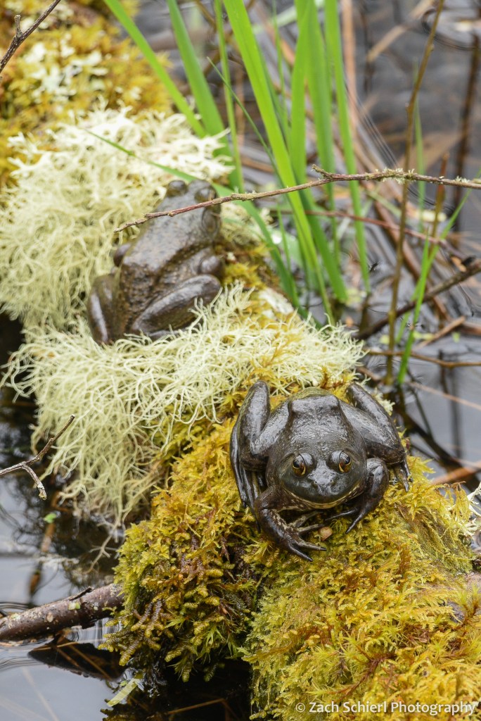
Bullfrogs on a log, Billy Frank Jr. Nisqually National Wildlife Refuge, WA
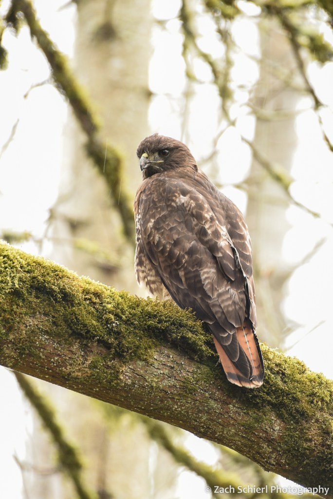
A red-tailed hawk in the rain, Billy Frank Jr. Nisqually National Wildlife Refuge, WA. I was taking pictures of the frogs in the previous photo when another hiker alerted me to the presence of this hawk about ~10 feet above my head.
Moss-covered nest, Billy Frank Jr. Nisqually National Wildlife Refuge, WA
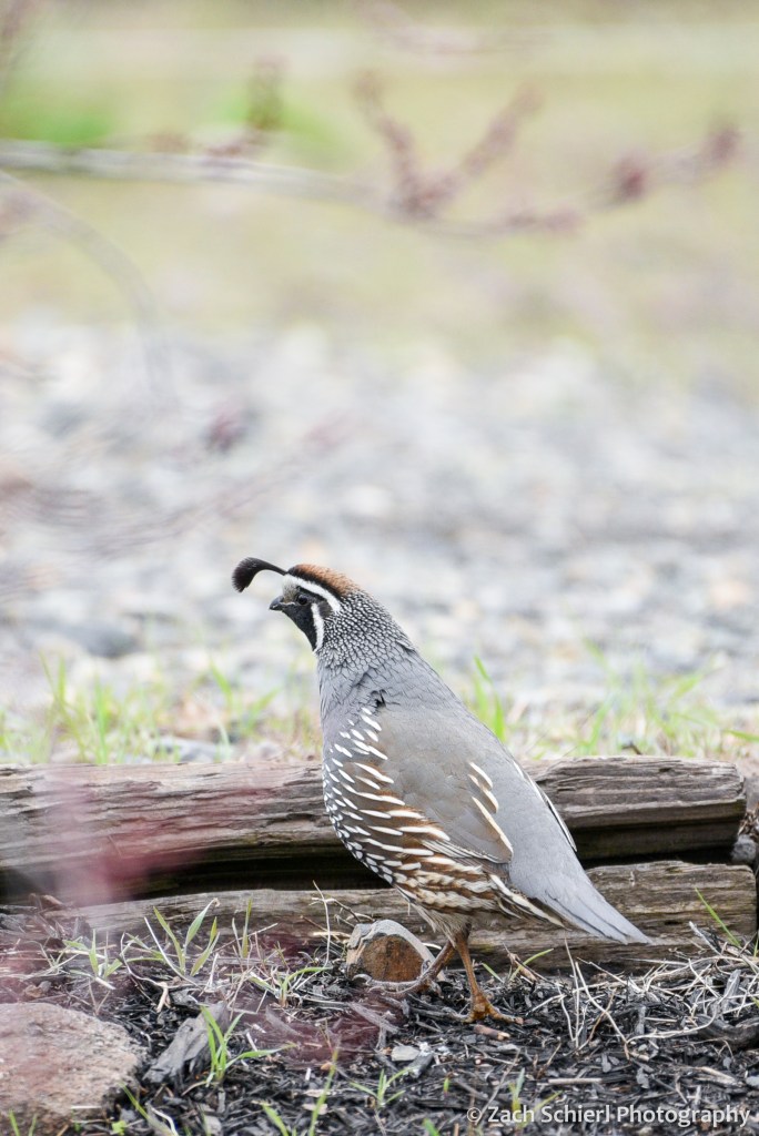
California Quail, Yakima, WA
Mt. Hood rises above The Dalles, OR as seen from across the Columbia River in Washington.
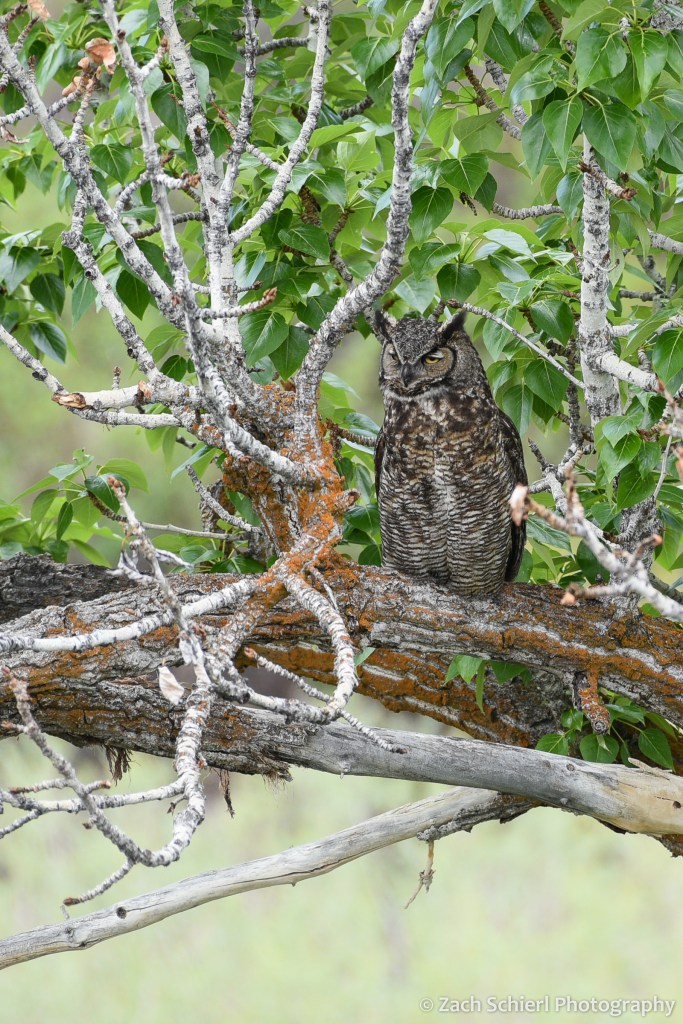
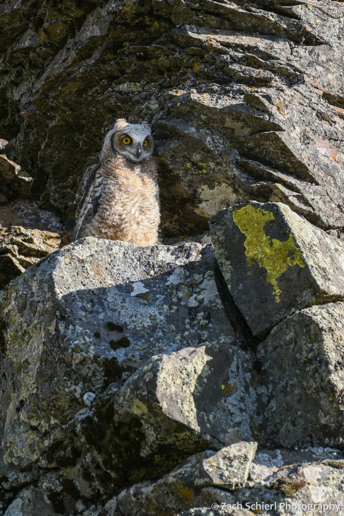
Juvenile Great Horned Owl, Yakima, WA. This was actually a somewhat alarming experience, as this young owl was sitting on the ground just a few feet off the trail. It made its presence known by aggressively clacking its beak and puffing up its feathers. I initially thought it was a badger or some other mammal before realizing that it was an owl. We retreated a little ways down the trail before looking back to capture this photo.
We found the adults nearby: one in a tree…
…another blending in with the rocks…
…along with a second juvenile!
A week later, I returned and saw just one of the juveniles, now complete with ear tufts (the “horns”)!
A mountain goat expresses skepticism regarding our appearance on a remote mesa in the Wenatchee National Forest, WA
A rare Pacific Northwest thunderstorm builds over the Ahtanum State Forest, WA
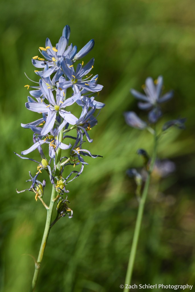
Blue Camas (Camassia quamash), Ahtanum State Forest, WA
In recent years, the onset of wildflower season has been the catalyst for reviving my photography habit (and thus, this blog) from the dead each spring. That has certainly been true again this year (though my recent purchase of a new telephoto lens may have also played a role…) as the hills of central Washington have been awash in green grass and a riot of colorful flowers for much of the past month. The show is fantastic, but fleeting. Today on my drive home from work, I noticed that the hillsides have already taken a turn toward the brown as temperatures warm and the early season grasses begin to die back. Fortunately, by heading up into the mountains, one can follow the flowers all the way into July and August in the higher elevations of the Cascades.
Here are some of my favorite photos from the past month:
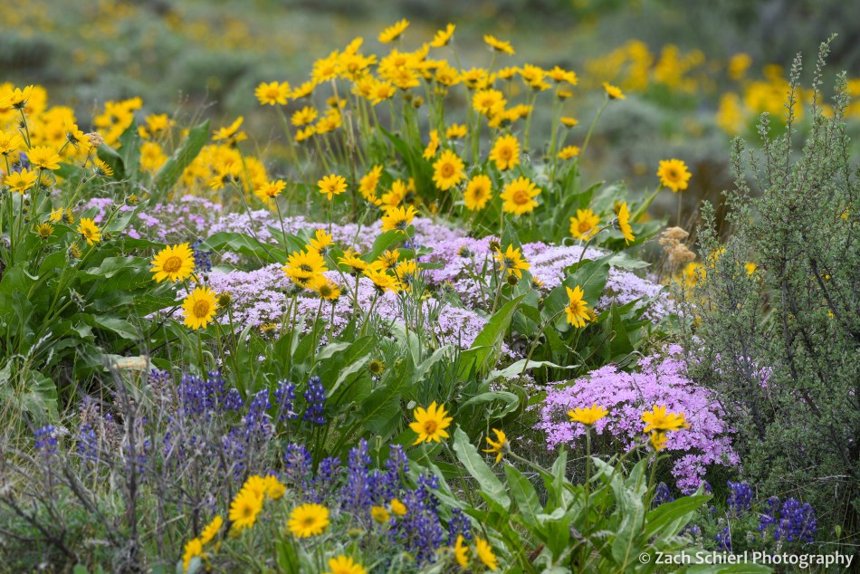
Arrowleaf balsamroot (Balsamorhiza sagittata), Snow Mountain Ranch, Yakima, WA
Grass widows (Olsynium douglasii), Cowiche Canyon, WA
Poet’s shooting star (Primula poetica), Klickitat River, WA
Showy phlox (Phlox speciosa), Snow Mountain Ranch, Yakima, WA
Spring wildflowers bloom at Columbia Hills State Park, WA, with Mt. Hood in the distance.
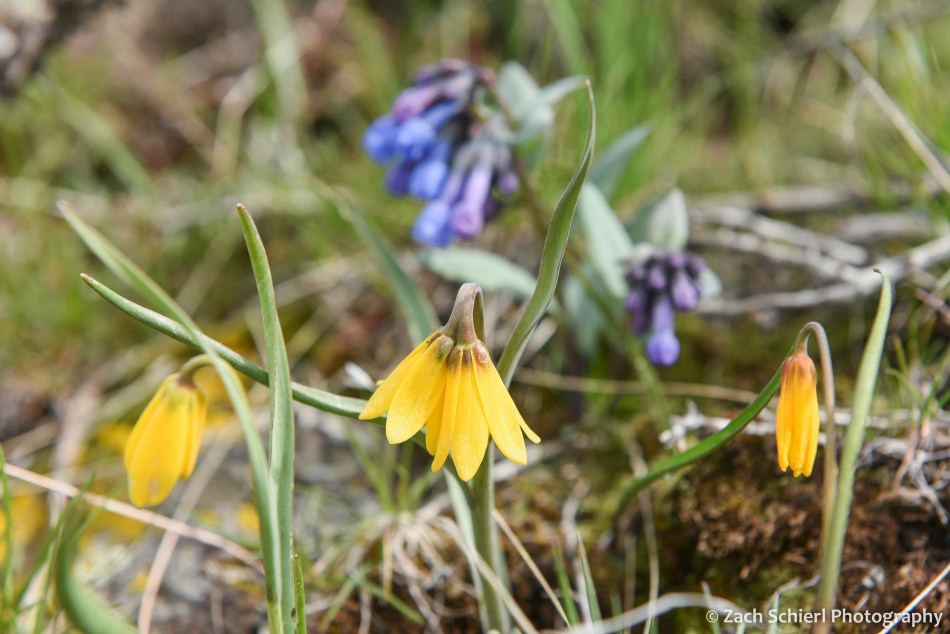
Yellow fritillary (Fritillaria pudica) and bluebells (Mertensia sp.), Snow Mountain Ranch, Yakima, WA
Lupine (Lupinus sp.) bouquet at Columbia Hills State Park, WA
Wildflowers coat the hillside at Snow Mountain Ranch near Yakima, WA
Lupine (Lupnius sp.) and large-flower triteleia (Triteleia grandiflora), Columbia River Gorge, WA
One of my favorite wildflowers, the elusive chocolate lily (Fritillaria affinis), Columbia River Gorge, WA
Wildflowers line the trail at Columbia Hills State Park, WA
Hikers traverse slopes covered in arrowleaf balsamroot (Balsamorhiza sagittata), Snow Mountain Ranch, Yakima, WA
Wildflower covered slopes, Columbia Hills State Park, WA
Upland larkspur (Delphinium nuttallianum), Klickitat River, WA
Grass widows (Olsynium douglasii), Cowiche Canyon, WA
Spring is my favorite season here in central Washington. Our winters, while short and relatively mild in terms of snowfall and temperatures, can be quite dreary. Temperature inversions, freezing fog, and bad air quality are a staple of our weather forecasts from November to February. Summers can be brutally hot: the third digit on my home weather station spends quite a bit of time illuminated from June through August. While conditions in the Cascades are more tolerable, here in the arid sagebrush-steppe of the Yakima Valley, shade trees are found only along rivers and in watered urban backyards.
Spring holds the perfect balance: the days get progressively longer, conditions are perfect for outdoor exploring, and, as an added bonus, foothills of the Cascades come alive with wildflowers (one of my favorite photographic subjects the past few years.) Fall has its merits as well, but the with the onset of winter occupying the back of ones mind, the urge to get outside before the snow starts falling can feel almost stressful compared to the relaxed bliss of spring.
Here are some of my favorite photos from this past spring, from March’s vernal equinox up through June’s summer solstice:
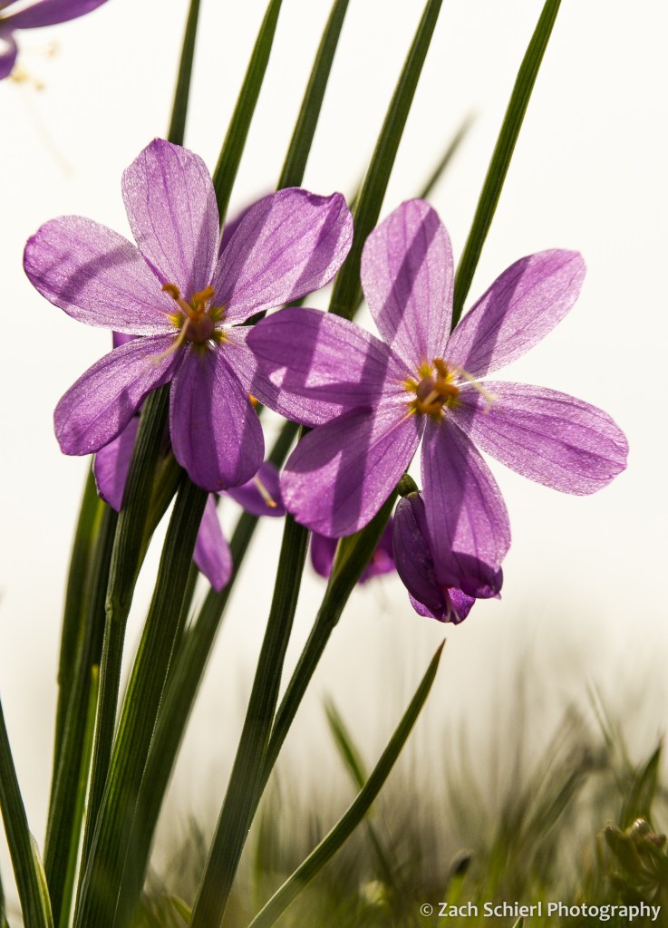
A cluster of grass widows (Olsynium douglasii) backlit by the sun, Cowiche Canyon Preserve, Yakima, WA
Arrowleaf balsamroot (Balsamorhiza sagittata) plants cover a dry slope near Chelan, WA
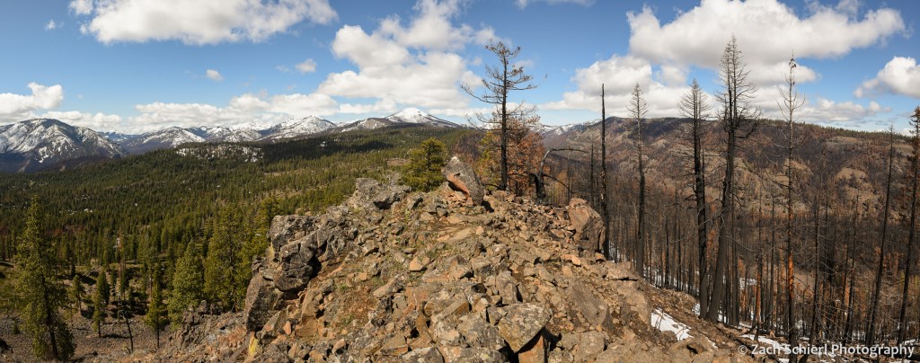
A rocky ridge in the William O. Douglas Wilderness separates burned from unburned forest. The 2021 Schneider Springs Fire was ignited by lightning on the ridge in the upper right, and proceeded to burn 107,000 acres in the Cascade foothills west of Yakima.
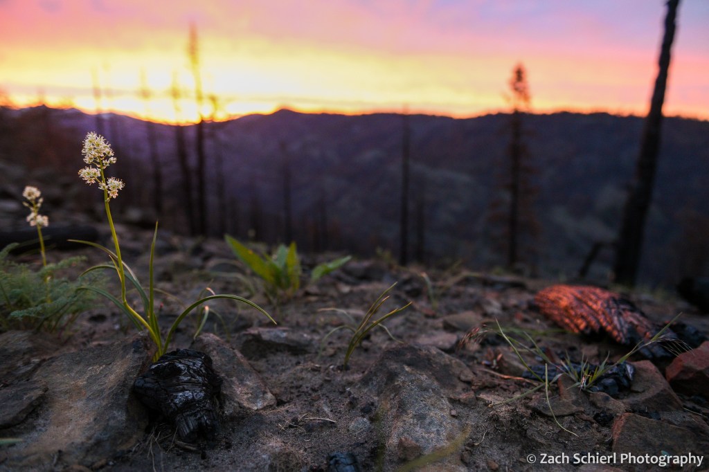
Foothill death camas (Toxicoscordion paniculatum) plants emerge from ashy soil in an area burned by the Schneider Springs fire in 2021.
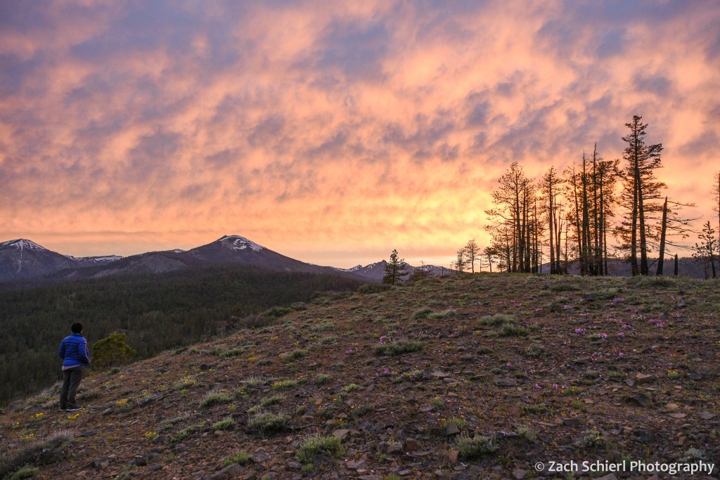
A top-notch sunset from a wildflower-strewn plateau in the William O. Douglas Wilderness west of Yakima.
Scorched ponderosa pine trees silhouetted against an orange sunset sky.
Night on the shores of Lake Chelan, WA
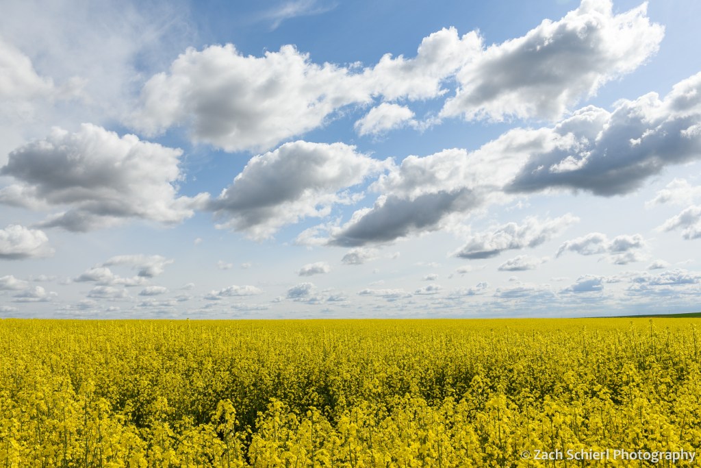
Blooming canola fields near Wilbur, WA
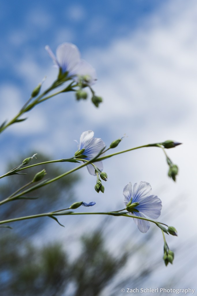
A trio of blue flax (Linum lewisii) flowers nearly blend in against a partly cloudy sky, Lake Roosevelt National Recreation Area, WA
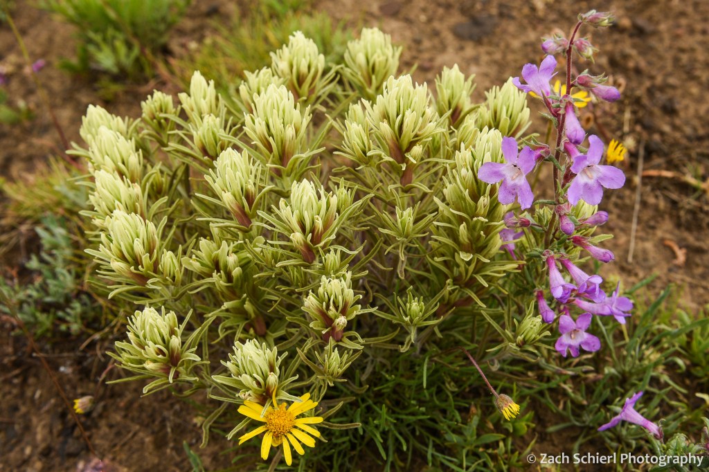
Thompsons paintbrush (Castilleja thompsonii) and Gairdner’s penstemon (Penstemon gairdneri) on Manastash Ridge, WA
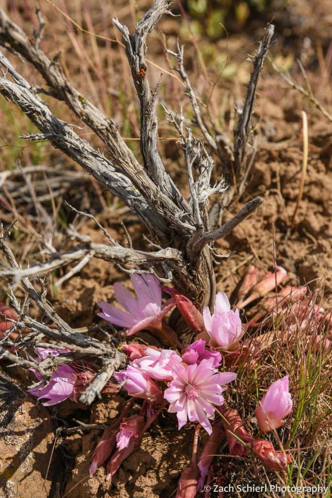
A cluster of bitterroot (Lewisia rediviva) flowers beneath a gnarled sagebrush stem, Cowiche Mountain, WA